
Hide
Haugh
hide
Hide
hide
Hide
hide
Hide
Hide
hide
Hide
Hide
The Community Library at Alford has a local history archive that will prove useful in your research.
| St Leonard, Haugh, Church of England |
- The parish was in the Withern sub-district of the Louth Registration District.
- Check our Census Resource page for county-wide resources.
- The table below gives census piece numbers, where known:
Census
YearPiece No. 1841 H.O. 107 / 636 1851 H.O. 107 / 2111 1861 R.G. 9 / 2379 1871 R.G. 10 / 3398 1891 R.G. 12 / 2606
| St Leonard, Haugh, Church of England |
- The Anglican parish church is dedicated to Saint Leonard.
- Portions of the church building date back to around 1400.
- The church was restored in 1873.
- This church is a Grade I structure with English Heritage.
- This small church only seats about 33.
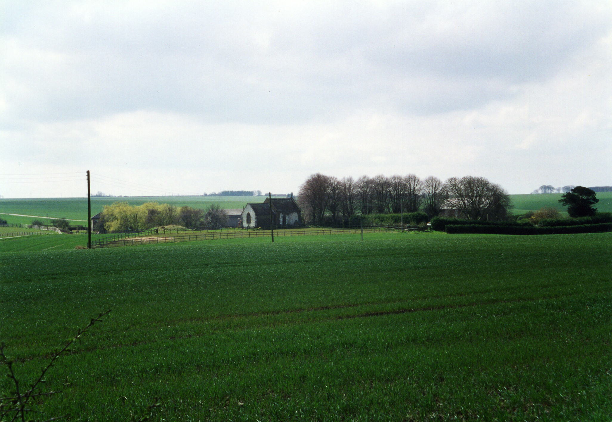
- Here is a photograph of Saint Leonard's Church and the village supplied by Ron COLE (who retains the copyright):
- Here is a close-up view of the church supplied by Ron COLE (who retains the copyright):

- The Anglican parish register dates from 1762.
- Church services were an ocassional thing by 1841.
- The LFHS has published several marriage and burial indexes for the Bolingbroke Deanery to make your search easier.
- Check our Church Records page for county-wide resources.
- The parish was in the Withern sub-district of the Louth Registration District.
- Check our Civil Registration page for sources and background on Civil Registration which began in July, 1837.
Haugh is both a parish and a small village on the edge of the Wold hills, about 3 miles west of Alford. South Thoresby parish lies to the north and South Ormsby parish lies to the west. The parish covered about 1,370 acres in the early 1800's, but was reduced to 585 acres by 1891.
The village is small. If you are planning a visit:
- By automobile, take the old Roman Road west out of Skegness to Ulceby Cross. That road becomes the A16 trunk road, which you will follow through Driby Top. Turn north (right) into South Thoresby, then right again on the narrow county road to Haugh.
- See our touring page for visitor services.
- Ask for a calculation of the distance from Haugh to another place.
Haugh is listed in the 1086 Domesday Book with 37 households.
In 1550, Richard BOLLE of Haugh was the High Sheriff of Lincolnshire. And, again in 1569.
Julian P. GUFFOGG has a photograph of the Memorial to Sir John BOLLE & wife on Geo-graph, taken in August, 2012.
- The manor house was erected in the reign of Henry VII. It was the seat of the HAUGH family, then later the BOLLE family.
- A portion of the house was in use as a farmhouse in 1900.
- J. THOMAS has a photograph of Haugh Manor on Geo-graph, taken in June, 2020.
- See our Maps page for additional resources.
You can see maps centred on OS grid reference TF415759 (Lat/Lon: 53.261157, 0.119905), Haugh which are provided by:
- OpenStreetMap
- Google Maps
- StreetMap (Current Ordnance Survey maps)
- Bing (was Multimap)
- Old Maps Online
- National Library of Scotland (Old Ordnance Survey maps)
- Vision of Britain (Click "Historical units & statistics" for administrative areas.)
- English Jurisdictions in 1851 (Unfortunately the LDS have removed the facility to enable us to specify a starting location, you will need to search yourself on their map.)
- Magic (Geographic information) (Click + on map if it doesn't show)
- GeoHack (Links to on-line maps and location specific services.)
- All places within the same township/parish shown on an Openstreetmap map.
- Nearby townships/parishes shown on an Openstreetmap map.
- Nearby places shown on an Openstreetmap map.
- This place was an ancient parish in Lincolnshire and became a modern Civil Parish when those were established.
- The parish was in the Marsh division of the ancient Calceworth Wapentake in the East Lindsey district in the parts of Lindsey.
- In 1841 the parish consisted of one farm, one church and eight inhabitants. It was termed extra parochial because there could be no meeting of parishioners, no officers, etc.
- White's 1900 Directory of Lincolnshire places the parish, perhaps erroneously, in the South Lindsey division of the county.
- The parish is governed by a joint Swaby, Haugh and South Thoresby Parish Council. They are NOT funded to provide you with help in family history research.
- For today's district governance, see the East Lindsey District Council.
- Bastardy cases would be heard in the Alford petty sessional hearings on alternate Tuesdays.
- After the 1834 Poor Law Amendment Act reforms, this parish became part of the Louth Poor Law Union.
- The children of this parish attended school in South Thoresby parish or at Aby parish.
- See our Schools page for more information on researching school records.