
Hide
Langton
hide
Hide
hide
Hide
hide
Hide
Hide
Hide
- The parish was in the Horncastle sub-district of the Horncastle Registration District.
- The North Lincolnshire Library holds a copy of the 1881 census for this parish.
- Check our Census Resource page for county-wide resources.
- The table below gives census piece numbers, where known:
| Census Year | Piece No. |
|---|---|
| 1841 | H.O. 107 / 639 |
| 1851 | H.O. 107 / 2108 |
| 1861 | R.G. 9 / 2368 |
| 1871 | R.G. 10 / 3382 |
| 1891 | R.G. 12 / 2598 |
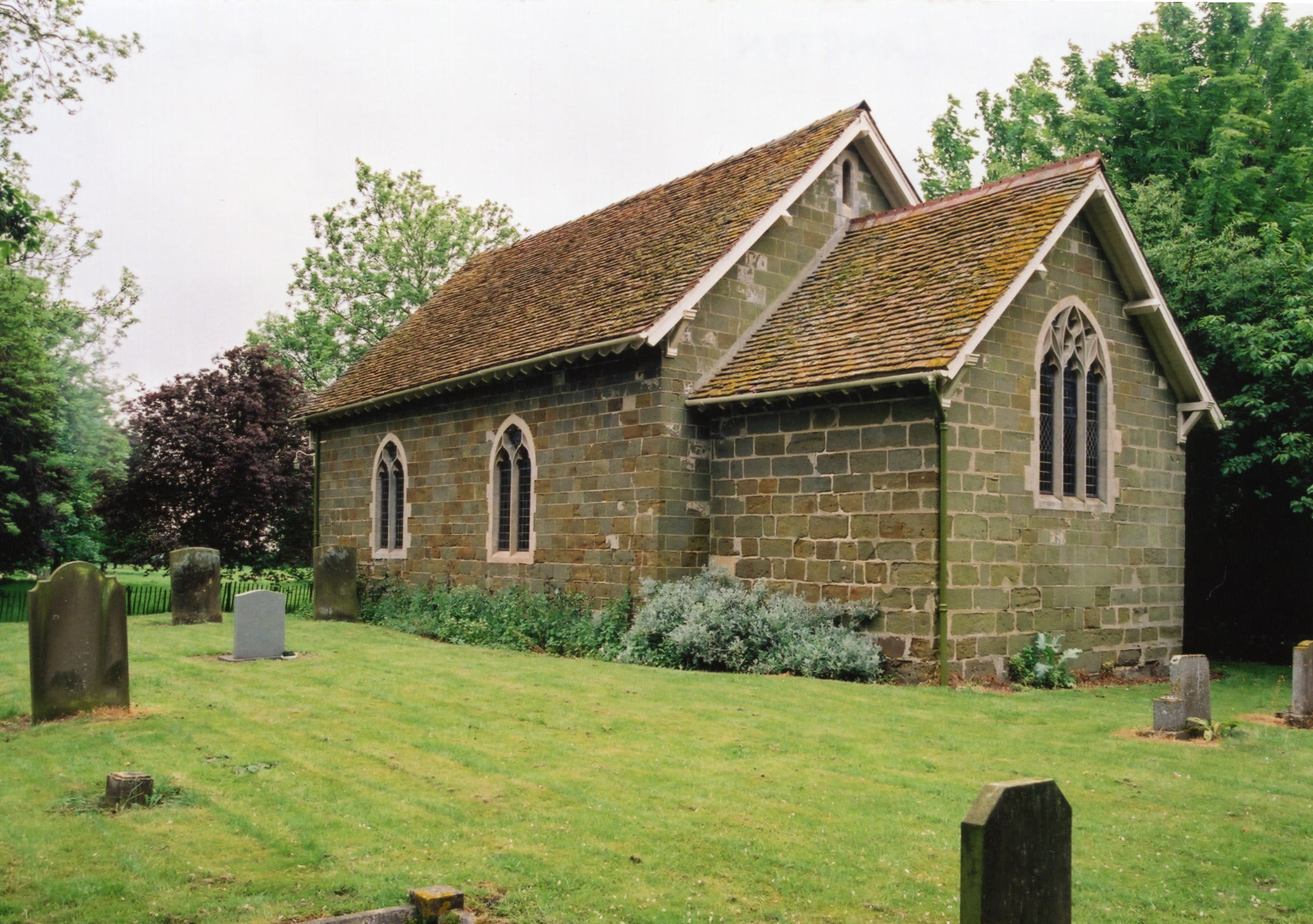
- The Anglican parish church is dedicated to Saint Margaret.
- The church was restored in 1891.
- The church only seats about 80.
- Richard CROFT has a photograph of St. Margaret's Church on Geo-graph, taken in December, 2005.
- Here is a photo of St. Margaret's, taken by Ron COLE (who retains the copyright):
- The Anglican parish register dates from 1753 for baptisms and burials; from 1768 for marriages.
- The British Vital Records Index (BVRI) has 151 burials for St. Margaret's, 1815 through 1900 (with gaps).
- The LFHS has published several marriage indexes for the Horncastle Deanery to make your search easier.
- Check our Church Records page for county-wide resources.
- The parish was in the Horncastle sub-district of the Horncastle Registration District.
- Check our Civil Registration page for sources and background on Civil Registration which began in July, 1837.
Langton is just south-west of Horncastle by about a mile. Thimbleby parish is to the north and Thornton parish to the south. The parish is small and covers about 695 acres. The population in the parish has dwindled in recent decades.
What is left of the village sits to the south side of the road to Woodhall Spa. If you are planning a visit:
- By automobile, take the B1191 arterial road out of Horncastle to the west and follow the signs for Langton.
- Visit our touring page for more sources.
- Ask for a calculation of the distance from Langton to another place.
- See our Maps page for additional resources.
You can see maps centred on OS grid reference TF237689 (Lat/Lon: 53.20279, -0.1495), Langton which are provided by:
- OpenStreetMap
- Google Maps
- StreetMap (Current Ordnance Survey maps)
- Bing (was Multimap)
- Old Maps Online
- National Library of Scotland (Old Ordnance Survey maps)
- Vision of Britain (Click "Historical units & statistics" for administrative areas.)
- English Jurisdictions in 1851 (Unfortunately the LDS have removed the facility to enable us to specify a starting location, you will need to search yourself on their map.)
- Magic (Geographic information) (Click + on map if it doesn't show)
- GeoHack (Links to on-line maps and location specific services.)
- All places within the same township/parish shown on an Openstreetmap map.
- Nearby townships/parishes shown on an Openstreetmap map.
- Nearby places shown on an Openstreetmap map.
- This place was an ancient parish in Lincoln county and became a modern Civil Parish when those were established.
- The parish was in the Southern Division of the ancient Gartree Wapentake in the East Lindsey district in the parts of Lindsey.
- For today's district governance, see the East Lindsey District Council.
- Bastardy cases would be heard in the Horncastle petty session hearings.
- The parish has two almshouses for two poor women, founded in 1690 by the Rev. Willougby WEST.
- As a result of the 1834 Poor Law Amendment Act, the parish became part of the Horncastle Poor Law Union.
- The children of this parish attended school at either Horncastle or Thimbleby.
- For more on researching school records, see our Schools Research page.