
Hide
Lusby
hide
Hide
hide
Hide
hide
Hide
Hide
hide
Hide
Hide
| St Peter, Lusby, Church of England |
- The parish was in the Tetford sub-district of the Horncastle Registration District.
- Check our Census Resource page for county-wide resources.
- The table below gives census piece numbers, where known:
| Census Year | Piece No. |
|---|---|
| 1841 | H.O. 107 / 639 |
| 1861 | R.G. 9 / 2371 & 2375 |
| 1871 | R.G. 10 / 3383 |
| 1891 | R.G. 12 / 2599 |
| St Peter, Lusby, Church of England |
| Lusby, Methodist (Wesleyan) |
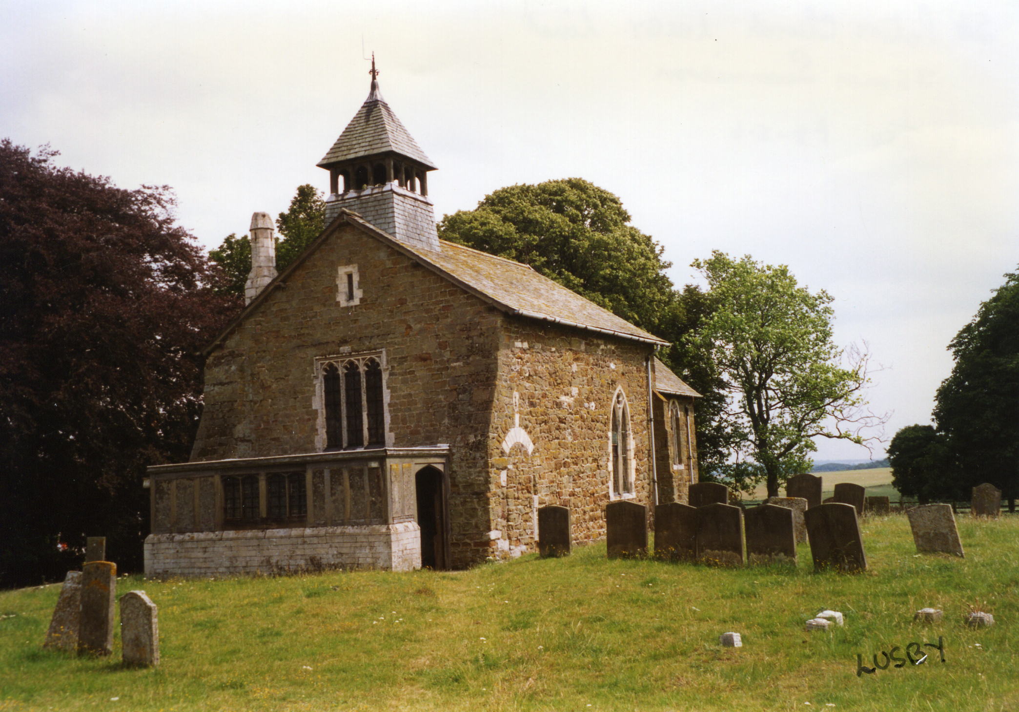
- The Church of St. Peter is a small structure of Norman origin, having seats for 80 worshipers. Inside is a brass plate from circa 1600.
- The parish church is medieval and is described in Pevsner's, "The Buildings of England - Lincolnshire."
- The Church was restored in 1892.
- Here is a photo of St. Peter's Church, taken by Ron COLE (who retains the copyright):
- The parish register dates fromn 1691.
- The Lincolnshire Archives has the parish register baptisms 1690-1812, marriages 1691-1836, and burials1691-1812 on deposit. The Bishop's Transcripts there begin in 1562 but there will be many gaps.
- The LFHS has published several marriage and burial indexes for the Bolingbroke Deanery to make your search easier.
- The Wesleyan Methodists had a small chapel here. For information and assistance in researching these chapels, see our non-conformist religions page.
- Check our Church Records page for county-wide resources.
- The parish was in the Tetford sub-district of the Horncastle Registration District.
- Check our Civil Registration page for sources and background on Civil Registration which started in July, 1837.
Lusby is both a village and a parish in the Wold hills, 4.5 miles west of Spilsby and 6 miles east of Horncastle. Hagworthingham parish lies to the north and Asgarby parish to the south. The parish covered about 760 acres in 1842, increasing to 1,075 (including a Fen allotment of 212 acres) by 1872. In 1900, the parish covered about 880 acres. The parish has been a predominatly agricultural settlement over the centuries.
Lusby village is on a road that runs from Hagworthingham south to East Kirkby. If you are planning a visit:
- Take the B1195 road between Horncastle and Spilsby. The village is one mile south of Hagworthingham.
- See our touring page for visitor services.
- Ask for a calculation of the distance from Lusby to another place.
- The parish is mentioned in the 1086 Domesday Book and is recorded as having a church, a priest and a mill as well as outlying land (berewic) in Hagworthingham, a larger village nearby.
- In 1842, the principal landowner was Mrs. Sarah BRACKENBURY, lady of the manor.
- In 1882, the principal landowners were the Ecclesiastical Commissioners.
- See our Maps page for additional resources.
You can see maps centred on OS grid reference TF339678 (Lat/Lon: 53.190762, 0.002489), Lusby which are provided by:
- OpenStreetMap
- Google Maps
- StreetMap (Current Ordnance Survey maps)
- Bing (was Multimap)
- Old Maps Online
- National Library of Scotland (Old Ordnance Survey maps)
- Vision of Britain (Click "Historical units & statistics" for administrative areas.)
- English Jurisdictions in 1851 (Unfortunately the LDS have removed the facility to enable us to specify a starting location, you will need to search yourself on their map.)
- Magic (Geographic information) (Click + on map if it doesn't show)
- GeoHack (Links to on-line maps and location specific services.)
- All places within the same township/parish shown on an Openstreetmap map.
- Nearby townships/parishes shown on an Openstreetmap map.
- Nearby places shown on an Openstreetmap map.
David HITCHBORNE has a photograph of the War Memorial to the ELSEY family on Geo-graph, taken in July, 2004.
- The name comes from the Old Scandinavian Lutr+by for "village of Lutr" and appeared in the 1086 Domesday Book as Luzeby.
[A. D. Mills, "A Dictionary of English Place-Names," Oxford University Press, 1991].
- White's 1842 Directory lists the following people in the parish: Richd. CLARK, Jervis GOODWIN, Samuel JOLL, Joseph LILL, John MATTHEWS, Wm. NICHOLSON and Robert ROBINSON.
- White's 1872 Directory lists the following people in the parish: Robert BELL, Henry BRUMLEY, Jas. BURRELL, Jarvis GOODWIN, Mrs. Mary Ann HARDY, Henry MARCH, Joseph Samuel ROBINSON, Thomas ROBINSON and Robert STONES.
- White's 1882 Directory lists the following people in the parish: Robert BELL, Rev. Brackenbury Dickson BOGIE, Henry BRUMBY, -- DRACASS, John EVISON, Jarvis GOODWIN, John HOLDCROSS, Henry MARCH, William PALETHORPE, Mrs. Betsy PROCTOR, Alfred ROBINSON, Robert STONES and Richard TOYNO.
- Kelly's 1900 Directory lists the following people in the parish: Salisbury BOND Jnr., Henry BRUMBY, John EVISON, Charles Thomas LETTICE, John PROCTOR and Alfd. ROBINSON.
- Kelly's 1913 Directory lists the following people in the parish: Rev. Clement Hy. W. BELLAIRS, Salisbury BOND Jnr., Henry BRUMBY, Arthur William JOHNSON, Brothers LETTICE, John PROCTOR, Alfred ROBINSON and George WATSON.
- This place was an ancient parish in Lincoln county and became a modern Civil Parish when those were established.
- The parish was in the East division of the ancient Bolingbroke Wapentake in the East Lindsey district in the parts of Lindsey.
- The parish was also in the Bolingbroke Soke.
- In December, 1880, this parish was reduced in size by around 180 acres to enlarge Stickford Civil Parishd.
- For today's district governance, see the East Lindsey Govt. Council.
- Bastardy cases would be heard in the Spilsby petty session hearings.
- In the early 1800's, the Parishes Houses were a building divided into six tenements, occupied by the poor.
- In 1842, the parish poor had a yearly rent-charge of 3s. 4d. from a farm in Hagworthingham.
- As a result of the 1834 Poor Law Amendment Act, the parish became part of the Horncastle Poor Law Union.
- The parish school was built here prior to 1872 to serve the needs of both Lusby and Asgarby parish. Some Winceby students attended, too.
- For more on researching school records, see our Schools Research page.