
Hide
Marsh Chapel
hide
Hide
hide
Hide
hide
Hide
Hide
hide
Hide
Hide
The Library at Louth will prove useful in your research.
- The parish was in the Tetney sub-district of the Louth Registration District.
- Check our Census Resource page for county-wide resources.
- The table below gives census piece numbers, where known:
| Census Year | Piece No. |
|---|---|
| 1841 | H.O. 107 / 640 |
| 1851 | H.O. 107 / 2112 |
| 1861 | R.G. 9 / 2386 |
| 1871 | R.G. 10 / 3409 |
| 1881 | R.G. 11 / 3266 |
| 1891 | R.G. 12 / 2611 |
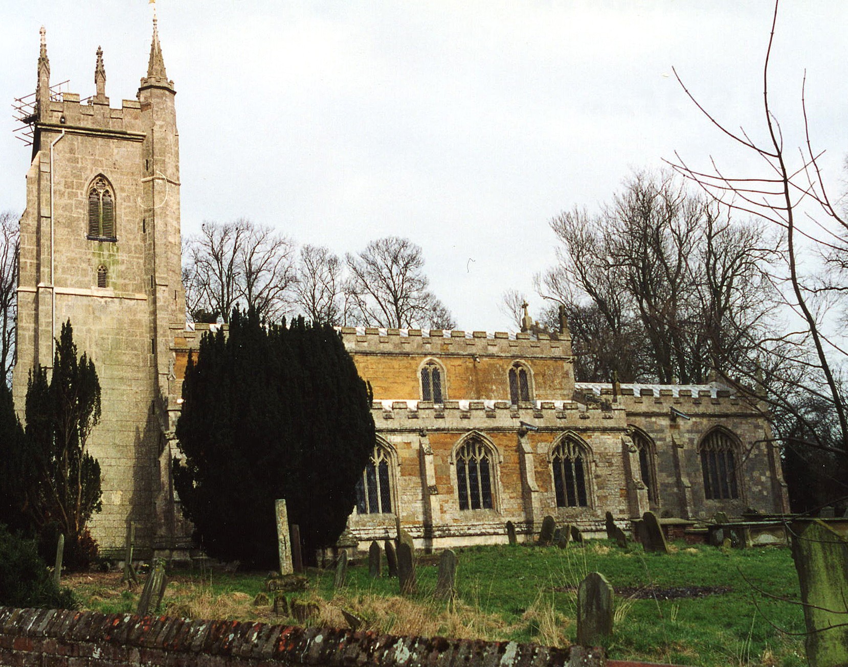
- The Anglican parish church is dedicated to Saint Mary.
- The church was built circa 1420.
- A new roof was put on the nave in 1845.
- The chancel was rebuilt in 1848.
- The church is large, seating about 490 people.
- Because the church is large, it is often called "The Cathedral in the Marsh" or, as an alternative, "Chapel in the Marsh."
- J. HANNAH-BRIGGS has a photograph of the church interior on Geo-graph, taken in June, 2012.
- Here is a photo of St. Mary's Church, taken by Ron COLE (who retains the copyright):
- The Anglican parish register dates from 1 April, 1590.
- We have the beginning of a Parish Register Extract in a text file for your review. Your corrections and additions are welcome.
- The Lincolnshire FHS has published several Marriage indexes and a Burial index for the Louthesk Deanery to make your search easier.
- A Wesleyan Methodist chapel, built in 1838 and rebuilt in 1888, graced the parish, as did both a Free Methodist and a Primitive Methodist chapel.
- Michael PATTERSON has a photograph of the Methodist chapel on Geo-graph, taken in February, 2007.
- For information and assistance in researching these chapels, see our non-conformist religions page.
- Check our Church Records page for county-wide resources.
- The parish was in the Tetney sub-district of the Louth Registration District.
- Check our Civil Registration page for sources and background on Civil Registration which began in July, 1837.
The parish lies near the North Sea, just west of North Somercoates and southeast of Tetney, about 10 miles north-north-east of Louth and 10 miles southeast of Grimsby. The parish covers over 3,100 acres. West End is a hamlet in the parish, as is Eskham or East Holme. A place called Fire Beacon was near the Louth Navigation Canal and is partly in this parish and partly in Fulstow parish.
If you are planning a visit:
- Take the A1031 south from Cleethorpes, it runs right through the village.
- See the Lincolnshire Touring and Holidays page on this site.
- Ask for a calculation of the distance from Marsh Chapel to another place.
- The Greyhound Public House on the A1031 has been providing refreshment for locals and wanderers since at least 1868.
- John FIRTH has a photograph of the Greyhound on Geo-graph, taken in July, 2011.
- These are the names associated with the Greyhound Public House in various directories:
| Year | Person |
|---|---|
| 1842 | Wm STOTHARD, vict. |
| 1861 | William STOTHARD |
| 1868 | Wm. SWABY, carrier |
| 1882 | George MUMBY, vict. |
| 1896 | George MUMBY, farmer |
| 1900 | Thomas SARGENT, carpenter |
| 1913 | Thomas YOUNG |
| 1919 | Alfred STEPHENSON |
| 1930 | Chas. BERRIDGE |
- You might like the 1906 inch-to-the-mile map of North East Lincolnshire.
- See our Maps page for additional resources.
You can see maps centred on OS grid reference TF360993 (Lat/Lon: 53.472671, 0.047293), Marsh Chapel which are provided by:
- OpenStreetMap
- Google Maps
- StreetMap (Current Ordnance Survey maps)
- Bing (was Multimap)
- Old Maps Online
- National Library of Scotland (Old Ordnance Survey maps)
- Vision of Britain (Click "Historical units & statistics" for administrative areas.)
- English Jurisdictions in 1851 (Unfortunately the LDS have removed the facility to enable us to specify a starting location, you will need to search yourself on their map.)
- Magic (Geographic information) (Click + on map if it doesn't show)
- GeoHack (Links to on-line maps and location specific services.)
- All places within the same township/parish shown on an Openstreetmap map.
- Nearby townships/parishes shown on an Openstreetmap map.
- Nearby places shown on an Openstreetmap map.
- Jonathan THACKER has a photograph of the War Memorial on Geo-graph, taken in 2012.
- For a list of the names on the War Memorial, check the Roll of Honour site
- This place was an ancient Chapelry in Lincolnshire and was converted to a Civil Parish at an early date.
- The parish was in the ancient Bradley Haverstoe Wapentake in the East Lindsey district and parts of Lindsey.
- The Parish Council of Marshchapel does not have a website, but they will NOT do family history research for you.
- The Village Hall is on Mill Lane.
- For today's district governance, see the East Lindsey District Council.
- Bastardy cases would be heard in the Grimsby petty session hearings.
- In 1625 about 6 acres of land was purchased with the annual income going to the poor at Easter and Christmas.
- In 1800, Mr. LILL left a little over 3 acres of meadowland whose rent went to the poor of the parish.
- After the Poor Law Amendment Act of 1834, this parish became part of the Louth Poor Law Union.
- A National School was built in the centre of the village in 1872 to hold 162 children. An earlier school had existed at a different location.
- The school had a website with a virtual tour, but that no longer appears to be supported.
- School log books have been kept since 1921.
- Marshchapel Infants School is on Sea Dyke Way at the north end of the village.
- See our Schools page for more information on researching school records.