
Hide
North Reston
hide
Hide
hide
Hide
hide
Hide
Hide
hide
Hide
Hide
- The parish was in the Withern sub-district of the Louth Registration District.
- Check our Census Resource page for county-wide resources.
- The table below gives census piece numbers, where known:
| Census Year | Piece No. |
|---|---|
| 1841 | H.O. 107 / 642 |
| 1851 | H.O. 107 / 2111 |
| 1861 | R.G. 9 / 2379 |
| 1871 | R.G. 10 / 3398 |
| 1891 | R.G. 12 / 2606 |
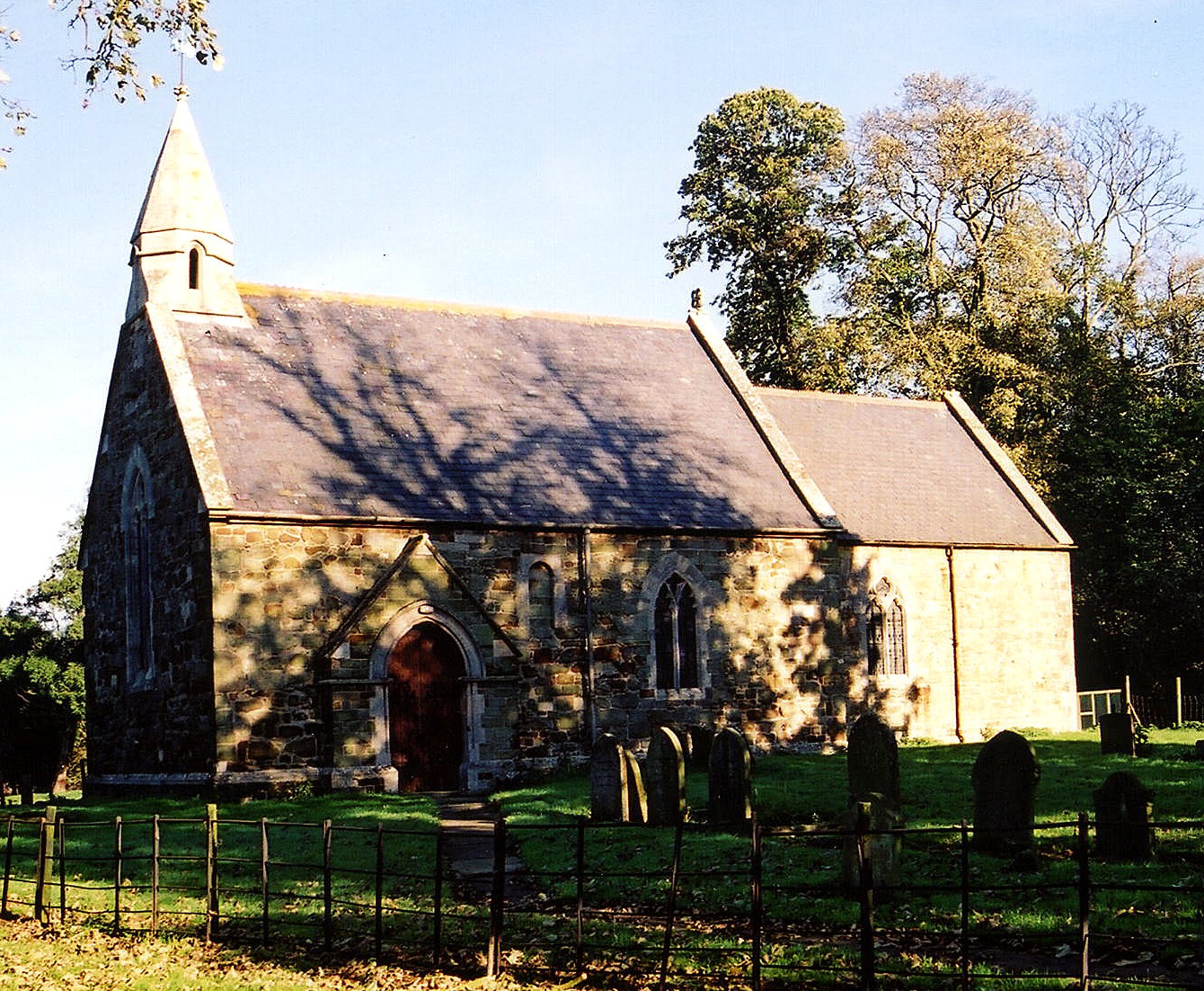
- The Anglican parish church is dedicated to Saint Edith and is made of sandstone.
- The church's plain round chancel arch is dated from 1036-66.
- The church was restored and largely rebuilt in 1867-68.
- The church is now closed.
- The church seats only about 60 people.
- The church is a Grade II listed building with British Heritage.
- Here is a photo of St. Edith's Church, taken by Ron COLE (who retains the copyright):
- The Anglican parish register dates from 1562.
- The Lincolnshire FHS has published several marriage indexes and a burial index for the Calcewaith and Candleshoe Deanery to make your search easier.
- Check our Church Records page for county-wide resources.
- The parish was in the Withern sub-district of the Louth Registration District.
- Check our Civil Registration page for sources and background on Civil Registration which began in July, 1837.
This village and parish are about 137 miles north of London and 4.5 miles south-east of Louth. The parish of North Reston covers about 700 acres these days, but was larger in ancient times.
If you are planning a visit:
- By automobile, the village lies just off of the A157 which travels between Louth and Mablethorpe. The village is between South Reston and Legbourne.
- See our touring page for visitor services.
- Ask for a calculation of the distance from North Reston to another place.
- North Reston is listed in the 1086 Domesday Book as having 13 households.
- George JACKSON and his wife Mary (nee HOWARD) moved to North Reston from India in about 1800. One of their sons, George JACKSON, born 29 September 1800, became vicar of North Reston.
- Reston Hall lies just off of the A157 trunk road. It was built in the 17th century.
- The Hall is a Grade II listed building with British Heritage.
- See our Maps page for additional resources.
You can see maps centred on OS grid reference TF384838 (Lat/Lon: 53.332667, 0.077076), North Reston which are provided by:
- OpenStreetMap
- Google Maps
- StreetMap (Current Ordnance Survey maps)
- Bing (was Multimap)
- Old Maps Online
- National Library of Scotland (Old Ordnance Survey maps)
- Vision of Britain (Click "Historical units & statistics" for administrative areas.)
- English Jurisdictions in 1851 (Unfortunately the LDS have removed the facility to enable us to specify a starting location, you will need to search yourself on their map.)
- Magic (Geographic information) (Click + on map if it doesn't show)
- GeoHack (Links to on-line maps and location specific services.)
- All places within the same township/parish shown on an Openstreetmap map.
- Nearby townships/parishes shown on an Openstreetmap map.
- Nearby places shown on an Openstreetmap map.
- This place was an ancient parish in Lincolnshire and became a modern Civil Parish when those were established.
- The parish was in the Marsh division of the ancient Louth Eske Wapentake in the East Lindsey district in the parts of Lindsey.
- This parish is now part of the combined Civil Parish of Reston, which includes North Reston, South Reston, and Castle Carlton.
- For today's district governance, see the East Lindsey District Council.
- Bastardy cases would be heard in the Louth petty session hearings every other Wednesday.
- After the Poor Law Amendment Act reforms of 1834, this parish became part of the Louth Poor Law Union.