
Hide
Oxcombe
hide
Hide
hide
Hide
hide
Hide
Hide
hide
- Maps
- Migration, Internal◬
- Military History
- Military Records
- Monumental Inscriptions
- Names, Geographical
- Names, Personal◬
- Naturalisation & Citizenship◬
- Newspapers◬
- Occupations◬
- Politics & Government
- Poor Houses, Poor Law
- Population
- Postal & Shipping Guides◬
- Probate Records◬
- Public Records◬
- Schools
- Societies◬
- Voting Registers◬
Hide
Hide
The Library at Louth will prove useful in your research.
- The parish was in the Louth sub-district of the Louth Registration District.
- The North Lincolnshire Library holds copies of the census returns for 1841 and 1881.
- Check our Census Resource page for county-wide resources.
- The table below gives census piece numbers, where known:
| Census Year | Piece No. |
|---|---|
| 1851 | H.O. 107 / 2111 |
| 1861 | R.G. 9 / 2381 |
| 1871 | R.G. 10 / 3404 |
| 1891 | R.G. 12 / 2608 |
| 1901 | R.G. 13 / 3084 |
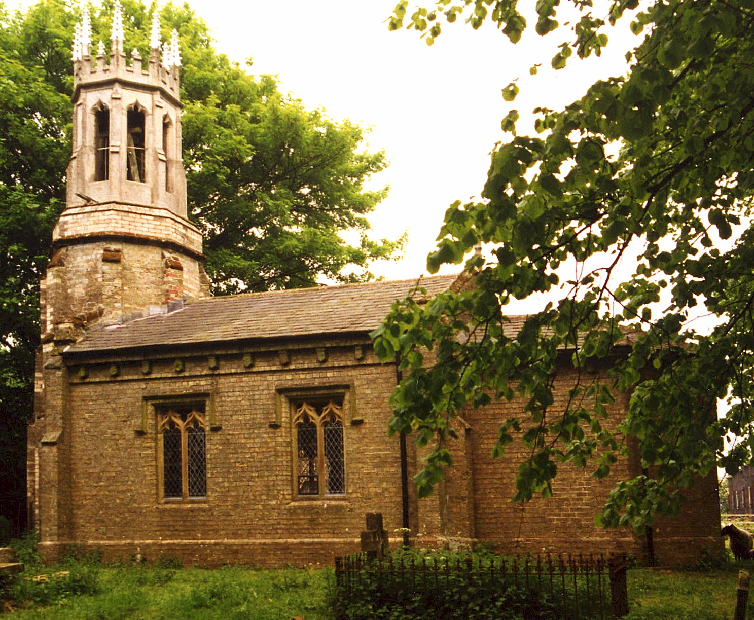
- The Anglican parish church is dedicated to All Saints.
- The church was rebuilt in 1842.
- David HITCHBORNE has a photograph of a Date Stone for March, 1825 on Geo-graph, taken in October, 2006.
- The church seated only about 50 persons.
- The Diocese of Lincoln declared this church redundant in October, 1980.
- Here is a photo of All Saints Church taken by Ron COLE (who retains the copyright):
- A parish register was kept, but the register dates back only to 1813 (some sources give 1822). Bishop's transcripts exist from 1561.
- The LFHS has published several marriage indexes for the Bolingbroke Deanery to make your search easier.
- Check our Church Records page for county-wide resources.
- The parish was in the Louth sub-district of the Louth Registration District.
- Check our Civil Registration page for sources and background on Civil Registration which began in July, 1837.
Oxcombe is a tiny parish, both in size and population. For many decades it consisted of just one farm, located eight miles due south of Louth and seven miles northeast of Horncastle. Worlaby parish lies to the south and Ruckland parish to the East. The parish is still geographically small, covering just over 1,010 acres.
The "village" of Oxcombe consisted of just a few cottages and the church. The site is located just south of a road from Burwell on the A16 trunk road and Scamblesby on the A153 trunk road. If you are planning a visit:
- Visit our touring page for more sources.
- Ask for a calculation of the distance from Oxcombe to another place.
- According to White's 1872 Directory of Lincolnshire, "John GRANT, Esq., of Oxcomb, who died in 1799, aged 64, is said to have acquired £100,000 by farming."
- In 1871, all of the land was owned by David BRIGGS, Esq. and occupied by his brother, Chapman BRIGGS, Esq. In 1913, Sir Francis Sowerby BENNETT, JP, was the sole landowner.
- Oxcomb House was built in the Elizabethan style in 1845-6. In 1881 it was occupied by Frederick CROWDER.
- The Oxcombe estate was owned by the LANGTON family of Langton-by-Partney from 1641 to about 1790, when it was sold by Bennet LANGTON to Mr. GRANT for £10,000. A copy of the 1641 transaction can be found in the "Lincolnshire Notes & Queries" Vol 7.
- David HITCHBORNE has a photograph of Oxcombe Manor on Geo-graph, taken in October, 2006.
- See our Maps page for additional resources.
You can see maps centred on OS grid reference TF311772 (Lat/Lon: 53.275222, -0.035105), Oxcombe which are provided by:
- OpenStreetMap
- Google Maps
- StreetMap (Current Ordnance Survey maps)
- Bing (was Multimap)
- Old Maps Online
- National Library of Scotland (Old Ordnance Survey maps)
- Vision of Britain (Click "Historical units & statistics" for administrative areas.)
- English Jurisdictions in 1851 (Unfortunately the LDS have removed the facility to enable us to specify a starting location, you will need to search yourself on their map.)
- Magic (Geographic information) (Click + on map if it doesn't show)
- GeoHack (Links to on-line maps and location specific services.)
- All places within the same township/parish shown on an Openstreetmap map.
- Nearby townships/parishes shown on an Openstreetmap map.
- Nearby places shown on an Openstreetmap map.
David HITCHBORNE has a photograph of a Brass Roll of Honour 1914-1010 in All Saints on Geo-graph, taken in October, 2006.
david also has a photograph of the Great War Memorial Window in the church on geo-graph, taken in October, 2006.
All the men listed on the WWI Roll of Honour plaque can be found at the Roll of Honour website.
David HITCHBORN has a photograph of the plaque to Thomas and Anne ROSS which hangs in the parish church on Geo-graph, taken in October, 2006.
David also has a photograph of the plaque honoring William GRANT who was buried on 7 July 1817 on Geo-graph, taken in October, 2006. William was 47 years old.
David also has a phoograph of the plaque honoring Ann GRANT who died in 1840 on Geo-graph, taken in October, 2006.
David also has a photograph of the scroll-like memorial to Jessy BRIGGS on Geo-graph. also taken in October, 2006.
- The parish name appears to derive from the Old English (Saxon) oxa+coomb, which means "ox valley".
[A. D. Mills, "A Dictionary of English Place-Names," Oxford University Press, 1991]
- This place was an ancient parish in Lincoln county and became a modern Civil Parish when those were established.
- The parish was in the ancient Hill Wapentake (Hill Hundred) in the East Lindsey district in the parts of Lindsey.
- In April, 1936, this Civil Parish was abolished and amalgamated into Maidenwell Civil Parish.
- For today's district governance, see the East Lindsey District Council.
- Bastardy cases would be heard in the Horncastle petty session hearings.
- After the 1834 Poor Law Amendment Act reforms, the parish became part of the Louth Poorlaw Union.
- The children of Oxcombe attended school at the Farforth Council school to the north.
- For more on researching school records, see our Schools Research page.