
Hide
Rippingale
hide
Hide
hide
Hide
hide
Hide
Hide
hide
Hide
Hide
The Library at Bourne will prove useful in your research.
- A small cemetery was opened on the west end of the village, near the present A15 motorway, in 1900. It was opened as an extension of the parish churchyard, but burials were arranged through the Burial Board of the Parish Council.
- This parish was part of the Aslackby sub-district of the Bourne Registration District.
- Check our Census Resource page for county-wide resources.
- The table below gives census piece numbers, where known:
| Census Year | Piece No. |
|---|---|
| 1841 | H.O. 107 / 621 |
| 1851 | H.O. 107 / 2095 |
| 1861 | R.G. 9 / 2316 |
| 1871 | R.G. 10 / 3313 |
| 1891 | R.G. 12 / 2556 |
- There was a stone church here at the Domesday Survey of 1086, but all traces of it have disappeared.
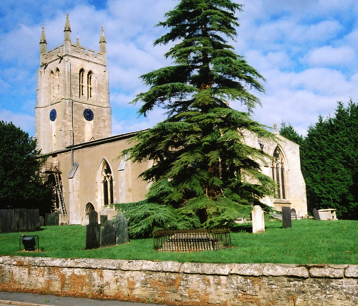
- The Anglican parish church is dedicated to Saint Andrew.
- The church was reportedly founded in 1250. The building itself was certainly in place by the late 14th century.
- The church was restored in 1854.
- The church is Grade I listed with British Heritage.
- The church seats 300.
- An additional burial ground was opened for the church in 1900.
- There is a photograph of St. Andrew's Church on the Wendy PARKINSON web site under her "Still more Lincolnshire churches".
- Here is a photo of St. Andrew's, taken by Ron COLE (who retains the copyright):
- The Anglican church parish registers exist from 1633, but the Bishop's Transcripts go back to 1562.
- Rippingale is in the Aveland and Ness Deanery. You may wish to purchase some of the Deanery marriage indexes.
- The Wesleyan Methodists had a chapel here, erected in 1832.
- The Primitive Methodists built their chapel in 1855 and replaced it in 1869. The Primitive Methodist chapel is not mentioned in 1913.
- For information and assistance in researching these chapels, see our non-conformist religions page.
- Check our Church Records page for county-wide resources.
- The parish was in the Aslackby sub-district of the Bourne Registration District.
- Check our Civil Registration page for sources and background on Civil Registration which started in July, 1837.
Rippingale is both a village and a parish about 100 miles north of London, just over four miles north of Bourne and about a mile east of the A15 trunk road. Dowsby parish lies to the north, Dunsby parish to the south. The South Forty Foot Drain forms the eastern border. The parish covers about 3,540 acres.
If you are planning a visit:
- Check out the Rippingale Village web site for current events.
- Richard CROFT has a photograph of Autumn on High Street, Rippingale on Ge-org, taken in November, 2009.
- Roger CALLOW has an arial photograph of Rippingale on Ge-orgraph, taken in September, 2006.
- See our touring page for more sources.
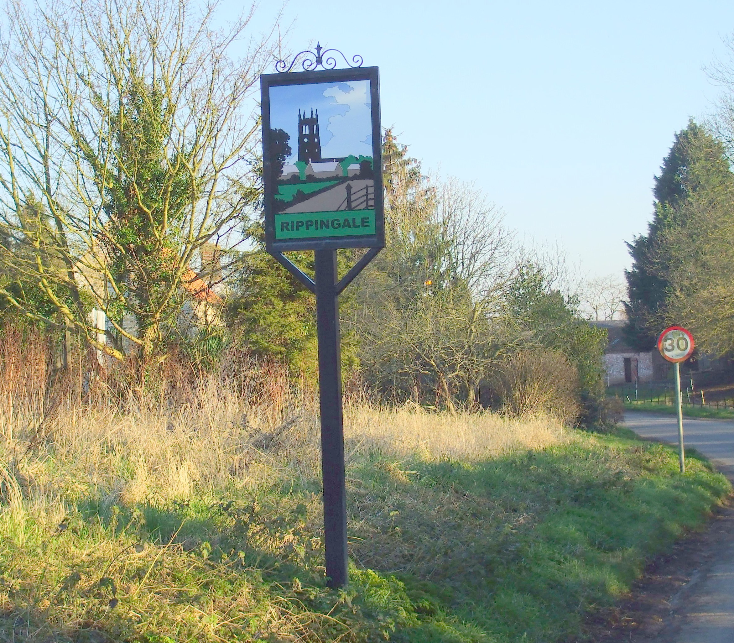
- Here is a photo of the village sign, taken in 2008 by Patricia McCRORY (who retains the copyright):
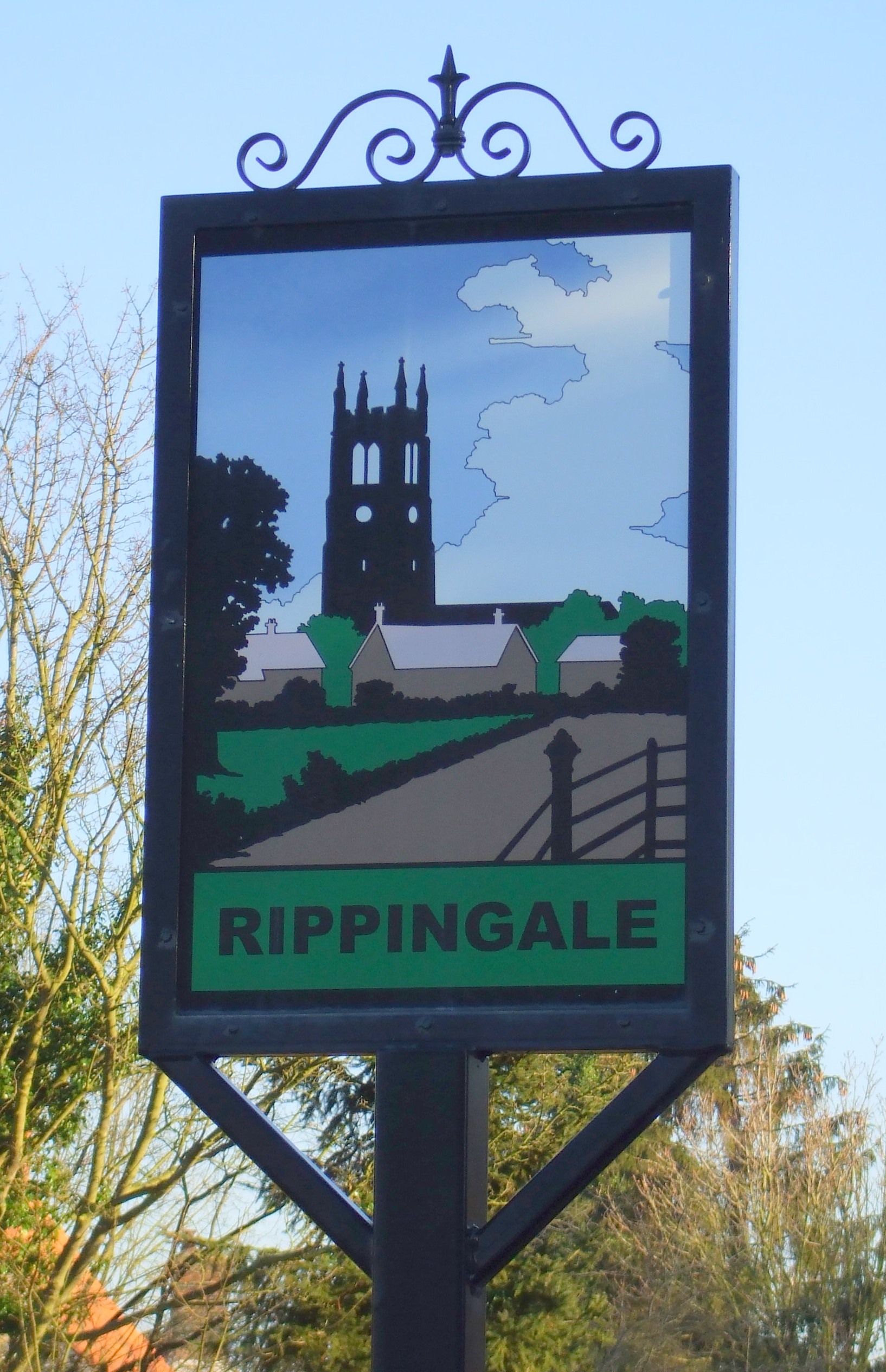
- Here is a closeup of the the same sign, taken in 2008 by Patricia McCRORY (who retains the copyright):
- Ask for a calculation of the distance from Rippingale to another place.
- Rippingale is first mentioned in the "Anglo-Saxon Chronicles" in the year 675.
- Hereward the Wake once rented land at Rippingale.
- The parish had a station on the Bourne and Sleaford Branch of the Great Northern Railway.
- Check out the Rippingale Newsletters which are online.
- Peter CHURCH has a photograph of the Bull Inn, Rippingale on Geograph, taken in May, 2009.
- The Bull Inn has long served as the place to catch up on local news and happenings. Here are the names associated with the Inn in various directories:
| Year | Person |
|---|---|
| 1842 | John SIMPSON, vict. |
| 1872 | -- not listed -- |
- See our Maps page for additional resources.
You can see maps centred on OS grid reference TF097278 (Lat/Lon: 52.836557, -0.372954), Rippingale which are provided by:
- OpenStreetMap
- Google Maps
- StreetMap (Current Ordnance Survey maps)
- Bing (was Multimap)
- Old Maps Online
- National Library of Scotland (Old Ordnance Survey maps)
- Vision of Britain (Click "Historical units & statistics" for administrative areas.)
- English Jurisdictions in 1851 (Unfortunately the LDS have removed the facility to enable us to specify a starting location, you will need to search yourself on their map.)
- Magic (Geographic information) (Click + on map if it doesn't show)
- GeoHack (Links to on-line maps and location specific services.)
- All places within the same township/parish shown on an Openstreetmap map.
- Nearby townships/parishes shown on an Openstreetmap map.
- Nearby places shown on an Openstreetmap map.
Michael STEEL has a photograph of the War Memorial on the edge of the churchyard on Geo-graph, taken in October, 2010.
David HITCHBORNE has a photograph of the War Memorial from the other side on Geo-graph, taken in August, 2013.
This limestone plinth on the High Street, erected circa 1918, is a Grade II listed structure with British Heritage.
There are no Commonwealth War Graves listed for the churchyard in the CWGC database.
Michael PECK tells us:
The War Memorials at Rippingale (St Andrew) have now been recorded. There are 4, but 3 are virtually identical except that on one the ranks of all the dead are recorded as Private and this is known to be wrong so should be ignored. The 4th memorial is to an individual. Their are no numbers or arms of service recorded. Names recorded are (all relate to WW1 except A. E. Sandall which is WW2):
- Arthur HILL
- George HILL
- Frank KIME
- Frederick Daff POLLARD
- John William SANDALL
- Walter SANDALL
- Charles SHARPE
- Walter SCARBOROUGH
- Arthur THOMPSON
- WW2 - A. E. SANDALL
Michael continues: Individual - In loving memory of Alfred Wilson Cooper Ensign in HMs 86th Regiment. He died in Gibralter on the 21st of October 1866 in the 21st year of his age.
- The name Rippingale is from the Old English Hrepa+inga+halh, for "nook of the family of Hrepa", appearing in 806 as Repingale and also in the 1086 Domesday Book as Repinghale.
[A. D. Mills, "A Dictionary of English Place-Names," Oxford University Press, 1991].
- The name is often misspelled as "Rippingdale" in old records. Even the FreeCen site lists it with the "-dale" ending.
- This place was an ancient parish in Lincolnshire and became a modern Civil Parish when those were established.
- The parish was in the ancient Aveland Wapentake in the South Kesteven district and parts of Kesteven.
- The local Parish Council meets in the Village Hall on the second Thursday of each month at 7:30pm. They are NOT funded to help you with family history searches.
- For today's district governance, contact the South Kesteven District Council.
- Bastardy cases would be heard in the Bourne petty session hearings.
- Sir Richard BROWNLOW left a yearly rent charge of 20s to the poor of the parish each year.
- In 1900, there was a charity fund of £150, and the interest from this was distributed to the poor of the parish each year.
- As a result of the1834 Poor Law Amendment Act reforms, the parish became part of the Bourne Poor Law Union.
- A National School was built in 1856 for 130 children. The school was enlarged in 1894.
- For more on researching school records, see our Schools Research page.