
Hide
Rowston
hide
Hide
hide
Hide
hide
Hide
Hide
hide
Hide
Hide
- The parish was in the Billinghay sub-district of the Sleaford Registration District.
- Check our Census Resource page for county-wide resources.
- The table below gives census piece numbers, where known:
| Census Year | Piece No. |
|---|---|
| 1841 | H.O. 107 / 621 |
| 1861 | R.G. 9 / 2341 |
| 1871 | R.G. 10 / 3348 |
| Rowston, Methodist (Wesleyan Reform) |
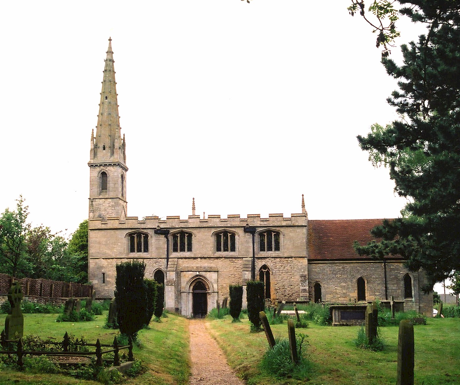
- The Anglican parish church is dedicated to Saint Clement.
- The church was built in the 12th century.
- The church was refitted in 1741.
- The church was restored in 1904-1910.
- The church is a Grade I listed building with British Heritage.
- The church seats 100.
- There is a photograph of St. Clement's Church on the Wendy PARKINSON Church Photos web site.
- There is another photograph of St. Clement's Church on FLICKR.
- Here is a photo of St. Clement's Church, taken by Ron COLE (who retains the copyright):
- The Anglican parish register dates from 1566.
- The Lincolnshire FHS has a Loan Library service which has the parish registers on microfiche for Baptisms from 1562 to 1813 and Marriages from 1562 to 1812.
- The LFHS has published several marriage and burial indexes for the Lafford Deanery to make your search easier.
- Check the Churchyard at St. Clements to see if you recognize any names.
- There was a Wesleyan Reform Methodist chapel built here in 1861. For information and assistance in researching this chapel, see our non-conformist religions page.
- Check our Church Records page for county-wide resources.
- The parish was in the Billinghay sub-district of the Sleaford Registration District.
- Check our Civil Registration page for sources and background on Civil Registration which started in July, 1837.
This village and parish are north of Sleaford about 12 miles and about a mile north of Digby parish. The parish covers about 1,880 acres.
If you are planning a visit:
- Richard CROFT has a photograph of the 14th century Village Cross on Geo-graph, taken in March, 2010.
- By automobile, the village lies between the B1188 trunk road and the rail line to the east.
- See our touring page for more sources.
- Ask for a calculation of the distance from Rowston to another place.
- Rowston Manor is a limestone house built in 1741.
- Additions were made to the house as recently as 1985.
- The Manor is a Grade II listed building with British Heritage.
- See our "Maps" page for additional resources.
You can see maps centred on OS grid reference TF084564 (Lat/Lon: 53.094024, -0.382376), Rowston which are provided by:
- OpenStreetMap
- Google Maps
- StreetMap (Current Ordnance Survey maps)
- Bing (was Multimap)
- Old Maps Online
- National Library of Scotland (Old Ordnance Survey maps)
- Vision of Britain (Click "Historical units & statistics" for administrative areas.)
- English Jurisdictions in 1851 (Unfortunately the LDS have removed the facility to enable us to specify a starting location, you will need to search yourself on their map.)
- Magic (Geographic information) (Click + on map if it doesn't show)
- GeoHack (Links to on-line maps and location specific services.)
- All places within the same township/parish shown on an Openstreetmap map.
- Nearby townships/parishes shown on an Openstreetmap map.
- Nearby places shown on an Openstreetmap map.
- This place was an ancient parish in Lincolnshire and became a modern Civil Parish when those were established.
- The parish was in the ancient Flaxwell Wapentake in the North Kesteven division of the county, parts of Kesteven.
- For today's district governance, see the North Kesteven District Council.
- Bastardy cases would be heard in the Sleaford petty session hearings every Monday.
- After the Poor Law Amendment Act reforms of 1834, the parish became part of the Sleaford Poor Law Union.
- A National Schools was built here in 1852. It could hold up to 60 students.
- The school is a Grade II listed building with British Heritage.
- For more on researching school records, see our Schools Research page.