
Hide
Roxby
hide
Hide
hide
Hide
hide
Hide
Hide
Roxby cum Risby, par. and local government dist., Lincolnshire, 1 mile S. of Winterton and 8 miles NW. of Brigg, 4,784 ac., pop. 417; Roman remains have been found.
From: John BARTHOLOMEW's "Gazetteer of the British Isles (1887)"
Hide
The Scunthorpe Library is an excellent resource with a Local History section.
Alternatively, the Brigg Library also has a Local History section.
- The parish was in the Winterton sub-district of the Glanford Brigg Registration District.
- Check our Census Resource page for county-wide resources.
- The table below gives census piece numbers, where known:
| Census Year | Piece No. |
|---|---|
| 1841 | H.O. 107 / 642 |
| 1861 | R.G. 9 / 2400 |
| 1871 | R.G. 10 / 3431 |
| 1891 | R.G. 12 / 2627 |
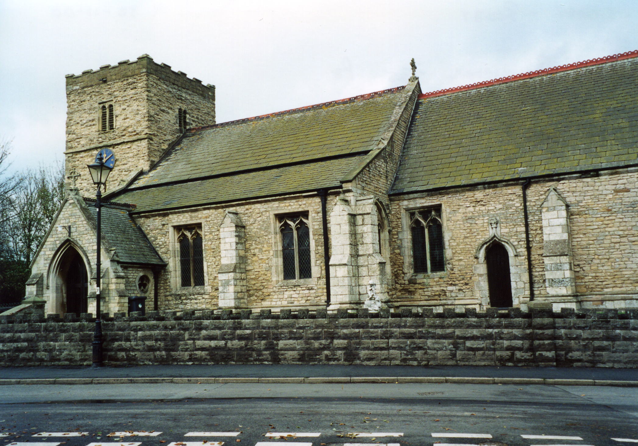
- The Anglican parish church is dedicated to Saint Mary.
- The structure dates back to the 12th century.
- The church was restored in 1875.
- The church is a Grade I listed building with British Heritage.
- Risby had an ancient Anglican parish church, dedicated to Saint Bartholomew, but only traces of the foundation could be traced in 1911.
- St. Mary's Church seats 200.
- There is a photograph of St. Mary's Church on the Wendy PARKINSON Church Photos web site, taken by Sheila FENTON.
- Here is a photo of St. Mary's Church, taken by Ron COLE (who retains the copyright):
- Parish registers exist from 1689 (some sources give 1694, others 1603), although Bishop's transcripts go back to 1599. Risby entries are included in the Roxby parish register.
- We have the beginnings of a Parish Register Extract in a pop-up text file. Your additions are welcomed.
- Check the Manlake Deanery to see existing Marriage Indexes.
- Check our Church Records page for county-wide resources.
- The parish was in the Winterton sub-district of the Glanford Brigg Registration District.
- Check our Civil Registration page for sources and background on Civil Registration which began in July, 1837.
Roxby with Risby (or "Roxby cum Risby") is a pair of villages that make up a single parish in the north of Lincolnshire. Both villages lie west of the old Roman Road known as Ermine Street, about 9 miles WSW of Barton on Humber and just north of Scunthorpe. Branches of the Old River Ancholme flow between the villages. The parish of Appleby borders on the south and east and Winterton lies only a mile to the north. The parish covers about 4,900 acres of land and also includes the hamlets of Sawcliffe and Dragonby.
Roxby sits near the top of the Cliff Hills with a nice view of the Humber River. If you are planning a visit:
- By automobile, out of Scunthorpe, take the A1077 north to reach either village.
- Check our touring page for Lincolnshire.
- Ask for a calculation of the distance from Roxby to another place.
- A Roman pavement, some twenty feet in width, was found in 1709 just southwest of the church.
- In the 1800's, rabbit hunting was a popular sport and probably many a rabbit found their way into a poacher's stew.
- See our Maps page for additional resources.
You can see maps centred on OS grid reference SE940167 (Lat/Lon: 53.638375, -0.579107), Roxby which are provided by:
- OpenStreetMap
- Google Maps
- StreetMap (Current Ordnance Survey maps)
- Bing (was Multimap)
- Old Maps Online
- National Library of Scotland (Old Ordnance Survey maps)
- Vision of Britain (Click "Historical units & statistics" for administrative areas.)
- English Jurisdictions in 1851 (Unfortunately the LDS have removed the facility to enable us to specify a starting location, you will need to search yourself on their map.)
- Magic (Geographic information) (Click + on map if it doesn't show)
- GeoHack (Links to on-line maps and location specific services.)
- All places within the same township/parish shown on an Openstreetmap map.
- Nearby townships/parishes shown on an Openstreetmap map.
- Nearby places shown on an Openstreetmap map.
- The name Roxby is from the Old Scandinavian Hrokr+by, or "farmstead of a man named Hrokr". In the 1086 Domesday Book, the village name is given as Roxebi. The name also appears in northern Yorkshire.
- Risby is also Old Scandinavian in origin, hris+by or ryth+by, meaning "farmstead among the brushwood or by a clearing." The first meaning is more likely. In the 1086 Domesday Book, the village name is given as Risebi. A village with the same name is in Suffolk.
["A Dictionary of English Place-Names," A. D. Mills, Oxford University Press, 1991].
- This place was created as a modern Civil Parish shortly after 1717.
- The parish was in the northern division of the ancient Wapentake of Manley in the parts of Lindsey in North Lincolnshire.
- District governance is currently provided by the North Lincolnshire Council.
- Bastardy cases would be heard at the Winterton petty session hearings.
- After the Poor Law Amendment Act reforms of 1834, this parish became part of the Glanford Brigg Poor Law Union.
- There was a school here prior to 1841.
- In 1868, Valentine H. D. CARY-ELWAS funded the building of a National School, built to hold 56 children, initially attended by over 40 children.
- For more on researching school records, see our Schools Research page.