
Hide
Saleby
hide
Hide
hide
Hide
hide
Hide
Hide
Hide
The Community Library at Alford has a local history archive that will prove useful in your research.
You can see some of the churchyard graves in Ron COLE's photo under Church History.
Peter WOOD has a photograph of St. Margaret's Burial Ground on Geo-graph, taken in February, 2019.
Ian S. also has a photograph of a portion of St. Margaret's Churchyard on Geo-graph, taken in April, 2012.
- The parish was in the Withern sub-district of the Louth Registration District.
- We have an extract of a small portion of the 1901 surname index which you are welcome to review or add to.
- Check our Census Resource page for county-wide resources.
- The table below gives census piece numbers, where known:
Census
YearPiece No. 1841 H.O. 107 / 643 1851 H.O. 107 / 2111 1861 R.G. 9 / 2379 1871 R.G. 10 / 3399 1891 R.G. 12 / 2606 1901 R.G. 13 / 3082
| Rose Lane, Saleby, Methodist (Wesleyan) |
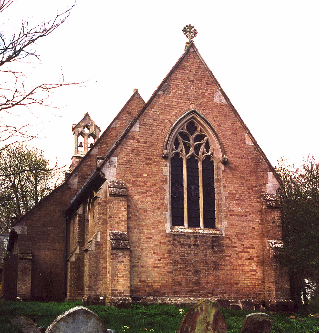
- The Anglican parish church is dedicated to Saint Margaret.
- The original church has been dated back to before 1303. The church chapel was apparently rebuilt in 1592 by John HARYINGTON of Wickham.
- The church was rebuilt in 1850 of white (or buff) brick.
- The church was restored in 1958.
- The church is a Grade II listed building with British Heritage.
- The church seats 150.
- There is a photograph of St. Margaret's church on the Wendy PARKINSON Church Photos web site, taken by Paul Fenwick.
- Richard CROFT provides a photograph of St. Margaret's church on the Geo-graph web site, taken in 2008
. - Here is a photo of Saint Margaret's Church, taken by Ron COLE (who retains the copyright):
- The parish register dates from 1554.
- The Churchwardens' accounts exist for 1634, 1646, 1689 and 1701.
- The Lincolnshire FHS has published several marriage indexes and a burial index for the Calcewaith and Candleshoe Deanery to make your search easier.
- Check our Church Records page for county-wide resources.
- The Wesleyan Methodists had a small chapel here, built in 1855. For information and assistance in researching these chapels, see our non-conformist religions page.
- The parish was in the Withern sub-district of the Louth Registration District.
- Check our Civil Registration page for sources and background on Civil Registration which began in July, 1837.
Saleby is a village and parish which is just north of Alford on the road to Louth and 11 miles south-east of Louth itself. The parish includes the hamlet of Thoresthorpe, about one mile north of Saleby village. The parish covers about 1,790 acres.
And any visit to Saleby should start with:
- By automobile, take the A1104 trunk road north out of Louth. Saleby will be about one mile outside of Alford. Alternatively, one can take the A1104 east out of Mablethorpe and stay on that road. Saleby village sits just east of the roadway.
- See our touring page for visitor services.
- Ask for a calculation of the distance from Saleby to another place.
- See our Maps page for additional resources.
You can see maps centred on OS grid reference TF457786 (Lat/Lon: 53.28446, 0.18445), Saleby which are provided by:
- OpenStreetMap
- Google Maps
- StreetMap (Current Ordnance Survey maps)
- Bing (was Multimap)
- Old Maps Online
- National Library of Scotland (Old Ordnance Survey maps)
- Vision of Britain (Click "Historical units & statistics" for administrative areas.)
- English Jurisdictions in 1851 (Unfortunately the LDS have removed the facility to enable us to specify a starting location, you will need to search yourself on their map.)
- Magic (Geographic information) (Click + on map if it doesn't show)
- GeoHack (Links to on-line maps and location specific services.)
- All places within the same township/parish shown on an Openstreetmap map.
- Nearby townships/parishes shown on an Openstreetmap map.
- Nearby places shown on an Openstreetmap map.
- Richard CROFT has a photograph of Sir William de Hardreshull's tomb on Geo-graph, taken in April, 2008. Sir William was born 15th April 1269 in Scotton in Lincolnshire. Sir William de Hardreshull fought with King Edward I in his campaigns to subjugate the Scots and the Welsh, he died in 1303.
- This place was an ancient parish of Lincolnshire and became a modern Civil Parish when those were established.
- The parish was in the ancient Calceworth Wapentake in the East Lindsey district in the parts of Lindsey.
- Kelly's 1900 Directory of Lincolnshire places the parish in the South Lindsey division of the county.
- In recent times the Civil Parish has merged with another to create the modern Civil Parish of Beesby with Saleby. The combined parish does not have a formal Parish Council, but has a Parish Meeting from time to time to deal with civic and political issues.
- For today's district governance, see the East Lindsey District Council.
- After the Poor Law Amendment Act of 1834, this parish became part of the Louth Poor Law Union.
- Bastardy cases would be heard in the Alford petty sessional hearings on alternate Tuesdays.
- Education for poor children started here in 1762, with a bequest from Thomas FAULKNER.
- A Pulic Elementary School was built here in 1845 to hold 30 children. Some parish poor children went to school at Queen Elizabeth's Grammar School in Alford. The elementary school closed in 1932.
- For more on researching school records, see our Schools Research page.