
Hide
Saltfleetby St Clement
hide
Hide
hide
Hide
hide
Hide
Hide
Hide
The Library at Louth will prove useful in your research.
Alan HEARDMAN has a photograph of St. Clement's Lych Gate on Geo-graph, taken in September, 2009.
Richard CROFT has a photograph of St. Clement's church showing part of the churchyard on Geo0graph, taken in October, 2007.
- The parish was in the Saltfleet sub-district of the Louth Registration District.
- Check our Census Resource page for county-wide resources.
- The table below gives census piece numbers, where known:
| Census Year | Piece No. |
|---|---|
| 1841 | H.O. 107 / 643 |
| 1851 | H.O. 107 / 2111 & 2112 |
| 1861 | R.G. 9 / 2385 |
| 1871 | R.G. 10 / 3407 |
| 1891 | R.G. 12 / 2610 |
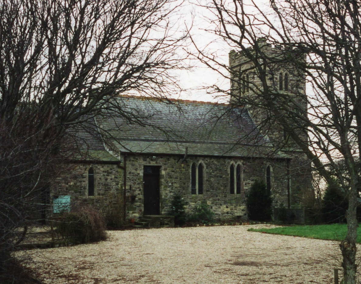
- The Anglican parish church is dedicated to Saint Clement.
- The church was originally erected in 1225. That building was taken down and a new structure erected in 1885-6 at a new site. The new building was made with Ancaster stone.
- The old churchyard is still used for burials.
- The church seats about 130.
- The Diocese of Lincoln declared this church redundant in November, 1973. In July of 1977 it was opened as a craft workshop and dislay center.
- There is a photograph of St. Clement's Church on the Wendy PARKINSON Church Photos web site.
- Here is a photo of St. Clement's Church, taken by Ron COLE (who retains the copyright):
- The Anglican parish register dates from 1716. Earlier entries for the parish can be found in the Saltfleetby All Saints register.
- The Lincolnshire FHS has published several Marriage indexes and a Burial index for the Louthesk Deanery to make your search easier.
- Check our Church Records page for county-wide resources.
- The parish was in the Saltfleet sub-district of the Louth Registration District.
- Check our Civil Registration page for sources and background on Civil Registration which began in July, 1837.
Saltfleetby St. Clements is a village and parish which is bounded on the east by the North Sea, on the north by Skidbrooke parish, and lies 7 miles east of Louth and a similar distance due north of Alford. The parish covers about 1,160 acres and includes the hamlet of Three Bridges, just to the south.
The three Saltfleetby villages have operated as one entity for many years. If you are planning a visit:
- By automobile, take the A1031 trunk road (runs up the coast near the North Sea) and turn east onto the B1200. The village is less than a mile west of the intersection of the two roads.
- There is caravan parking just north of the village.
- A portion of the seashore is part of the "Saltfleetby-Theddlethorpe Dunes National Nature Reserve".
- See our touring page for visitor services.
- Ask for a calculation of the distance from Saltfleetby St Clement to another place.
- See our Maps page for additional resources.
You can see maps centred on OS grid reference TF459918 (Lat/Lon: 53.40286, 0.193136), Saltfleetby St Clement which are provided by:
- OpenStreetMap
- Google Maps
- StreetMap (Current Ordnance Survey maps)
- Bing (was Multimap)
- Old Maps Online
- National Library of Scotland (Old Ordnance Survey maps)
- Vision of Britain (Click "Historical units & statistics" for administrative areas.)
- English Jurisdictions in 1851 (Unfortunately the LDS have removed the facility to enable us to specify a starting location, you will need to search yourself on their map.)
- Magic (Geographic information) (Click + on map if it doesn't show)
- GeoHack (Links to on-line maps and location specific services.)
- All places within the same township/parish shown on an Openstreetmap map.
- Nearby townships/parishes shown on an Openstreetmap map.
- Nearby places shown on an Openstreetmap map.
Chris ? has a photograph of the grave of Able Seaman W. MOIR, who died when the SS Orsa sunk after striking a mine in 1939. The photo is on Geo-grap, taken in September, 2013.
- This place was an ancient parish in Lincoln county and became a modern Civil Parish when those were established.
- For governance, the parish was in the ancient Louth Eske Wapentake in the East Lindsey district in the parts of Lindsey.
- In August, 1882, this Civil Parish gained a portion of Saltfleetby All Saints and a portion of Saltfleetby St. Peter Civil Parishes.
- In March, 1887, this Civil Parish was reduced in size to enlarge Saltfleetby All Saints Civil Parish.
- In March, 1887, this Civil Parish was reduced in size to enlarge Saltfleetby St. Peter Civil Parish.
- For today's governance, see the East Lindsey District Council.
- Bastardy cases would be heard in the Louth petty session hearings.
- After the Poor Law Act of 1834, this parish became part of the Louth Poor Law Union.
- The children of this parish attended school at the joint school of the three Saltfleetbys in the parish of Saltfleetby St. Peter.
- See our Schools page for more information on researching school records.