
Hide
Scredington
hide
Hide
hide
Hide
hide
Hide
Hide
Hide
Take advantage of the nearby Sleaford Library to see how they can assist you with your search.
- The parish was in the Aswarby sub-district of the Sleaford Registration District.
- In 1891, the parish was transferred to the Leadenham sub-district.
- Check our Census Resource page for county-wide resources.
- The table below gives census piece numbers, where known:
Census
YearPiece No. 1841 H.O. 107 / 622 1861 R.G. 9 / 2346 1871 R.G. 10 / 3353 1891 R.G. 12 / 2581
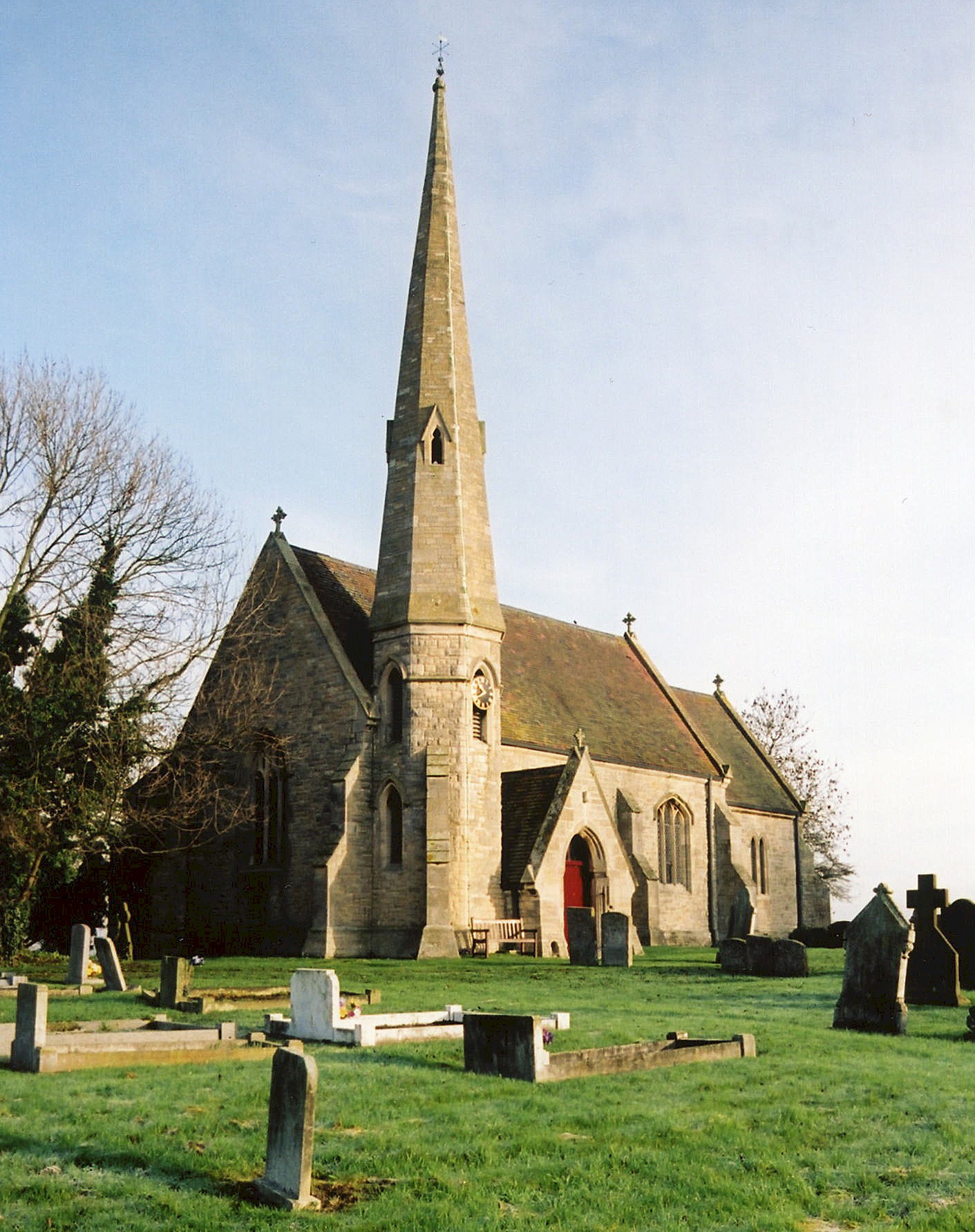
- The Anglican parish church is dedicated to Saint Andrew.
- The church was restored in 1869.
- The church seats 150.
- There is a photograph of St. Andrew's Church on the Wendy PARKINSON Church Photos web site.
- Richard CROFT has a photograph of St.Andrew's Church on Geo-graph, taken in June, 2006.
- J. THOMAS also has a photograph of St.Andrew's Church on Geo-graph, taken in April, 2012.
- Here is a photo of St. Andrew's Church, taken by Ron COLE (who retains the copyright):
- The Anglican parish register dates from 1738.
- We have a partial Parish Register Extract. Your contributions would be appreciated.
- The Lincolnshire FHS has a Loan Library service which has the parish registers on microfiche for Baptisms from 1738 to 1814 and Marriages from 1738 to 1812.
- The LFHS has published several marriage and burial indexes for the Lafford Deanery to make your search easier.
- The Wesleyan Methodists had a chapel here, built in 1875. For information and assistance in researching these chapels, see our non-conformist religions page.
- Check our Church Records page for county-wide resources.
- The parish was in the Aswarby sub-district of the Sleaford Registration District.
- In 1891, the parish was reassigned to the Leadenham sub-district.
- Check our Civil Registration page for sources and background on Civil Registration which started in July, 1837.
Scredington is both a village and parish about 3.5 miles southeast of Sleaford. Swaton parish lies to the south and Helpringham parish to the east. In 1841, the parish covered 2,530 acres and in 1913 2,633 acres.
The hamlet of Northbeck lies a quarter mile north of the village of Scredington and Highgate hamlet lies a miles southeast. If you are planning a visit:
- See our touring page for more sources.
- Ask for a calculation of the distance from Scredington to another place.
- J. HANNAN-BRIGGS has a photograph of the 15th century Packhourse Bridge on Geo-graph, taken in May, 2013.
- Robert HARVEY also has a photograph of the Packhorse Bridge over the North Beck at Geo-graph, taken in March, 2018.
- Bricks and tiles were made here in the 1800s.
- See our "Maps" page for additional resources.
You can see maps centred on OS grid reference TF094405 (Lat/Lon: 52.950736, -0.373138), Scredington which are provided by:
- OpenStreetMap
- Google Maps
- StreetMap (Current Ordnance Survey maps)
- Bing (was Multimap)
- Old Maps Online
- National Library of Scotland (Old Ordnance Survey maps)
- Vision of Britain (Click "Historical units & statistics" for administrative areas.)
- English Jurisdictions in 1851 (Unfortunately the LDS have removed the facility to enable us to specify a starting location, you will need to search yourself on their map.)
- Magic (Geographic information) (Click + on map if it doesn't show)
- GeoHack (Links to on-line maps and location specific services.)
- All places within the same township/parish shown on an Openstreetmap map.
- Nearby townships/parishes shown on an Openstreetmap map.
- Nearby places shown on an Openstreetmap map.
- Adrian S. PYE has a photograph of the Lancaster ED439 Memorial, taken in June, 2020.
- St. Andrew's Church in the village contains a memorial plaque to those who lost their lives during the First World War.
These are the names from the Lancaster ED439 Memorial (all died June, 1943):
- Pilot Officer Max Keiran CUMMINGS, RAAF, age 30
- Sgt. Henry Whitfield LUKER, RAAF, age 24
- Sgt. Francis William WILCOX, RAF, age 24
- Sgt. John ROUGHLEY, RAFVR, age 21
- Sgt. Harry William CHESHIRE, RAFVR, age 22
- Sgt. Norman WOODCOCK, RAFVR, age 24
- Flt Sgt. Robert Allen TAYLOR, RCAF, age 25
- Cpl. Thomas John BOND, RAFVR, age 30
- Cpl. Francis Neville SLOSS, RAFVR, age 19
The World War One Memorial names are:
- Herbert William BROCKET (apperes as BROCKEY on monument)
- Ellis CARTER
- Ernest CARTER
- James CARTER
- Samuel CARTER
- Thomas COY
- William COULSON
- Robert HANDFORD
- Frank HOLMES
- Samuel S. LINDSEY - missing
- Herbert Henry PELL, RFA
- William SHARPE
- This place was an ancient parish in county Lincoln and became a modern Civil Parish when those were established.
- The parish was in the ancient Aswardhurn Wapentake in the North Kesteven division of the county, parts of Kesteven.
- You may contact the local Parish Council regarding civic or political issues, but they are NOT staffed to do family history lookups for you.
- For today's district governance, see the North Kesteven District Council.
- Bastardy cases would be heard in the Sleaford petty session hearings.
- The common land was enclosed here in 1798. 19 acres were allotted to the poor and let to a number of cottagers. The revenue was distributed to paupers as coal.
- The poor here also had the interest of £50, left by an unknown donor.
- After the Poor Law Amendment Act reforms of 1834, the parish became part of the Sleaford Poor Law Union.
- A Public Elementary School was built here in 1877 to hold 80 children.
- For more on researching school records, see our Schools Research page.