
Hide
Skellingthorpe
hide
Hide
hide
Hide
hide
Hide
Hide
hide
Hide
Hide
- The parish was in the South West sub-district of the Lincoln Registration District.
- Check our Census Resource page for county-wide resources.
- The table below gives census piece numbers, where known (contributed by Keith Dorey):
| Census Year | Piece No. |
|---|---|
| 1841 | H.O. 107 / 622 |
| 1851 | H.O. 107 / 2104 |
| 1861 | R.G. 9 / 2355 |
| 1871 | R.G. 10 / 3366 |
| 1881 | R.G. 11 / 3236 |
| 1891 | R.G. 12 / 2587 |
| 1901 | R.G. 13 / 3057 |
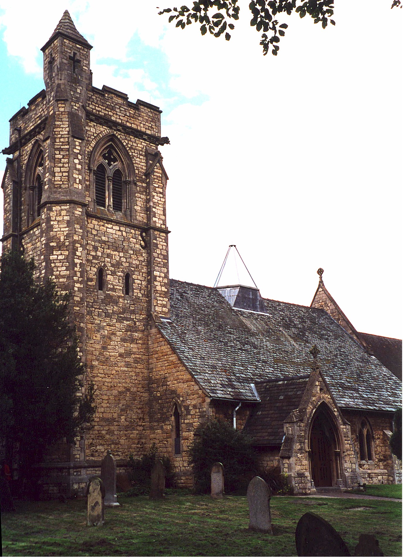
- The Anglican parish church is dedicated to St. Lawrence.
- The church was rebuilt in 1855.
- The church seats 130.
- A photograph of the Anglican parish church is at the Wendy PARKINSON English Church Photographs site.
- Here is a photo of the church, taken by Ron COLE (who retains the copyright):
- The Anglican parish register dates from 1563.
- We have a partial Parish Register Extract. Your contributions would be appreciated.
- The author of this page has been advised that the parish register in the Archives has been damaged by fire and is too fragile to access.
- The Lincolnshire FHS has published several marriage indexes and a burial index for the Graffoe Deanery to make your search easier.
- There was a chapel for Wesleyan Methodists in the parish, built in 1894 to seat 200. The Primitive Methodists also had a chapel here. For more on researching these chapel records, see our non-conformist religions page.
- Richard CROFT has a photograph of the Methodist Church on Geo-graph, taken in April, 2009.
- Check our Church Records page for county-wide resources.
- The parish was in the South West sub-district of the Lincoln Registration District.
- Check our Civil Registration page for sources and background on Civil Registration which began in July, 1837.
This village and parish lie just west of Lincoln in Lincolnshire, across the Fossdyke Navigation canal. Saxilby parish is to the north-west and the city and parish of Lincoln lies due east. The parish covers just over 6,200 acres and includes the hamlet of Swallow Beck.
If you are planning a visit:
- All railway service to Skellingthorpe ended in 1980.
- Take the A46 bypass (around the west side of Lincoln), take the Birchwood turnoff and head west to Skellington.
- See our touring page for more sources.
- Ask for a calculation of the distance from Skellingthorpe to another place.
- Much of the land in the parish was reclaimed from a marshy state in 1835.
- The large reservoir for Lincoln Water Works was built in this parish. It covered 25 acres.
- Richard CROFT has a photograph of the Stone Arms P.H. on Geo-graph, taken in September, 2010.
- The Manor was bequeathed in 1693 to Christ's Hospital in London by H. STONE.
- Hartsholme Hall, a tudor style building, was built in 1862. In 1900 it was unoccupied.
- Skellingthorpe Hall was the residence and property of Richard C. BERGNE-COUPLAND in 1871. This secluded Georgian Manor House was built in 1811 to replace an earlier structure.
- See our Maps page for additional resources.
You can see maps centred on OS grid reference SK922720 (Lat/Lon: 53.237174, -0.620127), Skellingthorpe which are provided by:
- OpenStreetMap
- Google Maps
- StreetMap (Current Ordnance Survey maps)
- Bing (was Multimap)
- Old Maps Online
- National Library of Scotland (Old Ordnance Survey maps)
- Vision of Britain (Click "Historical units & statistics" for administrative areas.)
- English Jurisdictions in 1851 (Unfortunately the LDS have removed the facility to enable us to specify a starting location, you will need to search yourself on their map.)
- Magic (Geographic information) (Click + on map if it doesn't show)
- GeoHack (Links to on-line maps and location specific services.)
- All places within the same township/parish shown on an Openstreetmap map.
- Nearby townships/parishes shown on an Openstreetmap map.
- Nearby places shown on an Openstreetmap map.
- Richard CROFT has a photograph of the War Memorial in the churchyard on Geo-graph, taken in September, 2005.
- RAF Skellingthorpe opened in October, 1941, and was initially home of 50 Squadron. Airfield construction was completed in November, 1941.
- In 1945, the airfield took over the job of salvaging crashed aircraft.
- The airfield closed in 1952.
- There is a museum to 50 and 51 Squadrons at the site (now the Birchwood Community Centre).
- Tony HIBBERD has a photograph of the WWII War Memorial on Geo-graph, taken in December, 2012.
- The parish boundaries and size have changed over time, so look in neighboring parishes for family history information. In the 1800s, the parish covered 6,220 acres. In 1921, it covered only 5,600 acres.
- The parish was in the Lower division of the ancient Boothby Graffoe Wapentake in the North Kesteven division of the county, in the parts of Kesteven.
- For today's governance, see the North Kesteven District Council.
- Skellingthorpe Village Office is on Lincoln Road, LN6 5UT.
- Bastardy cases would be heard in the LIncoln South petty session hearings.
- The Common Land was enclosed here around 1805.
- The poor of the parish had the interest from £100 left by Charles HAYWARD, a steward of Christ's Hospital.
- As a result of the 1834 Poor Law Amendment Act, the parish became part of the Lincoln Poor Law Union.
Year Inhabitants 1801 193 1821 370 1831 417 1841 533 1851 584 1861 662 1871 726 1881 722 1891 650 1901 772 1911 650 1921 624 1971 2,594
- A Church of England Endowed School was built in 1856 and enlarged in 1899.
- For more on researching school records, see our Schools Research page.