
Hide
Skendleby
hide
Hide
hide
Hide
hide
Hide
Hide
hide
Hide
Hide
- The parish was in the Spilsby sub-district of the Spilsby Registration District.
- Check our Census Resource page for county-wide resources.
- The table below gives census piece numbers, where known:
| Census Year | Piece No. |
|---|---|
| 1841 | H.O. 107 / 644 |
| 1851 | H.O. 107 / 2109 |
| 1861 | R.G. 9 / 2375 |
| 1871 | R.G. 10 / 3393 |
| 1891 | R.G. 12 / 2603 |
| Skendleby Hall Chapel, Skendleby, Roman Catholic |
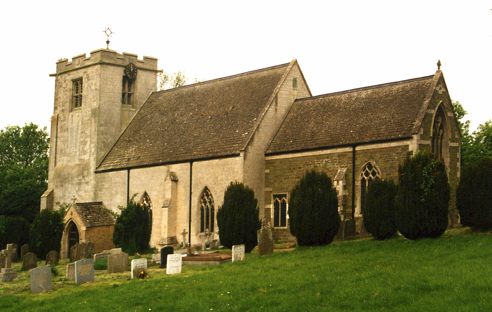
- The Anglican parish church is dedicated to Saint Peter.
- There was a church here at the time of the Domesday survey (1068).
- The church dates back to prior to 1094.
- The church was repaired in 1851 and again in 1858.
- The church was restored in 1875.
- The church is a Grade II listed building with British Heritage.
- Here is a photo of St. Peter and Saint Paul Church, taken by Ron COLE (who retains the copyright):
- The Anglican parish register dates from 1723 for baptisms and burials and 1745 for marriages.
- The Lincolnshire FHS has published several marriage indexes and a burial index for the Bolingbroke Deanery to make your search easier.
- Kelly's 1913 Directory of Lincolnshire places the parish in the South Hill rural deanery.
- A Wesleyan Methodist chapel was built here, in the village, in 1849, replacing an earlier chapel. There was a Roman Catholic chapel in Skendleby Hall which held Mass on Thursdays. For information and assistance in researching these chapels, see our non-conformist religions page.
- Check our Church Records page for county-wide resources.
- The parish was in the Spilsby sub-district of the Spilsby Registration District.
- Check our Civil Registration page for sources and background on Civil Registration which began in July, 1837.
This small village and parish lies about 4 miles north of Spilsby. Scremby parish lies just to the southeast and Ulceby parish to the north. The parish covers just over 1,500 acres.
If you are planning a visit:
- By automobile, take the A1028 trunk road between Louth and Skegness. Just south of Ulceby, turn west for Skendleby.
- See our touring page for more sources.
- Ask for a calculation of the distance from Skendleby to another place.
- Skendleby Hall was built in the Elizabethan style, built of red brick with stone facings.
- The Hall was the property and seat of William Dunn GAINSFORD in 1900 thru 1912.
- Skendleby Hall is now available for hire, should you need a place to gather all your relatives for a family re-union.
- See our "Maps" page for additional resources.
You can see maps centred on OS grid reference TF433697 (Lat/Lon: 53.204953, 0.144711), Skendleby which are provided by:
- OpenStreetMap
- Google Maps
- StreetMap (Current Ordnance Survey maps)
- Bing (was Multimap)
- Old Maps Online
- National Library of Scotland (Old Ordnance Survey maps)
- Vision of Britain (Click "Historical units & statistics" for administrative areas.)
- English Jurisdictions in 1851 (Unfortunately the LDS have removed the facility to enable us to specify a starting location, you will need to search yourself on their map.)
- Magic (Geographic information) (Click + on map if it doesn't show)
- GeoHack (Links to on-line maps and location specific services.)
- All places within the same township/parish shown on an Openstreetmap map.
- Nearby townships/parishes shown on an Openstreetmap map.
- Nearby places shown on an Openstreetmap map.
- In 1941, Skendleby became a Chain Home Low Radar site for detecting Axis aircraft approaching the English coast.
- The site became a Ground Control Intercept site in the 1950s.
- RAF Skendleby closed some time after 1950 and passed into private owndership. It has been used for some years as a storage site.
- In the year 2000, the site was visited by Subterranea Britannica.
For a photograph of the Skendleby War Memorial and the names on it, see the Roll of Honour site.
- This place was an ancient parish in Lincoln county and became a modern Civil Parish when those were established.
- The parish was in the Wold division of the ancient Candleshoe Wapentake in the East Lindsey division of the county, in the parts of Lindsey.
- Kelly's 1900 Directory of Lincolnshire places the parish, perhaps erroneously, in the South Lindsey division of the county.
- For today's district governance, see the East Lindsey District Council.
- Bastardy cases would be heard in the Spilsby petty session hearings every other Monday.
- In 1644, Thomas WOODRIFFE left 7 acres of land to be worked by the poor.
- In 1666, William FREEMAN left a yearly rent-charge of 4 Shillings for the poor.
- An undated charity of the interest from £100, left by Isabella PILKINGTON, is distributed in gowns to poor widows.
- The parish had a Clothing Club, supported by the chief landowners of the parish, which distributed clothing to the poor.
- As a result of the 1834 Poor Law Amendment Act, the parish became part of the Spilsby Poor Law Union.
- A National School was built here in 1842.
- It appears that the old school has closed and the property now used as a private day care for infants.
- For more on researching school records, see our Schools Research page.