
Hide
South Cockerington
hide
Hide
hide
Hide
hide
Hide
Hide
hide
- Maps
- Migration, Internal◬
- Military History◬
- Military Records◬
- Monumental Inscriptions
- Names, Geographical
- Names, Personal◬
- Naturalisation & Citizenship◬
- Newspapers◬
- Occupations◬
- Politics & Government
- Poor Houses, Poor Law
- Population
- Postal & Shipping Guides◬
- Probate Records◬
- Public Records◬
- Schools
- Societies◬
- Voting Registers◬
Hide
Hide
The Library at Louth will prove useful in your research.
Richard CROFT has a photograph of St. Leonard's Churchyard on Geo-graph, taken in September, 2019.
Peter WOOD also has a photograph of a portion of the Burial Ground on Geo-graph, taken in February, 2019.
- The parish was in the Saltfleet sub-district of the Louth Registration District.
- The North Lincolnshire Library holds copies of the census returns for 1841 and 1881.
- Check our Census Resource page for county-wide resources.
- The table below gives census piece numbers, where known:
| Census Year | Piece No. |
|---|---|
| 1841 | H.O. 107 / 631 |
| 1851 | H.O. 107 / 2112 |
| 1861 | R.G. 9 / 2385 |
| 1871 | R.G. 10 / 3407 |
| 1891 | R.G. 12 / 2610 |
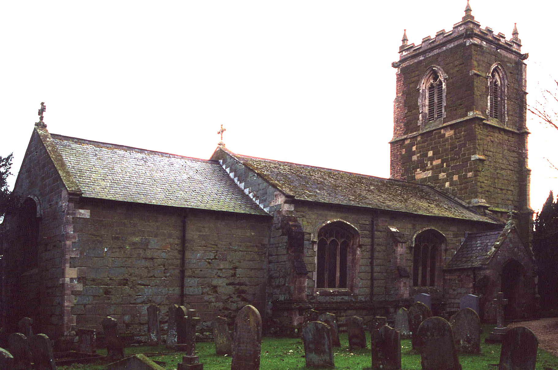
- The Anglican parish church is dedicated to Saint Leonard.
- The church was built of stone in the 1500s.
- The church was restored in 1873.
- The church is a Grade I listed building with British Heritage.
- The church seats about 120.
- There is a photograph of St. Leonard's Church on the Wendy PARKINSON Church Photos web site.
- J. HANNAH-BRIGGS has a photograph of the church interior on Geo-graph, taken in 2012.
- Here is a photo of St. Leonard's Church, taken by Ron COLE (who retains the copyright):
- The Anglican parish register dates from 1593.
- The Lincolnshire FHS has published several marriage indexes and a burial index for the Louthesk Deanery to make your search easier.
- The Wesleyan Methodists built a chapel here in 1837. The United Methodists (later "Free Methodists") built a chapel here in 1855.
- For information and assistance in researching these chapels, see our non-conformist religions page.
- Check our Church Records page for county-wide resources.
- The parish was in the Saltfleet sub-district of the Louth Registration District.
- Check our Civil Registration page for sources and background on Civil Registration which began in July, 1837.
South Cockerington, or "Cockerington St. Leonard", is a village and a parish about 1 mile north of Grimoldby parish and 4 miles east of Louth. The parish covers over 2,100 acres.
The southern boundary of the parish is a beck (stream) which empties into the North Sea near Saltfleet. Monk's Dyke flows through the parish and was the source for the ancient moats in the parish. If you are planning a visit:
- By automobile, it is probably easiest to approach from Louth, taking the road to Keddington and passing straight through to Cockerington.
- See our touring page for visitor services.
- Ask for a calculation of the distance from South Cockerington to another place.
- Cockerington Hall was the seat of the SCROPE family for centuries. The name also appears as SCROOPE.
- Cockerington Hall was demolished in 1926.
- See our Maps page for additional resources.
You can see maps centred on OS grid reference TF381891 (Lat/Lon: 53.380359, 0.074158), South Cockerington which are provided by:
- OpenStreetMap
- Google Maps
- StreetMap (Current Ordnance Survey maps)
- Bing (was Multimap)
- Old Maps Online
- National Library of Scotland (Old Ordnance Survey maps)
- Vision of Britain (Click "Historical units & statistics" for administrative areas.)
- English Jurisdictions in 1851 (Unfortunately the LDS have removed the facility to enable us to specify a starting location, you will need to search yourself on their map.)
- Magic (Geographic information) (Click + on map if it doesn't show)
- GeoHack (Links to on-line maps and location specific services.)
- All places within the same township/parish shown on an Openstreetmap map.
- Nearby townships/parishes shown on an Openstreetmap map.
- Nearby places shown on an Openstreetmap map.
- J. HANNAN-BRIGGS has a photograph of the tomb of Sir Adrian SCROPE in St. Leonard's Church on Geo-graph, taken in July, 2012. A plaque above the tomb tells us:
“The thrice noble Sir Adrian Scrope, Knight
Deceased the 10th December 1623
Tombes are but dumbe lay-bookes, they onely keepe
Their names alive, who in there wombs doe sleepe
But who would pen the vertues of this Knight
A story not an epitaph, must write”
For more on Colonel Adian Scrope check his Wikipedia article. No ties to South Cockerington are shown, however.
- This place was an ancient parish in Lincolnshire and became a modern Civil Parish when those were established.
- The parish was in the the Wold division of the ancient Louth Eske Wapentake in the East Lindsey district in the parts of Lindsey.
- In March, 1888, this parish gave over the Longwoods area to Louth Park Civil Parish.
- In March, 1888, this parish gave over the Newlands area to North Cockerington Civil Parish, but it received the Howdales parcel in return.
- For today's district governance, see the East Lindsey District Council.
- Bastardy cases would be heard in the Louth petty session hearings.
- At the enclosure of Common Lands, the parish had 96 acres which were alloted to the church in place of tithes.
- The parish had four almshouses for aged persons, each of whom received about 2 shillings per week from the SCROPE estate. These buildings are now Grade II listed with British Heritage.
- After the Poor Law Amendment Act reforms of 1834, this parish was assigned to the Louth Poor Law Union.
- The children of South Cockerington attended school in North Cockerington.
- See our Schools page for more information on researching school records.