
Hide
Thornton
hide
Hide
hide
Hide
hide
Hide
Hide
Hide
- The parish was in the Horncastle sub-district of the Horncastle Registration District.
- Check our Census Resource page for county-wide resources.
- The table below gives census piece numbers, where known:
| Census Year | Piece No. |
|---|---|
| 1861 | R.G. 9 / 2368 |
| 1871 | R.G. 10 / 3382 |
| 1881 | R.G. 11 / 3249 |
| 1891 | R.G. 12 / 2598 |
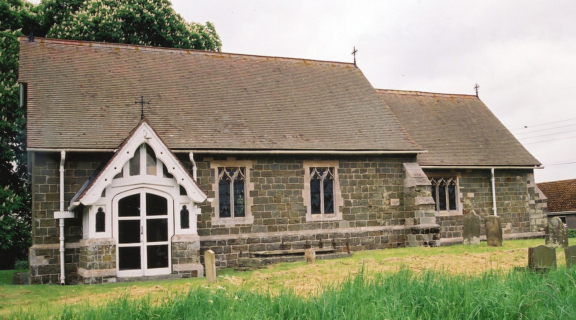
- The Anglican parish church is dedicated to Saint Wilfred (spelling variations abound).
- The church was "heavily" restored in 1890.
- The church only seats about 80.
- There is a photograph of St. Wilfred's church on the Wendy PARKINSON Church Photos web site.
- There is a photograph of St. Wilfred's church on the Flickr web site. On that same site there is an exterior shot taken on a beautiful, sunny day.
- Richard CROFT has a photograph of St. Wilfrid's Church on Geo-graph, taken in December, 2005.
- Here is a photograph of St. Wilfred's church, taken by Ron COLE (who retains the copyright):
- The Anglican parish register dates from 1562.
- The LFHS has published several marriage and burial indexes for the Horncastle Deanery to make your search easier.
- Check our Church Records page for county-wide resources.
- The parish was in the Horncastle sub-district of the Horncastle Registration District.
- Check our Civil Registration page for sources and background on Civil Registration which began in July, 1837.
This village and parish sit 1.5 miles south-west of Horncastle on a rise. The River Bain passes through the east end of the parish. The parish covers some 1,755 acres, but its size has changed over time. In 1900 it covered only 1,280 acres.
The village population has melted away in recent decades. If you are planning a visit:
- By automobile, take the B1191 arterial road south-west out of Horncastle.
- Visit our touring page for more sources.
- Ask for a calculation of the distance from Thornton to another place.
- See our Maps page for additional resources.
You can see maps centred on OS grid reference TF243678 (Lat/Lon: 53.192768, -0.14095), Thornton which are provided by:
- OpenStreetMap
- Google Maps
- StreetMap (Current Ordnance Survey maps)
- Bing (was Multimap)
- Old Maps Online
- National Library of Scotland (Old Ordnance Survey maps)
- Vision of Britain (Click "Historical units & statistics" for administrative areas.)
- English Jurisdictions in 1851 (Unfortunately the LDS have removed the facility to enable us to specify a starting location, you will need to search yourself on their map.)
- Magic (Geographic information) (Click + on map if it doesn't show)
- GeoHack (Links to on-line maps and location specific services.)
- All places within the same township/parish shown on an Openstreetmap map.
- Nearby townships/parishes shown on an Openstreetmap map.
- Nearby places shown on an Openstreetmap map.
- In 1887, a portion of the parish was transfered to the new parish of Woodhall.
- In 1936, the parish boundaries with Horncastle, just to the east, were re-aligned.
- The parish was in the South division of the ancient Gartree Wapentake in the East Lindsey district in the parts of Lindsey.
- For today's district governance, see the East Lindsey District Council.
- Bastardy cases would be heard in the Horncastle petty session hearings.
- As a result of the 1834 Poor Law Amendment Act, the parish became part of the Horncastle Poor Law Union.
Year Inhabitants 1801 97 1811 107 1821 153 1831 216 1841 236 1851 240 1861 281 1871 208 1881 192 1891 95 1901 66 1921 80 1931 75
- The children of this parish attended school in Horncastle.
- For more on researching school records, see our Schools Research page.