
Hide
Ulceby cum Fordington
hide
Hide
hide
Hide
hide
Hide
Hide
Hide
Caution: There are two parishes named Ulceby in Lincolnshire. Make sure that you are researching the correct one.
Hide
The Community Library at Alford has a local history archive that will prove useful in your research.
Jonathan THACKER has a photograph of All Saints' churchyard on Geo-graph, taken in December, 1989.
- The parish was in the Alford sub-district of the Spilsby Registration District.
- Check our Census Resource page for county-wide resources.
- The table below gives the Census Piece Numbers for the parish, where known:
Census
YearPiece Nos. 1841 H.O. 107 / 647 1851 H.O. 107 / 2110 1871 R.G. 10 / 3395 1881 R.G. 11 / 3258 1891 R.G. 12 / 2629
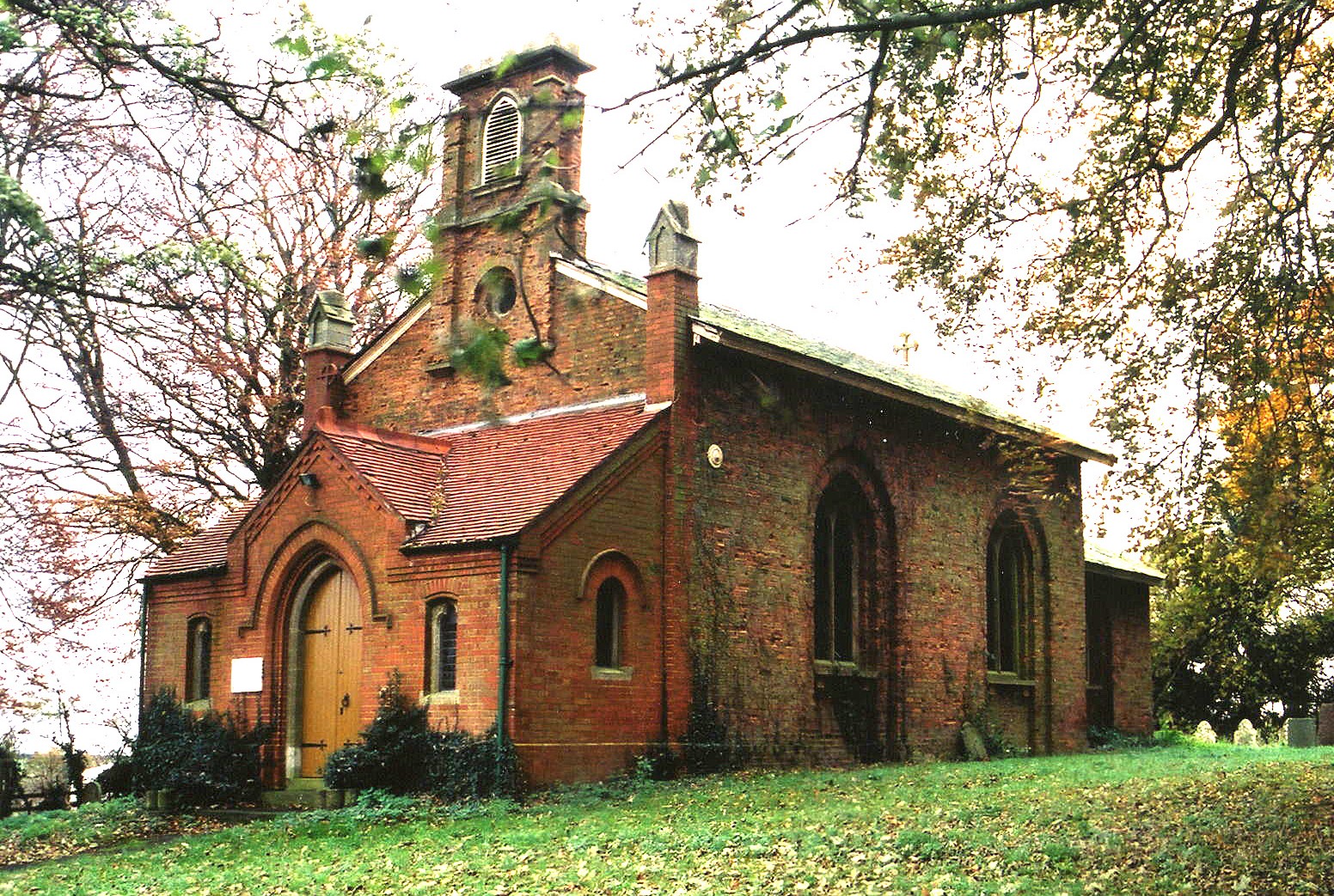
- The Anglican parish church is dedicated to All Saints.
- The church was rebuilt in 1826 and restored in 1885.
- The church seats 120.
- Richard CROFT has a photograph of All Saints' Church on Geo-graph, taken in January, 2006.
- Here is a photo of All Saints Church, taken by Ron COLE (who retains the copyright):
- There was once an Anglican church in Fordington hamlet, but no trace of it remains.
- The Anglican parish register dates from 1749.
- The Lincolnshire FHS has published several marriage indexes and a burial index for the Calcewaith and Candleshoe Deanery to make your search easier.
- The Wesleyan Methodists built a chapel here in 1863. For information and assistance in researching these chapels, see our non-conformist religions page.
- Check our Church Records page for county-wide resources.
- The parish was in the Alford sub-district of the Spilsby Registration District.
- Check our Civil Registration page for sources and background on Civil Registration which began in July, 1837.
Ulceby is both a village and a parish about 3.5 miles southwest of Alford and 5 miles east of Spilsby. The parish covers just over 1,900 acres and includes the tiny hamlet of Fordington.
The A1028 arterial road runs past the village. If you are planning a visit:
- By automobile, take the A158 northwest out of Skegness or the A16 southeast out of Louth. Pick up the A1058 trunk road which passes next to Ulceby village.
- J. HANNAN-BRIGGS has a photograph of the Village Sign on Geo-graph, taken in April, 2013. This is southbound on Church Lane.
- See our touring page for visitor services.
- Ask for a calculation of the distance from Ulceby cum Fordington to another place.
- Fordington is the site of an old Roman camp.
- In the parish is a lofty hill called "Bull's Head."
- See our Maps page for additional resources.
You can see maps centred on OS grid reference TF422726 (Lat/Lon: 53.231405, 0.128922), Ulceby cum Fordington which are provided by:
- OpenStreetMap
- Google Maps
- StreetMap (Current Ordnance Survey maps)
- Bing (was Multimap)
- Old Maps Online
- National Library of Scotland (Old Ordnance Survey maps)
- Vision of Britain (Click "Historical units & statistics" for administrative areas.)
- English Jurisdictions in 1851 (Unfortunately the LDS have removed the facility to enable us to specify a starting location, you will need to search yourself on their map.)
- Magic (Geographic information) (Click + on map if it doesn't show)
- GeoHack (Links to on-line maps and location specific services.)
- All places within the same township/parish shown on an Openstreetmap map.
- Nearby townships/parishes shown on an Openstreetmap map.
- Nearby places shown on an Openstreetmap map.
A plaque inside the church was unveiled in May 1920 listing seven men who served in World War I. There are two other plaques inside the church, including one to Captain George MANSEL, who died in September 1884.
The Ulceby War Memorial is in a field alongside the A16 road. A photograph by John READMAN exists on Geo-graph. It commemorates an RAF Lancaster crew shot down by a German fighter.
For a photograph of the Ulceby cum Fordington War Memorial and the names on it, see the Roll of Honour site.
- This place was an ancient parish in Lincoln county and became a modern Civil Parish when those were established.
- The parish was in the Wold division of the ancient Calceworth Wapentake in the East Lindsey district in the parts of Lindsey.
- Kelly's 1900 Directory of Lincolnshire places the parish (perhaps erroneously) in the South Lindsey division of the county.
- To differentiate the parish from the "Ulceby by Barton" parish, this parish is officially "Ulceby cum Fordington".
- For today's district governance, see the East Lindsey District Council.
- The Common Land was enclosed here in 1820.
- As a result of the 1834 Poor Law Amendment Act, the parish became part the Spilsby Poor Law Union.
- Bastardy cases would be heard in the Alford petty session hearings every other Tuesday.
- Prior to 1912, the children of this parish attended school in Well parish.
- This parish built a County Council School here in 1912.
- See our Schools page for more information on researching school records.