
Hide
Wragby
hide
Hide
hide
Hide
hide
Hide
Hide
Hide
- The parish was in the Wragby sub-district of the Horncastle Registration District.
- Check our Census Resource page for county-wide resources.
- The table below gives census piece numbers, where known:
| Census Year | Piece No. |
|---|---|
| 1841 | H.O. 107 / 650 |
| 1851 | H.O. 107 / 2107 |
| 1861 | R.G. 9 / 2365 |
| 1871 | R.G. 10 / 3378 |
| 1891 | R.G. 12 / 2597 |
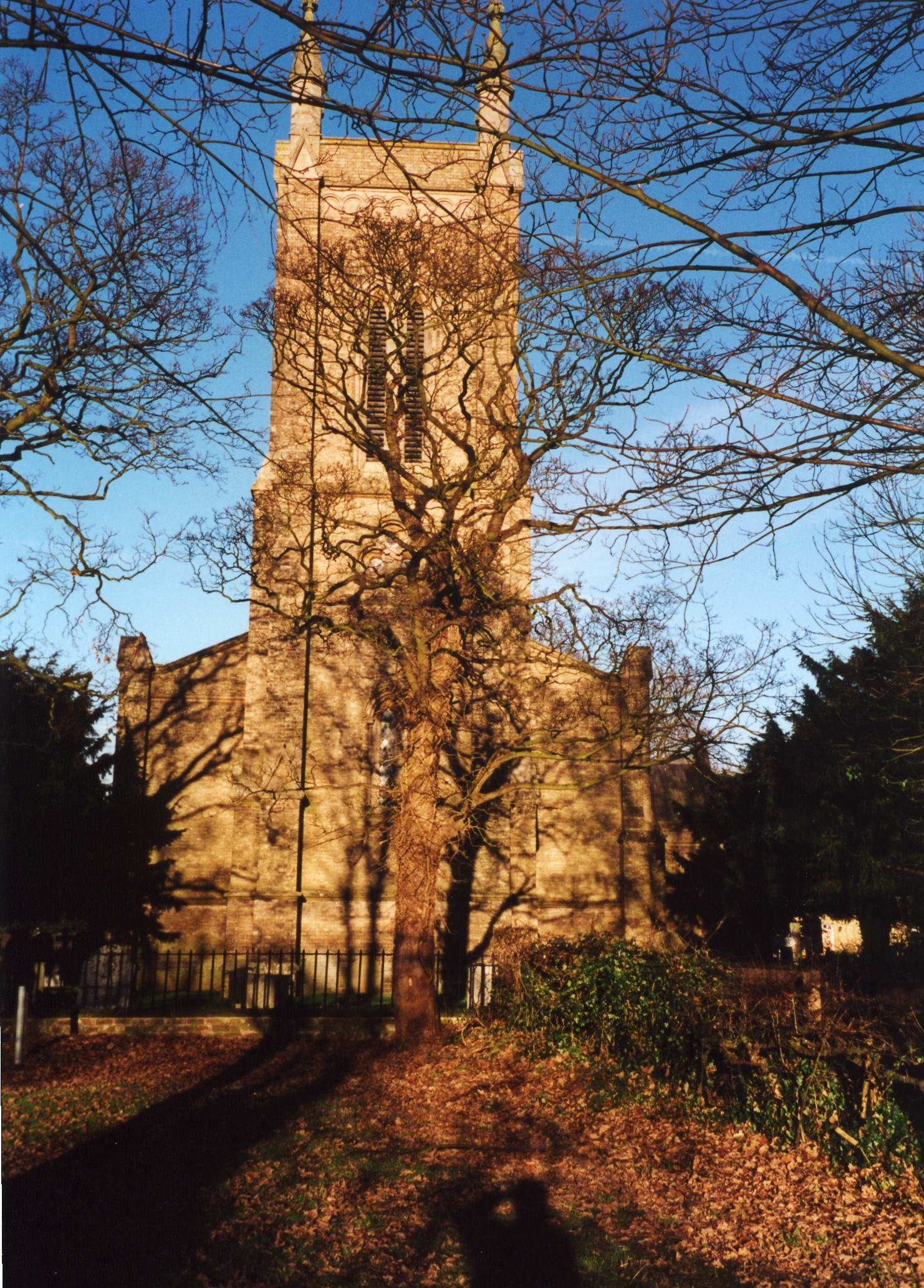
- The Anglican parish church is dedicated to All Saints.
- In 1838, the current church was built, about a quarter mile from the old church.
- The old church was used as a mortuary chapel and the burial field kept in use.
- The Diocese of Lincoln declared the Old Church chancel redundant in July, 1980. In October of that year the church was demolished and the site used to expand the burial ground.
- The new church seats 330 people.
- Here is a photo of All Saints Church, taken by Ron COLE (who retains the copyright):
- The Anglican parish register dates from the year 1567.
- We have a small extract of the parish register for you to examine and add to.
- The LFHS has published several marriage and burial indexes for the Horncastle Deanery to make your search easier.
- The Wesleyan Methodists had a chapel here, built before 1900. For information and assistance in researching these chapels, see our non-conformist religions page.
- David HITCHBORNE has a photograph of the Methodist Church on Geo-graph, taken in April, 2004.
- Check our Church Records page for county-wide resources.
- The parish was in the Wragby sub-district of the Horncastle Registration District.
- Check our Civil Registration page for sources and background on Civil Registration which began in July, 1837.
Wragby is both a village and a parish in the Wolds, 142 miles north of London, 9 miles WNW of Horncastle and ten miles ENE of Lincoln. Panton parish lies to the east and West Torrington parish to the north. The parish covers 1,580 acres.
Wragby village was for centuries a small market town. It lies astride the old Horncastle Road (now the A158 trunk road) where it is crossed by the Louth Road (now the A157). If you are planning a visit:
- By automobile you will find Wragby at the junction of several main roads. You may take the A167 arterial road west out of Louth or the A158 trunk road north out of Horncastle. Alternatively, you may take the A158 east out of Lincoln.
- Richard CROFT provides a photograph of Shops on the main road at Geo-graph, taken in 2012.
- Visit our touring page for more sources.
- Ask for a calculation of the distance from Wragby to another place.
- A Library and reading room were established here in 1856.
- The Thursday market day was extinct by 1900. The old Market House was used as a fire station.
- A cattle fair was held twice each year; one on May 1st and one on September 29th.
- A flower show and foal show were held annually in July.
- Check out Francis Frith's page for Wragby maps.
- See our Maps page for additional resources.
You can see maps centred on OS grid reference TF132780 (Lat/Lon: 53.286889, -0.303389), Wragby which are provided by:
- OpenStreetMap
- Google Maps
- StreetMap (Current Ordnance Survey maps)
- Bing (was Multimap)
- Old Maps Online
- National Library of Scotland (Old Ordnance Survey maps)
- Vision of Britain (Click "Historical units & statistics" for administrative areas.)
- English Jurisdictions in 1851 (Unfortunately the LDS have removed the facility to enable us to specify a starting location, you will need to search yourself on their map.)
- Magic (Geographic information) (Click + on map if it doesn't show)
- GeoHack (Links to on-line maps and location specific services.)
- All places within the same township/parish shown on an Openstreetmap map.
- Nearby townships/parishes shown on an Openstreetmap map.
- Nearby places shown on an Openstreetmap map.
- There is a photograph of the War Memorial at the Wakefield Family History site.
- This place was an ancient parish of Lincolnshire and became a modern Civil Parish when those were established.
- Wragby was a sub-district of the Horncastle Registration District and poor law union. As such it had some 17 parishes to co-ordinate in the north part of the district.
- The parish was in the ancient Wraggoe Wapentake in the East Lindsey district in the parts of Lindsey.
- For today's district governance, see the East Lindsey District Council.
- Bastardy cases would be heard in the Wragby petty session hearings on the first Thursday of the month at the police station.
- In 1697, Sir Edmund TURNOR founded a chapel and almshouses for 12 widows or widowers of Wragby. These were rebuilt in 1840 and still in use in 1871.
- Richard CROFT has a photograph of Turnor Square on Geo-graph, taken in September, 2008.
- As a result of the 1834 Poor Law Amendment Act, the parish became part of the Horncastle Poor Law Union.
;Year Inhabitants 1801 410 1811 509 1821 633 1831 601 1841 610 1851 610 1861 619 1871 581 1881 508 1891 546 1901 494 1911 454 1921 463 1931 454 2001 1,361
- A Free Grammar School was established here in 1632 by Wm. HANSARD. It was later merged with the National School. The school was rebuilt in 1775 and a new building erected in 1839. The school was enlarged in 1893 to hold up to 130 children.
- The existing Wragby Primary School is on Silver Street, Lincolnshire, LN8 5PJ. Tele: 01673 858477.
- For more on researching school records, see our Schools Research page.