
Hide
Holy Trinity-the-Less
hide
Hide
hide
Hide
Hide
Hide
"TRINITY THE LESS, the church of, was situated, before the fire of London, at the north-east corner of Little Trinity-lane, where a German chapel now stands. It received the epithet "the Less," to distinguish it from the Trinity priory at Aldgate; but having been destroyed by the great fire of 1666, the parish was united to that of St. Michael, Queenhithe, and the church was not rebuilt." [James Elmes. A Topographical Dictionary of London and its Environs (1831) - transcribed by Brian Randell]
Hide
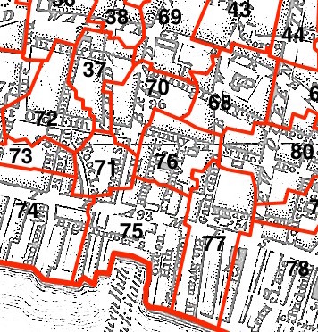
This parish - no. 76 in the above map - is located in Queenhithe Ward.
The church was destroyed in 1666 and not rebuilt.
The parish was later united with St Michael Queenhithe 1670, and St James Garlickhithe 1875.
Hide
London Metropolitan Archive holdings for Holy Trinity-the-Less.
Biographical account of John Rogers, rector of Holy Trinity the Less and later vicar of St Sepulchre, Bible editor and martyr, who was found guilty of heresy and burnt at the stake in 1555.
Pearce, E.G. The Story of the Lutheran Church in Britain. The Evangelical Lutheran Church of England (1969) 28 pp. ["At the centre of the new London that emerged from the ashes, a few yards from Old St. Pauls, still in charred ruins, arose the first Lutheran church in Britain. It was begun in November 1672, dedicated thirteen months later. It was named Trinity Lutheran Church because it was built on the site of Holy Trinity the Less, an anglican Parish Church destroyed in the fire."]
Online Parish Register Images and Indexes for Holy Trinity-the-Less parish are provided by, or at various subscription sites via, the LDS FamilySearch wiki.
Non-Church of England denominations identified in St Michael Queenhithe with Holy Trinity the Less include: Lutheran and Roman Catholic (German) [LDS FamilySearch Wiki].
Wikipedia page on Holy Trinity-the-Less.
- Ask for a calculation of the distance from Holy Trinity-the-Less to another place.
Summary history of Holy Trinity-the-Less parish, from the Worshipful Company of Parish Clerks.
Public Houses, Inns & Taverns of the parish of Holy Trinity-the-Less - provides "information from census records, trade directories, etc."
You can see maps centred on OS grid reference TQ323809 (Lat/Lon: 51.511929, -0.094489), Holy Trinity-the-Less which are provided by:
- OpenStreetMap
- Google Maps
- StreetMap (Current Ordnance Survey maps)
- Bing (was Multimap)
- Old Maps Online
- National Library of Scotland (Old Ordnance Survey maps)
- Vision of Britain (Click "Historical units & statistics" for administrative areas.)
- English Jurisdictions in 1851 (Unfortunately the LDS have removed the facility to enable us to specify a starting location, you will need to search yourself on their map.)
- Magic (Geographic information) (Click + on map if it doesn't show)
- GeoHack (Links to on-line maps and location specific services.)
- All places within the same township/parish shown on an Openstreetmap map.
- Nearby townships/parishes shown on an Openstreetmap map.
- Nearby places shown on an Openstreetmap map.
Surnames from the 1881 census in the Holy Trinity Less and Holy Trinity Less districts.
Clerical career summaries for the parish of (i) Holy Trinity-the-Less and (ii) St Michael Queenhithe With Holy Trinity The Less, from the Clergy of the Church of England Database website.
Sources for listings of taxpayer names for Holy Trinity-the-Less parish, listed on the LDS FamilySearch wiki: 1582 subsidy and 1541 subsidy.