
Hide
St Mary Aldermary
hide
Hide
hide
Hide
Hide
Hide
"ST. MARY ALDERMARY, the church of, is situated near the middle, and on the east side of Bow-lane, Cheapside, and derives its name from being dedicated to the Virgin Mary, and its addition of Alder, to Older or Elder Mary, from its being the oldest church in the city, dedicated to that saint. . . . The body of the church was destroyed by the great fire of 1666, and was rebuilt, and the tower repaired and cased, by Sir Christopher Wren, in 1711. . . The style is an impure imitation of the pointed style, (which was never understood or relished by our great national architect,) with the absurd addition of a composite altar-piece. . . The church is a rectory, and one of the thirteen peculiars of the Archbishop of Canterbury. After the fire of London, the adjoining parish of St. Thomas the Apostle, was united to it by act of parliament; the patronage of which being in the Dean and Chapter of St. Paul, that of the united parishes is with the Archbishop and Dean alternately. It is a rectory, in the city of London, and in the province of Canterbury. The present rector is the Rev. H. B. Wilson, B.D., formerly one of the masters of Merchant Taylors' school." [James Elmes. A Topographical Dictionary of London and its Environs (1831) - transcribed by Brian Randell]
Hide
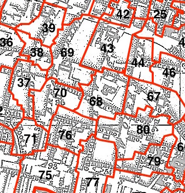
This parish - no. 68 in the above map - is located in Cordwainer Ward.
The church dates from before the Great Fire, and was rebuilt by Wren 1682, tower 1701.
Hide
London Metropolitan Archive holdings for St Mary Aldermary.
St Mary Aldermary - a site "dedicated to the history and architecture of St. Mary Aldermary in London" (now archived).
Online Parish Register Images and Indexes for St Mary Aldermary parish are provided by, or at various subscription sites via, the LDS FamilySearch wiki.
Presbyterian is the only identified non-Church of England denomination in St Mary Aldermary with St Thomas the Apostle [LDS FamilySearch Wiki].
Chester, Joseph Lemuel (ed). The parish registers of St. Mary Aldermary, London, containing the marriages, baptisms, and burials from 1558 to 1754. Harleian Society, Vol. 5. London (1880) 300pp. [Full text]
Wikipedia page on St Mary Aldermary.
- Ask for a calculation of the distance from St Mary Aldermary to another place.
Summary history of St Mary Aldermary parish, from the Worshipful Company of Parish Clerks.
Cordwainer - well-illustrated historical account of the Cordwainer statue from the London Details website ("A statue of a cordwainer can be found in Watling Street at the Queen Victoria Street end, beside the wall of St. Mary Aldermary Church.).
Public Houses, Inns & Taverns of the parish of St Mary Aldermary - provides "information from census records, trade directories, etc."
1859 map of St Mary Aldermary - illustration of the location covered, and of archive(s) holding a copy, provided by the Catalogue of British Town Maps.
You can see maps centred on OS grid reference TQ324810 (Lat/Lon: 51.5127, -0.093534), St Mary Aldermary which are provided by:
- OpenStreetMap
- Google Maps
- StreetMap (Current Ordnance Survey maps)
- Bing (was Multimap)
- Old Maps Online
- National Library of Scotland (Old Ordnance Survey maps)
- Vision of Britain (Click "Historical units & statistics" for administrative areas.)
- English Jurisdictions in 1851 (Unfortunately the LDS have removed the facility to enable us to specify a starting location, you will need to search yourself on their map.)
- Magic (Geographic information) (Click + on map if it doesn't show)
- GeoHack (Links to on-line maps and location specific services.)
- All places within the same township/parish shown on an Openstreetmap map.
- Nearby townships/parishes shown on an Openstreetmap map.
- Nearby places shown on an Openstreetmap map.
Surnames from the 1881 census in the St Mary Aldermary and St Mary Aldermary London districts.
Sources for listings of taxpayer names for St Mary Aldermary parish, listed on the LDS FamilySearch wiki.