
Hide
St Mary Bothaw
hide
Hide
hide
Hide
Hide
Hide
"ST. MARY BOTHAW, the church of, stood formerly on the east side of Turnwheel-lane, Cannon-street, and took its addition, according to a surmise of Stowe, from its vicinity to a boat-haw, or boat-builder's yard, in its neighbourhood. This church, which was one of the thirteen peculiars within the city, belonging to the Archbishop of Canterbury, having suffered greatly by the fire of London, was not rebuilt, but the parish was united by act of parliament to that of St. Swithin." [James Elmes. A Topographical Dictionary of London and its Environs (1831) - transcribed by Brian Randell]
Hide
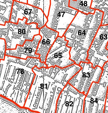
This parish - no. 65 in the above map - is located in Walbrook Ward.
The church was destroyed in 1666 and not rebuilt.
The parish was later united with St Swithin London Stone 1670, St Stephen Walbrook 1954.
Hide
London Metropolitan Archive holdings for St Mary Bothaw.
Online Parish Register Images and Indexes for St Mary Bothaw parish are provided by, or at various subscription sites via, the LDS FamilySearch wiki.
Non-Church of England denominations identified in St Swithun London Stone with St Mary Bothaw include: Baptist and Presbyterian [LDS FamilySearch Wiki].
Wikipedia page on St Mary Bothaw.
- Ask for a calculation of the distance from St Mary Bothaw to another place.
Summary history of St Mary Bothaw parish, from the Worshipful Company of Parish Clerks.
L'Erber: Warwicks lost London house - on History Geeks page.
Plan of the Parish of St Mary Bothaw in 1837 from COLLAGE, the London Picture Archive.
1854 map of St Mary Bothaw - illustration of the location covered, and of archive(s) holding a copy, provided by the Catalogue of British Town Maps.
You can see maps centred on OS grid reference TQ326809 (Lat/Lon: 51.511331, -0.090227), St Mary Bothaw which are provided by:
- OpenStreetMap
- Google Maps
- StreetMap (Current Ordnance Survey maps)
- Bing (was Multimap)
- Old Maps Online
- National Library of Scotland (Old Ordnance Survey maps)
- Vision of Britain (Click "Historical units & statistics" for administrative areas.)
- English Jurisdictions in 1851 (Unfortunately the LDS have removed the facility to enable us to specify a starting location, you will need to search yourself on their map.)
- Magic (Geographic information) (Click + on map if it doesn't show)
- GeoHack (Links to on-line maps and location specific services.)
- All places within the same township/parish shown on an Openstreetmap map.
- Nearby townships/parishes shown on an Openstreetmap map.
- Nearby places shown on an Openstreetmap map.
Surnames from the 1881 census in the St Mary Bothaw district.
Clerical career summaries for the parish of St Swithun London Stone With St Mary Bothaw, from the Clergy of the Church of England Database website.
Sources for listings of taxpayer names for St Mary Bothaw parish, listed on the LDS FamilySearch wiki.