
Hide
St Nicholas Acons
hide
Hide
hide
Hide
Hide
Hide
"The Church of St. Nicholas Acons stood on the West Side of Nicholas-lane, near Lombard-street. It was a rectory subject to the Archdeacon of LONDON, saving only as to Wills and Administrations, which belonged to the Commissary. Sir John Bridges, Brug or Bruges, (for by all these Names he is written in Stow, Mayor of LONDON in 1520, repaired this Church, and embattled it, and was there buried. . . This Parish Church was repaired and beautified in 1615, at the cost of the Parishioners; but being burnt down by the dreadful Fire, was afterwards annex'd to that of St. Edmund Lombard-street, which is made the Parochial Church for the Inhabitants of both these Parishes, the profits thereof, in lieu of Tithes, are made of the yearly value of 180l. to the Incumbent. . . And the site of this Church remains now only as a Burying-place for the Inhabitants of this Parish." [John Stow. A survey of the cities of London and Westminster . . . (1733-35) - transcribed by Brian Randell]
Hide
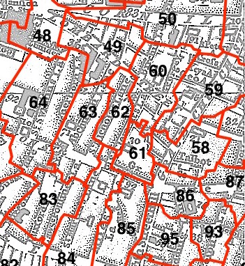
This parish - no. 62 in the above map - is located in Langbourn Ward.
The church was destroyed in 1666 and not rebuilt.
The parish was later united with St Edmund the King and Martyr 1670.
Hide
London Metropolitan Archive holdings for St Nicholas Acons.
Online Parish Register Images and Indexes for St Nicholas Acons parish are provided by, or at various subscription sites via, the LDS FamilySearch wiki.
No non-Church of England denominations have been identified for St Edmund the King with St Nicholas Acons [LDS FamilySearch Wiki].
Brigg, William. The Register book of the parish of St. Nicholas Acons, London, 1539-1812. Leeds: Walker and Laycock (1890) [160 pp. ]
Wikipedia page on St Nicholas Acons.
St Nicholas Acons - brief description, with section of a Sketch Map of London under Henry II, circa 1190, showing location of St Nicholas Acons.
- Ask for a calculation of the distance from St Nicholas Acons to another place.
Summary history of St Nicholas Acons parish, from the Worshipful Company of Parish Clerks.
Public Houses, Inns & Taverns of the parish of St Nicholas Acons - provides "information from census records, trade directories, etc."
You can see maps centred on OS grid reference TQ328810 (Lat/Lon: 51.511976, -0.087279), St Nicholas Acons which are provided by:
- OpenStreetMap
- Google Maps
- StreetMap (Current Ordnance Survey maps)
- Bing (was Multimap)
- Old Maps Online
- National Library of Scotland (Old Ordnance Survey maps)
- Vision of Britain (Click "Historical units & statistics" for administrative areas.)
- English Jurisdictions in 1851 (Unfortunately the LDS have removed the facility to enable us to specify a starting location, you will need to search yourself on their map.)
- Magic (Geographic information) (Click + on map if it doesn't show)
- GeoHack (Links to on-line maps and location specific services.)
- All places within the same township/parish shown on an Openstreetmap map.
- Nearby townships/parishes shown on an Openstreetmap map.
- Nearby places shown on an Openstreetmap map.
Surnames from the 1881 census in the St Nicholas Acons and St Nicholas Acons London districts.
Clerical career summaries for the parish of (i) St Nicholas Acons and (ii) St Edmund The King With St Nicholas Acons, from the Clergy of the Church of England Database website.
Sources for listings of taxpayer names for St Nicholas Acons parish, listed on the LDS FamilySearch wiki.