
Hide
St Olave Hart Street
hide
Hide
hide
Hide
Hide
Hide
"St. OLAVE, Hart street, the church of, is situated on the south side of Hart-street, Crutched-friars, and derives its name and addition, from being dedicated to St. Olave, or Olaus, King of Norway, who, from his strong attachment to the christian religion, took part with the Christian English, against the Pagan Danes. A church stood on this site, dedicated to the same patron, before the year 1319. The present church is of considerable antiquity, as it escaped the ravages of the great fire of London. Since that time it has been often substantially repaired and beautifed. This church is a rectory, the advowson of which has always been in private hands, and is now in the patronage of the parishioners. It is in the city, diocese and archdeaconry of London, and the present rector is the Rev. H. B. Owen, D.D., who was instituted by the parishioners in 1794." [James Elmes. A Topographical Dictionary of London and its Environs (1831) - transcribed by Brian Randell]
Hide
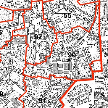
This parish - no. 90 in the above map - is located in Tower Ward.
The church survived the Great Fire but it was badly damaged in 1941 and restored post WWII.
Hide
London Metropolitan Archive holdings for St Olave Hart Street.
Samuel Pepys At St Olave's - a lavishly illustrated account, from Spitalfields Life.
History & Architecture at St Olave Hart Street - from the church website.
St Olave Hart Street - description of the church from the Medieval London website.
Povah, Alfred. The annals of the parishes of St. Olave Hart Street and Allhallows Staining, in the city of London. Ecclesiastically united, A.D. 1870. London, Simpkin, Marshall, Hamilton, Kent & Co. (1894) 429pp. [Full text]
Wellard, Tom. History of the united benefice of St. Olave Hart Street and All Hallows Staining with St. Catherine Coleman Typewritten (1966?) 277pp. [Guildhall Library]
Online Parish Register Images and Indexes for St Olave Hart Street parish are provided by, or at various subscription sites via, the LDS FamilySearch wiki.
No non-Church of England denominations have been identified for St Olave Hart Street [LDS FamilySearch Wiki].
Bannerman, William Bruce. The registers of St. Olave, Hart street, London. 1563-1700. London [Printed by Roworth and company, limited] (1916) 362 pp. [Full Text]
Wikipedia page on St Olave Hart Street.
- Ask for a calculation of the distance from St Olave Hart Street to another place.
Summary history of St Olave Hart Street parish, from the Worshipful Company of Parish Clerks.
Public Houses, Inns & Taverns of the parish of St Olave Hart Street - provides "information from census records, trade directories, etc."
1900 map of St Olave Hart St - illustration of the location covered, and of archive(s) holding a copy, provided by the Catalogue of British Town Maps.
You can see maps centred on OS grid reference TQ334809 (Lat/Lon: 51.511361, -0.078583), St Olave Hart Street which are provided by:
- OpenStreetMap
- Google Maps
- StreetMap (Current Ordnance Survey maps)
- Bing (was Multimap)
- Old Maps Online
- National Library of Scotland (Old Ordnance Survey maps)
- Vision of Britain (Click "Historical units & statistics" for administrative areas.)
- English Jurisdictions in 1851 (Unfortunately the LDS have removed the facility to enable us to specify a starting location, you will need to search yourself on their map.)
- Magic (Geographic information) (Click + on map if it doesn't show)
- GeoHack (Links to on-line maps and location specific services.)
- All places within the same township/parish shown on an Openstreetmap map.
- Nearby townships/parishes shown on an Openstreetmap map.
- Nearby places shown on an Openstreetmap map.
Surnames from the 1881 census in the St Olave Hart Street district.
Clerical career summaries for the parish of St Olave Hart Street, from the Clergy of the Church of England Database website.
Sources for listings of taxpayer names for St Olave Hart Street parish, listed on the LDS FamilySearch wiki.