
Hide
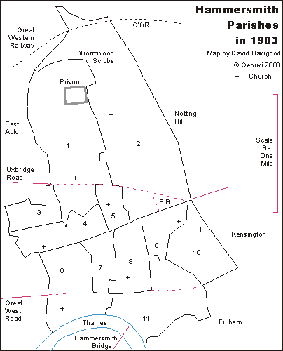
Outline map of parishes of Hammersmith, Middlesex in 1903
hide
Hide
Click on a parish name for creation date and location of registers of parishes. For clearer display or print, see map in pdf format.
|
|
Parish boundaries traced from "A map of the Ecclesiastical Divisions within the County of London, 1903" published by Edward Stanford of London, reprinted as a facsimile by the London Topographical Society. List from that map is of parishes within the rural deanery of Hammersmith in 1903; they were all sub-divisions of the historic parish of Hammersmith. They are in the Archdeaconry of London, and Diocese of London. We have a list of other deaneries.
Map and list by David Hawgood. ©2003, page modified 2 Feb 2004