
Hide
Bywell St Peter
hide
Hide
hide
Hide
Hide
Hide
"BYWELL, ST PETER'S is a parish comprising the townships of East Acomb, Apperley, Broomley, Bywell St Andrew and St Peter, Espershields with Millshields, High Fotherly, Healy, Newlands, Newton, Newton Hall, Stelling and the chapelry of Whittonstall. It is bounded by the parishes of Corbridge, Slaley, Ovingham, and Shotley, and a part of the county of Durham, and contains an area of 17,784 acres. Its population in 1801, was 1,303; in 1811, 1,317; in 1821, 1,406; in 1831, 1,478; in 1841, 1,512; and in 1851, 1,674 souls. A portion of this parish is very fertile, with a beautifully diversified surface, but the remainder consists of wild moors, of which about 2,979 acres were enclosed in 1817-18, pursuant to an act of parliament, obtained in 1812. [From History, Topography, and Directory of Northumberland, Whellan, 1855].
Hide
- Northumberland County Record Office holds copies of Census Returns 1841 - 1891 and provides a useful User Guide
- The 1851 Census Index (microfiche CN15) Bywell, Ovingham, Shotley, Blanchland and Whittonstall (PRO piece HO107/2414 folios 1-268) (Type A) (Book)
- Northumberland – Bywell (Broomley, Healey, High Fotherley, Espershields, Whittonstall, Newlands, Bywell, Styford, Newton, Stelling, Ovington, Newton Hall, Welton, Broomhaugh, Riding, Newbiggin, Blanchland, Shotley Low Quarter, Nafferton, Ovingham, Wylam, Hedley, Dukershagg and part of Prudhoe) (PRO piece RG12/4244) (Type B) (Book) (Volume 54) BOTH published by the https://www.ndfhs.org.uk/ may be of value to researchers interested in this parish.
- The Ancestral Indexes website provides information about Healey, St John and Newton Hall, St James.
- Bywell St Peter - Church Records - links and information.
- Bishops Transcript Baptisms 1762 to 1812 can be accessed here: https://Northumberlandparishregistertranscriptslocalhistory.wordpress.com please scroll down the page to the parish you require
- This area is within Northumberland West Registration District.
- Certificates of birth, death and marriage can be ordered locally from Northumberland County Council.
- Photographs of Bywell and the Derwent Reservoir from Les Bell's Northumberland Cam website.
- The section of The National Gazetteer (1868) relating to this parish - transcribed by Colin Hinson.
- Ask for a calculation of the distance from Bywell St Peter to another place.
- The history of Bywell, St Peter is included in:- Northumberland County History Committee, History of Northumberland, Volume 6. Newcastle, A. Reid, 1902.
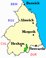
- Bywell St Peter - Maps - links and information.
You can see maps centred on OS grid reference NZ036594 (Lat/Lon: 54.929072, -1.945524), Bywell St Peter which are provided by:
- OpenStreetMap
- Google Maps
- StreetMap (Current Ordnance Survey maps)
- Bing (was Multimap)
- Old Maps Online
- National Library of Scotland (Old Ordnance Survey maps)
- Vision of Britain (Click "Historical units & statistics" for administrative areas.)
- English Jurisdictions in 1851 (Unfortunately the LDS have removed the facility to enable us to specify a starting location, you will need to search yourself on their map.)
- Magic (Geographic information) (Click + on map if it doesn't show)
- GeoHack (Links to on-line maps and location specific services.)
- All places within the same township/parish shown on an Openstreetmap map.
- Nearby townships/parishes shown on an Openstreetmap map.
- Nearby places shown on an Openstreetmap map.