
Hide
Kirkheaton
hide
Hide
hide
Hide
Hide
Hide
"KIRK HEATON is an extra parochial chapelry, on the north of the parish of Stamfordham, to which it was formerly annexed. It comprises an area of 1,760 acres, and its population in 1801, was 147; in 1811, 153; in 1821, 140; in l831, 182; in l841, 164; and in 1851, 153 souls. Calverley B. Bewick, Esq., is the landowner. Here is a colliery and limekiln, which are extensively worked by Messrs. William Grace & Co. THE VILLAGE of Kirk-Heaton occupies an elevated position about nine and a half miles north-east by north of Hexham. From the eminence upon which it is situated, a most extensive view of the surrounding country may be obtained, while on the east and south-east a portion of the German Ocean and Gaterhead Fell is plainly discernible. THE CHAPEL was rebuilt in 1775, at the expense of Mrs. H. D. Windsor, at that time lady of the manor. The living, a perpetual curacy in the patronage of C. B. Berwick, Esq., is valued at £60 per annum, and enjoyed by the Rev. Humphrey Brown. The Parsonage was formerly the Manor House. This chapelry registers with Thockrington, which see." [From History, Topography, and Directory of Northumberland, Whellan, 1855].
"KIRKHEATON, a chapelry in the parish of KIRKHARLE, north-eastern division of TINDALE ward, county of NORTHUMBERLAND ....." [Samuel Lewis Topographical Dictionary of England 1831 © Mel Lockie]
Hide
- Northumberland County Record Office holds copies of Census Returns 1841 - 1891 and provides a useful User Guide
- The 1851 Census Index (microfiche CN14)
- 1891 Census Stamfordham (Kirkheaton, Wallridge, Black Heddon, Bitchfield, Capheaton, East and West Shaftoe, Ryal, Kearsley, Ingoe, Hawkwell, Fenwick, East and West Matfen, Heugh, Ouston, Nesbit, Harlow Hill, Whitchester, Cheeseburn Grange, Dalton, North and South Dissington, Eachwick, East and West Heddon, Rudchester, Heddon on the Wall, Houghton and Close House and Throckley) (PRO piece RG12/4242) (Type B) (Book) (Volume 52) BOTH published by the https://www.ndfhs.org.uk/ may be of value to researchers interested in this parish.
- Kirkheaton - Church Records - links and information.
- This area is within Northumberland Central Registration District.
- Certificates of birth, death and marriage can be ordered from Northumberland County Council.
- The section of The National Gazetteer (1868) relating to this parish - transcribed by Colin Hinson.
- Ask for a calculation of the distance from Kirkheaton to another place.
- The history of Kirkheaton Parish is included in:- Northumberland County History Committee, History of Northumberland, Volume 4. Newcastle, A. Reid, 1897.
- Maps of locations in this parish provided by Streetmap.
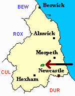
Kirkheaton.
You can see maps centred on OS grid reference NZ028777 (Lat/Lon: 55.09342, -1.956938), Kirkheaton which are provided by:
- OpenStreetMap
- Google Maps
- StreetMap (Current Ordnance Survey maps)
- Bing (was Multimap)
- Old Maps Online
- National Library of Scotland (Old Ordnance Survey maps)
- Vision of Britain (Click "Historical units & statistics" for administrative areas.)
- English Jurisdictions in 1851 (Unfortunately the LDS have removed the facility to enable us to specify a starting location, you will need to search yourself on their map.)
- Magic (Geographic information) (Click + on map if it doesn't show)
- GeoHack (Links to on-line maps and location specific services.)
- All places within the same township/parish shown on an Openstreetmap map.
- Nearby townships/parishes shown on an Openstreetmap map.
- Nearby places shown on an Openstreetmap map.