
Hide
Knaresdale
hide
Hide
hide
Hide
Hide
Hide
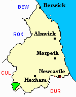
"KNARESDALE parish, comprising the villages of Eals, Burn Stones, Slaggyford, Town Green, and Williamston, occupies a wild maintainous tract, at the south-western extremity of Northumberland, and is bounded on the north by Lambley, on the west and south by Cumberland, and on the east by Kirkhaugh parish. It comprises an area of 7,144 acres, the property of the trustees of the late Hon. James Hope Wallace, and others, who also claim the manorial rights, and its rateahle value is £2,712 5s. The number of its inhabitants in 1801, was 481; in 1811, 526; in 1821, 564; in 1831, 566; in 1841, 491; and in 1851, 917 souls. It is supposed to derive its name from the Knare-burn which intersects the parish. The forest of Knaresdale was anciently very extensive and well stocked with red deer; the breed, however, is now nearly extinct. Snope Well is a medicinal spring, and was formerly held in great repute. Besides the Knare-burn, this district is watered by three other rivulets. viz.:- the Thinhope, Thomhope, and Barrough-burns." [From History, Topography, and Directory of Northumberland, Whellan, 1855].
Hide
- Kath Liddell has provided an indexed transcript of Monumental Inscriptions in Knaresdale Churchyard.
- Northumberland County Record Office holds copies of Census Returns 1841 - 1891 and provides a useful User Guide
- The 1851 Census Index (microfiche CN19) Whitfield, Kirkhaugh, Knarsdale, Lambley and Haltwhistle (PRO piece HO107/2416 folios 1-273) (Type A) (Book)
- 1891 Census Whitfield, Kirkhaugh, Knarsdale, Slaggyford, Lambley and Harper (PRO piece RG12/4250) (Type B) (Book) (Volume 60) BOTH published by the https://www.ndfhs.org.uk/ may be of value to researchers interested in this parish.
- Knaresdale - Church Records - links and information.
- This area is within Northumberland West Registration District.
- Certificates of birth, death and marriage can be ordered from Northumberland County Council.
- The South Tyneside Railway Preservation Society operates a narrow-gauge railway service between Alston, Cumbria (formerly Cumberland) and Kirkhaugh, Northumberland. It is hoped to extend the line to Slaggyford in Knaresdale Parish when funds allow. The track-bed is that of the Haltwhistle to Alston branch railway which closed to passengers in 1976.
- The section of The National Gazetteer (1868) relating to this parish - transcribed by Colin Hinson.
- Ask for a calculation of the distance from Knaresdale to another place.
- The history of Knaresdale Parish is included in:- Hodgson, J., History of Northumberland, Part 2, Volume 3. Newcastle, 1840. (Available on fiche from Ancestral Indexes).
- Maps of locations in this parish provided by Streetmap.
Eals, Knaresdale/Knarsdale, Slaggyford.
You can see maps centred on OS grid reference NY668516 (Lat/Lon: 54.85818, -2.518358), Knaresdale which are provided by:
- OpenStreetMap
- Google Maps
- StreetMap (Current Ordnance Survey maps)
- Bing (was Multimap)
- Old Maps Online
- National Library of Scotland (Old Ordnance Survey maps)
- Vision of Britain (Click "Historical units & statistics" for administrative areas.)
- English Jurisdictions in 1851 (Unfortunately the LDS have removed the facility to enable us to specify a starting location, you will need to search yourself on their map.)
- Magic (Geographic information) (Click + on map if it doesn't show)
- GeoHack (Links to on-line maps and location specific services.)
- All places within the same township/parish shown on an Openstreetmap map.
- Nearby townships/parishes shown on an Openstreetmap map.
- Nearby places shown on an Openstreetmap map.