
Hide
Longhorsley
hide
Hide
hide
Hide
Hide
Hide
"LONGHORSLEY is bounded by the parishes and chapelries of Rothbury, Framlington, Felton, Hebron, Mitford and Netherwitton. It is about 7 miles in length, and 3 in breadh, and contains both coal and limestone. The soil is generally clayey; and, though the surface is very monotonous, yet it lies high, and the air is sharp and piercing. This parish contains eight townships..." [From History, Directory, and Gazetteer, of the Counties of Durham and Northumberland, Parson and White, 1828.]
"HORSLEY (LONG), a parish in the ...county of NORTHUMBERLAND; ... comprising the townships of Bigge's Quarter, Freeholders Quarter, Longshaws, Riddle's Quarter, Stanton, Todburn, Wingates, and Witton-Shiels,....." [Samuel Lewis Topographical Dictionary of England 1831 © Mel Lockie]
Hide
- Northumberland County Record Office holds copies of Census Returns 1841 - 1891 and provides a useful User Guide
- The 1851 Census Index (microfiche CN21 and CN27) Hartburn, Netherwitton, Longhorsley, Hebron, Mitford and Meldon (PRO piece HO107/2418 folios 1-145) (Type B) (Book) published by the https://www.ndfhs.org.uk/ may be of value to researchers interested in this parish.
- Longhorsley - Church Records - links and information.
- This area is divided between Northumberland North Second Registration District and Northumberland Central Registration District.
- Certificates of birth, death and marriage can be ordered locally from Northumberland County Council.
- Photographs of Beacon Hill and Longshaws from Les Bell's Northumberland Cam website.
- The Northumberland Communities website includes pages relating to Longhorsley. They provide "a range of learning resource material that reflects Northumberland's heritage, providing a base for studying the County's history. The website provides a starting point for understanding the development of communities in Northumberland. It also seeks to illustrate the range of sources for family and local history research that are available via Northumberland Archives Service."
- The section of The National Gazetteer (1868) relating to this parish - transcribed by Colin Hinson.
- Ask for a calculation of the distance from Longhorsley to another place.
- A history of the village of Wingates from the Northumberland National Park website.
- Kristina Messier has kindly supplied her college dissertation, "Longhorsley Past and Present", which will be of great value to anyone interested in this area.
- The history of Longhorsley Parish is included in:- Hodgson, J., History of Northumberland, Part 2, Volume 2. Newcastle, 1832. (Available on fiche from Ancestral Indexes).
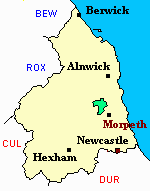
- Longhorsley - Maps - links and information.
You can see maps centred on OS grid reference NZ128931 (Lat/Lon: 55.231633, -1.800642), Longhorsley which are provided by:
- OpenStreetMap
- Google Maps
- StreetMap (Current Ordnance Survey maps)
- Bing (was Multimap)
- Old Maps Online
- National Library of Scotland (Old Ordnance Survey maps)
- Vision of Britain (Click "Historical units & statistics" for administrative areas.)
- English Jurisdictions in 1851 (Unfortunately the LDS have removed the facility to enable us to specify a starting location, you will need to search yourself on their map.)
- Magic (Geographic information) (Click + on map if it doesn't show)
- GeoHack (Links to on-line maps and location specific services.)
- All places within the same township/parish shown on an Openstreetmap map.
- Nearby townships/parishes shown on an Openstreetmap map.
- Nearby places shown on an Openstreetmap map.