
Hide
Wark
hide
Hide
hide
Hide
Hide
Hide
"WARK parish comprises the townships of Shitlington (High) Quarter, Shitlington (Low) Quarter, Wark, and Warksburn, which were formerly a portion of the extensive parish of Simonburn, from which they were severed and made into a distinct parish, by the act of 51 Geo. III. cap. 194. It comprises an area of 22,986 acres, and its population in 1801, was 728; in 1811, 783; in 1821, 866; in 1831, 861; in 1841, 940; and in 1851, 865 souls. There are traces of numerous encampments in various parts of this district. The Raven's Crag, so called from its being the solitary and secure retreat of that bird, is a steep range of freestone rocks, situated at the southern extremity of the parish. At the west end of these lofty crags, there is a fine spring overshadowed by a natural arch, and in its vicinity, are broken masses of rock lying in the wildest disorder." [From History, Topography, and Directory of Northumberland, Whellan, 1855].
Hide
- Northumberland County Record Office holds copies of Census Returns 1841 - 1891 and provides a useful User Guide
- The 1851 Census Index (microfiche CN20) Falstone, Thorneyburn, Greystead, Bellingham, Corsenbridge, Wark, Thockrington, Kirkharle, Elsdon (part), Kirkwhelpington and Birtley (PRO piece HO107/2417 folios 1-292) (Type A) (Book) published by the https://www.ndfhs.org.uk/may be of value to researchers interested in this parish.
- 1891 Census Northumberland – Ford (Carham, Wark, Downham, Presson, Branxton, Ford, Etal and New Etal, Crookham, Kimmerston, Berryhill, Lowick, Bowsden, Barmoor, Holburn, Millfield, Crookhouse, Lanton, Coupland, Coupland, Howtell, Kilham, Paston, Coldsmouth and Thompsons Wall, Kirknewton, Westnewton, Yeavering, Hethpool and Greys Forest) (PRO piece RG12/4270) (Type B) (Book) (Volume 80) published by the https://www.ndfhs.org.uk/may be of value to researchers interested in this parish.
- 1891 census Northumberland – Kirkwhelpington (Corsenside, Redesdale, Birtley, Thockrington, West Harle, Kirkwhelpington, Coldwell, Kirkharle and Wark (PRO piece RG12/4253) (Type B) (Book) (Volume 63) published by the https://www.ndfhs.org.uk/may be of value to researchers interested in this parish.
- The Ancestral Indexes website provides information about Wark, St Michael.
Church of England Records.
- Wark on Tyne, St Michael: Records of baptisms 1818-1966, marriages 1818-1979 and burials 1820-1960 are available at Northumberland Record Office
- Bishops' Transcripts for the period 1818-1844 are deposited at Durham University Library Archives and Special Collections, Palace Green, Durham City.
- The International Genealogical Index (I.G.I.) includes baptisms 1818-1875 and marriages 1818-1877 for this parish, but it is not included in Boyd's Marriage Index.
- A transcript of monumental inscriptions at Wark (microfiche TN84) is published by Northumberland and Durham Family History Society and these records are also available in book form at Newcastle Central Library, Local Studies Department.
- A photograph of Wark, St Michael supplied by George Bell.
Adjacent Parishes.
- The following parishes are adjacent to Wark:- Bellingham, Birtley, Greystead, Haltwhistle, Simonburn.
- This area is within Northumberland West Registration District.
- Certificates of birth, death and marriage can be ordered locally from Northumberland County Council.
- Photographs of Wark from Les Bell's Northumberland Cam website.
- The Northumberland Communities website includes pages relating to Wark-on-Tyne. They provide "a range of learning resource material that reflects Northumberland's heritage, providing a base for studying the County's history. The website provides a starting point for understanding the development of communities in Northumberland. It also seeks to illustrate the range of sources for family and local history research that are available via Northumberland Archives Service."
- The section of The National Gazetteer (1868) relating to this parish - transcribed by Colin Hinson.
- Ask for a calculation of the distance from Wark to another place.
- The history of Wark Parish is included in:- Northumberland County History Committee, History of Northumberland, Volume 15. Newcastle, A. Reid, 1940. (Available on fiche from Ancestral Indexes).
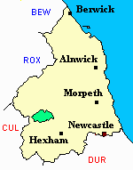
- Wark - Maps - links and information.
You can see maps centred on OS grid reference NY787786 (Lat/Lon: 55.101196, -2.334981), Wark which are provided by:
- OpenStreetMap
- Google Maps
- StreetMap (Current Ordnance Survey maps)
- Bing (was Multimap)
- Old Maps Online
- National Library of Scotland (Old Ordnance Survey maps)
- Vision of Britain (Click "Historical units & statistics" for administrative areas.)
- English Jurisdictions in 1851 (Unfortunately the LDS have removed the facility to enable us to specify a starting location, you will need to search yourself on their map.)
- Magic (Geographic information) (Click + on map if it doesn't show)
- GeoHack (Links to on-line maps and location specific services.)
- All places within the same township/parish shown on an Openstreetmap map.
- Nearby townships/parishes shown on an Openstreetmap map.
- Nearby places shown on an Openstreetmap map.