
Hide
Widdrington
hide
Hide
hide
Hide
Hide
Hide
"WIDDRINGTON is a parochial chapelry situated between the parishes of Woodhorn and Warkworth, having the sea for its eastern and Ulgham chapelry for its western boundary. It comprises the three small villages of Widdrington, Dunridge, and Linton, whose united area is 4,530 acres, and rateable value £4,156 17s. The population in 1801, was 446: in 1811, 370; in 1821, 388; in 1831, 395; in 1841, 447; and in 1851, 429 souls. It possesses a rich, strong, clayey soil, suitable both for pasturage and tillage, and Lord Vernon is the proprietor of the whole chapelry, with the exception of the Constablewick of Linton, which is the property of Mrs. Askew. Widdrington was formerly included in the parish of Woodhorn, but, in 1768, it was admitted to the enjoyment of separate and distinct parochial privileges, This manor was formerly the property of a family which bore the local name, Gerard de Widdrington possessing it in the reign of Edward III.; and we find various members of this family stand conspicuous in the list of sheriffs of the county. Sir William Widdrington, a most zealous royalist, was created Lord Widdrington by Charles 1., in 1643, and was subsequently slain at Wigan, in 1651. William, the third Lord Widdrington, having taken part with the Earl of Derwentwater, suffered attainder in 1715, when his real and personal estate, amounting to £100,000, was sold for public use, the purchaser being Sir George Revel, from whom it descended by heiresses to Viscount Bulkeley, and subsequently to the present proprietors." [From History, Topography, and Directory of Northumberland, Whellan, 1855].
"WIDDRINGTON, a chapelry (parochial), in the eastern division of MORPETH ward, county of NORTHUMBERLAND, ... The church is ancient, and appears to have been once much larger. A Scotch church was erected here in 1765.' Widdrington was separated from the parish of Woodhorn, and invested with distinct parochial rights, in 1768....." [Samuel Lewis Topographical Dictionary of England 1831 © Mel Lockie]
Hide
- Northumberland County Record Office holds copies of Census Returns 1841 - 1891 and provides a useful User Guide
- The 1851 Census Index (microfiche CN24) Woodhorn, Widdrington, Ulgham, Warkworth (part), Bothal, Hebron & Felton (part) (PRO piece HO 107/2418 folios 461-641) (Type B) (Book) published by the https://www.ndfhs.org.uk/may be of value to researchers interested in this parish.
- Widdrington - Church Records - links and information.
- This area is within Northumberland Central Registration District.
- Certificates of birth, death and marriage can be ordered from Northumberland County Council.
- Photographs of Druridge Bay, Low Chibburn and Low Hauxley from Les Bell's Northumberland Cam website.
- The Northumberland Communities website includes pages relating to Widdrington. They provide "a range of learning resource material that reflects Northumberland's heritage, providing a base for studying the County's history. The website provides a starting point for understanding the development of communities in Northumberland. It also seeks to illustrate the range of sources for family and local history research that are available via Northumberland Archives Service."
- The section of The National Gazetteer (1868) relating to this parish - transcribed by Colin Hinson.
- Ask for a calculation of the distance from Widdrington to another place.
- The history of Widdrington Parish is included in:- Hodgson, J., History of Northumberland, Part 2, Volume 2. Newcastle, 1832. (Available on fiche from Ancestral Indexes).
- Maps of locations in this parish provided by Streetmap.
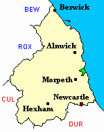
Linton, Widdrington.
You can see maps centred on OS grid reference NZ255961 (Lat/Lon: 55.258382, -1.600571), Widdrington which are provided by:
- OpenStreetMap
- Google Maps
- StreetMap (Current Ordnance Survey maps)
- Bing (was Multimap)
- Old Maps Online
- National Library of Scotland (Old Ordnance Survey maps)
- Vision of Britain (Click "Historical units & statistics" for administrative areas.)
- English Jurisdictions in 1851 (Unfortunately the LDS have removed the facility to enable us to specify a starting location, you will need to search yourself on their map.)
- Magic (Geographic information) (Click + on map if it doesn't show)
- GeoHack (Links to on-line maps and location specific services.)
- All places within the same township/parish shown on an Openstreetmap map.
- Nearby townships/parishes shown on an Openstreetmap map.
- Nearby places shown on an Openstreetmap map.