
Hide
Brandesburton
hide
Hide
hide
Hide
Hide
The Ancient Parish of BRANDESBURTON
[Transcribed information mainly from the early 1820s]
"BRANDESBURTON, a parish in the wapentake and liberty of Holderness; 8½ miles N. E of Beverley. This extensive and populous village is pleasantly situated on the high road leading from Hull to Scarborough, from which places coaches and other vehicles are passing and re-passing daily, which greatly tends to the benefit of its inhabitants There are two good inns for the accommodation of travellers A fortnight fair or market for all sorts of cattle, is held on alternate Wednesdays, which is very fully attended, a sure criterion of its rising prosperity. The church, dedicated to St Mary (see Churches for photograph), is a very ancient structure, but has suffered much from the corroding hand of time, although it has undergone several repairs, the patronage is in St. Johns College, Cambridge. The neighbouring magistrates meet here every Thursday, in a spacious room, at the Cross Keys Inn, for the administration of justice. Pop 562""BASWICK STEER, a coal and lime wharf, on the river Hull, in the township and parish of Brandesburton; 2½ miles W. of Brandesburton, 10 miles from Great-Driffield and Beverley."
"BURSHILL, in the parish of Brandesburton, wapentake and liberty of Holderness; 1½ miles WNW. of Brandesburton, 8 miles NE. of Beverley."
"HIGH BASWICK, in the parish of Brandesburton, wapentake and liberty of Holderness; 2¾ miles W. of Brandesburton, 8 miles. SSE. of Driffield. Population included with Brandesburton."
"LOW BASWICK, a farm house in the parish of Brandesburton, wapentake and liberty of Holderness; 2½ miles W. of Brandesburton, 8 miles. SSE. of Driffield. Population included with Brandesburton."
"MOOR TOWN, a small hamlet, in the parish of Brandesburton, wapentake and liberty of Holderness; 1¾ miles N. of Brandesburton, 7 miles WNW. of Hornsea, Pop. 29."
"WEEDLAND, a farm house in the parish of Brandesburton, wapentake and liberty of Holderness; 5 miles SE. of Driffield."
[Description(s) edited mainly from various 19th century sources by Colin Hinson. ©2010]
Hide
- Photographs of over 650 gravestones and plaques at Brandesburton church with linked surname index.
- Alan Longbottom has transcribed extracts from the Report of the Commissioners relating to the Charities at Brandesburton 1819.
- Here are photographs of Churches etc. in the parish:
- St Mary's Church, Brandesburton.
- Internal view looking down the aisle
- Internal view looking up the aisle
- The East Window
- The Font
- The Methodist Church, Brandesburton.
- St Mary's Church, Brandesburton.
- Transcript of the entry for Brandesburton in the "Collections relative to Churches and Chapels".
- The whereabouts and dates of the Registers etc. for the Parish of Brandesburton.
- The List of Rectors in St. Mary's Church, Brandesburton.
- Transcript of the entry of "professions and trades" in the Baines's Directory of 1823, of the East Riding.
- Transcript of the entry of "professions and trades" in the The Post Office Directory of the, East and North Ridings, 1857
- Transcript of the entry of "professions and trades" in the Bulmers Directory of 1892. of the East Riding.
- There is further information about this parish from the National Gazetteer 1868, Yorkshire extracts.
- There is further information about this parish from the Lewis's Topographical Dictionary of England 1835, Yorkshire extracts.
- There is further information about this parish from the Bulmer's 1892 History and Directory of the East Riding.
- Ask for a calculation of the distance from Brandesburton to another place.
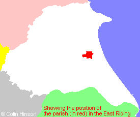
- For a detailed map of this parish see this parish boundaries map.
- For a more detailed map of the parishes in the riding please see the Yorkshire parish maps page.
- For a more detailed map of the county please see the Yorkshire map page.
- Here is a map showing the wapentakes for the county.
You can see maps centred on OS grid reference TA116476 (Lat/Lon: 53.91254, -0.302491), Brandesburton which are provided by:
- OpenStreetMap
- Google Maps
- StreetMap (Current Ordnance Survey maps)
- Bing (was Multimap)
- Old Maps Online
- National Library of Scotland (Old Ordnance Survey maps)
- Vision of Britain (Click "Historical units & statistics" for administrative areas.)
- English Jurisdictions in 1851 (Unfortunately the LDS have removed the facility to enable us to specify a starting location, you will need to search yourself on their map.)
- Magic (Geographic information) (Click + on map if it doesn't show)
- GeoHack (Links to on-line maps and location specific services.)
- All places within the same township/parish shown on an Openstreetmap map.
- Nearby townships/parishes shown on an Openstreetmap map.
- Nearby places shown on an Openstreetmap map.
- The 1914-1918 and 1939-45 War Memorial at Brandesburton.
- This parish is covered by the following Society:
- The 1834 Electoral Roll for this parish