
Hide
Fridaythorpe
hide
Hide
hide
Hide
Hide
The Ancient Parish of FRIDAYTHORPE
[Transcribed information mainly from the early 1820s]
"FRIDAYTHORPE, a parish in the wapentake of Buckrose and liberty of St. Peter's; 9 miles NE of Pocklington. The living is a vicarage, in the gift of the Prebendary of Wetwang of which the Rev Henry Torre is the incumbent. Here is also a Methodist chapel. Population 275." [Description(s) edited mainly from various 19th century sources by Colin Hinson. ©2010]
Hide
- Photographs of over 170 gravestones and plaques at Fridaythorpe church with linked surname index.
- Here are photographs of Churches etc. in the parish:
- St. Mary's Church, Fridaythorpe.
- Internal view looking down the aisle
- The font
- Another view of St. Mary's Church, showing the unusual clock.
- St. Mary's Church, Fridaythorpe.
- Transcript of the entry for Fridaythorpe in the "Collections relative to Churches and Chapels".
- The whereabouts and dates of the Registers etc. for the Parish of Fridaythorpe.
- The List of Vicars in St. Mary's Church.
- Transcript of the entry of "professions and trades" in the Baines's Directory of 1823, of the East Riding.
- Transcript of the entry of "professions and trades" in the The Post Office Directory of the, East and North Ridings, 1857
- Transcript of the entry of "professions and trades" in the Bulmers Directory of 1892. of the East Riding.
- There is further information about this parish from the National Gazetteer 1868, Yorkshire extracts.
- There is further information about this parish from the Lewis's Topographical Dictionary of England 1835, Yorkshire extracts.
- There is further information about this parish from the Bulmer's 1892 History and Directory of the East Riding.
- Ask for a calculation of the distance from Fridaythorpe to another place.
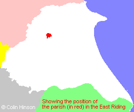
- For a detailed map of this parish see this parish boundaries map.
- For a more detailed map of the parishes in the riding please see the Yorkshire parish maps page.
- For a more detailed map of the county please see the Yorkshire map page.
- Here is a map showing the wapentakes for the county.
You can see maps centred on OS grid reference SE874591 (Lat/Lon: 54.020512, -0.667494), Fridaythorpe which are provided by:
- OpenStreetMap
- Google Maps
- StreetMap (Current Ordnance Survey maps)
- Bing (was Multimap)
- Old Maps Online
- National Library of Scotland (Old Ordnance Survey maps)
- Vision of Britain (Click "Historical units & statistics" for administrative areas.)
- English Jurisdictions in 1851 (Unfortunately the LDS have removed the facility to enable us to specify a starting location, you will need to search yourself on their map.)
- Magic (Geographic information) (Click + on map if it doesn't show)
- GeoHack (Links to on-line maps and location specific services.)
- All places within the same township/parish shown on an Openstreetmap map.
- Nearby townships/parishes shown on an Openstreetmap map.
- Nearby places shown on an Openstreetmap map.
- The Memorial Plaque in St. Mary's Church, Fridaythorpe.
- Photographs of over 170 gravestones and plaques at Fridaythorpe church.
- A transcription of the School Timetables, around 1902-3 in Adobe pdf format.
- This parish is covered by the following Society:
- The 1834 Electoral Roll for this parish