
Hide
Goodmanham
hide
Hide
hide
Hide
Hide
The Ancient Parish of GOODMANHAM
[Transcribed information mainly from the early 1820s]
"GOODMANHAM, alias Godmundin Gaham, is a parish in the wapentake of Harthill, partly in the liberty. of St Peter's; one mile and a half NNE. of Market Weighton, situated on the lowest acclivity of the Wolds. Pop. 240." (There is further information for Goodmanham). [Description(s) edited mainly from various 19th century sources by Colin Hinson. ©2010]
Hide
- Photographs of the over 180 gravestones in Goodmanham Churchyard with linked surname index.
- Here are photographs of Churches etc. in the parish:
- All Saints' Church, Goodmanham, from the Churchyard.
- Internal view looking down the aisle
- The modern font and cover
- The old font
- All Saints' Church, Goodmanham, but they don't want you to see it from the road!
- All Saints' Church, Goodmanham, from the Churchyard.
- Transcript of the entry for Goodmanham in the "Collections relative to Churches and Chapels".
- The whereabouts and dates of the Registers etc. for the Parish of Goodmanham.
- The List of Rectors in All Saints Church, Goodmanham.
- Transcript of the entry of "professions and trades" in the Baines's Directory of 1823, of the East Riding.
- Transcript of the entry of "professions and trades" in the The Post Office Directory of the, East and North Ridings, 1857
- Transcript of the entry of "professions and trades" in the Bulmers Directory of 1892. of the East Riding.
- There is further information about this parish from the National Gazetteer 1868, Yorkshire extracts.
- There is further information about this parish from the Lewis's Topographical Dictionary of England 1835, Yorkshire extracts.
- There is further information about this parish from the Stephen Whatley's Gazetteer 1750, Yorkshire extracts.
- There is further information about this parish from the Bulmer's 1892 History and Directory of the East Riding.
- Ask for a calculation of the distance from Goodmanham to another place.
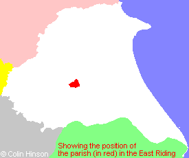
- For a detailed map of this parish see this parish boundaries map.
- For a more detailed map of the parishes in the riding please see the Yorkshire parish maps page.
- For a more detailed map of the county please see the Yorkshire map page.
- Here is a map showing the wapentakes for the county.
You can see maps centred on OS grid reference SE890431 (Lat/Lon: 53.876476, -0.647739), Goodmanham which are provided by:
- OpenStreetMap
- Google Maps
- StreetMap (Current Ordnance Survey maps)
- Bing (was Multimap)
- Old Maps Online
- National Library of Scotland (Old Ordnance Survey maps)
- Vision of Britain (Click "Historical units & statistics" for administrative areas.)
- English Jurisdictions in 1851 (Unfortunately the LDS have removed the facility to enable us to specify a starting location, you will need to search yourself on their map.)
- Magic (Geographic information) (Click + on map if it doesn't show)
- GeoHack (Links to on-line maps and location specific services.)
- All places within the same township/parish shown on an Openstreetmap map.
- Nearby townships/parishes shown on an Openstreetmap map.
- Nearby places shown on an Openstreetmap map.
- This parish is covered (or partly covered) by the following Societies:
- The 1834 Electoral Roll for this parish