
Hide
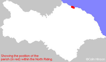
Brotton
hide
Hide
hide
Hide
Hide
The Ancient Parish of BROTTON
[Transcribed information mainly from the early 1820s]
"BROTTON, a parish in the wapentake and liberty of Langbargh; 6 miles NE. of Guisborough. The village is inhabited chiefly by farmers; it is pleasantly situated on an eminence, commanding an extensive view of the surrounding country. The chapel is a plain, modern structure, built in 1741 (see Churches for photograph), and the living is a perpetual curacy, in the patronage of the Archbishop of York, of which the Rev. William Close, is the incumbent. It is an ancient Chapelry dependant on the church of Skelton, enjoying parochial rights. Population, 332.""KILTON, in the parish of Brotton, wapentake and liberty of Langbargh; 1¼ miles SE. of Brotton, 7 miles NE. of Guisborough. The castle and lordship of Kilton, formerly belonged to the very ancient family of Thwengs, and then had the following hamlets belonging to them; viz. Liverton, Thorp Skelton, Easington, Skinnergrave, &c. Pop. 100."
"KILTON THORPE, a farm house in the parish of Brotton, wapentake and liberty of Langbargh; 1¼ miles S. of Brotton, 6 miles NE. of Guisborough.
In this farm are two ancient Manors, which at the general survey were held by Torchil, under the names of Chillune and Torp."
"SALTBURN, in the parishes of Skelton in Cleveland and Brotton, wapentake and liberty of Langbargh; 1½ miles NW. of Brotton, 6 miles NE. of Guisborough; situated upon the sea near Huntcliffe, inhabited chiefly by fishermen. (Please note that Saltburn by the sea did not exist in 1823. See Marske by the Sea parish, Bulmer's 1890 transcription for information)."
"SKINNINGROVE, in the parish of Brotton wap & liberty of Langbargh; 1½ miles E. of Brotton, 7 miles NE. of Guisborough. (the seat of John Easterby, Esq.) A small hamlet situated upon the sea, in a deep creek or bay, the lofty and rugged sides of which entirely seclude it from all distant view. Pop. 60."
[Description(s) edited mainly from various 19th century sources by Colin Hinson. ©2010]
Hide
- Here are photographs of Churches in the parish:
- The Church of St. Margaret of Antioch, Brotton.
- The Roman Catholic Church of St. Anthony of Padua, Brotton.
- St. Helen's Church, Carlin How.
- The Methodist Church, Carlin How. Originally Wesleyan, founded in 1912.
- The ex-Primitive Methodist Church, Carlin How.
- The Wesleyan Church, Skinningrove.
- Transcript of the entry for Brotton in the "Collections relative to Churches and Chapels".
- The whereabouts and dates of the Registers etc. for the Parish of Brotton.
- Transcript of the entry of "professions and trades" in the Baines's Directory of 1823, of the North Riding.
- Transcript of the entry of "professions and trades" in the White's Directory of 1840, Yorkshire section.
- Transcript of the entry of "professions and trades" in the Bulmers Directory of 1890. of the North Riding.
- There is further information about this parish from the National Gazetteer 1868, Yorkshire extracts.
- There is further information about this parish from the Lewis's Topographical Dictionary of England 1835, Yorkshire extracts.
- There is further information about this parish from the Stephen Whatley's Gazetteer 1750, Yorkshire extracts.
- There is further information about this parish from the Bulmer's 1890 History and Directory of the North Riding.
- Ask for a calculation of the distance from Brotton to another place.
- For a detailed map of this parish see this parish boundaries map.
- For a more detailed map of the parishes in the riding please see the Yorkshire parish maps page.
- For a more detailed map of the county please see the Yorkshire map page.
- Here is a map showing the wapentakes for the county.
You can see maps centred on OS grid reference NZ688198 (Lat/Lon: 54.568753, -0.93738), Brotton which are provided by:
- OpenStreetMap
- Google Maps
- StreetMap (Current Ordnance Survey maps)
- Bing (was Multimap)
- Old Maps Online
- National Library of Scotland (Old Ordnance Survey maps)
- Vision of Britain (Click "Historical units & statistics" for administrative areas.)
- English Jurisdictions in 1851 (Unfortunately the LDS have removed the facility to enable us to specify a starting location, you will need to search yourself on their map.)
- Magic (Geographic information) (Click + on map if it doesn't show)
- GeoHack (Links to on-line maps and location specific services.)
- All places within the same township/parish shown on an Openstreetmap map.
- Nearby townships/parishes shown on an Openstreetmap map.
- Nearby places shown on an Openstreetmap map.
- The 1914-1918 War Memorial at Brotton.
- This parish is covered by the following Society: