
Hide
Manfield
hide
Hide
hide
Hide
Hide
hide
Hide
The Ancient Parish of MANFIELD
[Transcribed information mainly from the early 1820s]
"MANFIELD, a parish in the wapentake of Gilling East, and liberty of Richmondshire; 9 miles N. of Richmond. A parochial village; the church is an ancient structure with a tower steeple, and is dedicated to All Saints (see Churches for photograph). The living is a rectory, in the patronage of the King. Here is a small free school, with an endowment of £10. per annum. Population, 440."Manfield," says Cade, "is now an insignificant village, but anciently a very considerable place of great extent, on an elevated situation, and probably once a British Oppidum, being every where strewed with small hillocks, resembling tumuli, and the neighbouring fields lined with the foundations of buildings and other vestigia; but nothing can be gleaned of its origin or downfall. -Archaeologia."
"CLIFFE, in the parish of Manfield, wapentake of Gilling West, and liberty of Richmondshire; (the seat of Henry Witham, Esq.) 1½ miles NNW. of Manfield, 6 miles WNW. of Darlington. Here is no place of worship, except a Catholic chapel, the Rev. William Hogarth, minister, Cliffe hall. Pop. 53."
"CLOWBECK, a farm house in the township and parish of Manfield; 2 miles SSE. of Manfield, 6 miles from Darlington, (Dur.)"
[Description(s) edited mainly from various 19th century sources by Colin Hinson. ©2010]
Hide
- Here are photographs of the Church:
- All Saints' Church, Manfield, view 1.
- All Saints' Church, Manfield, view 2.
- Transcript of the entry for Manfield in the "Collections relative to Churches and Chapels".
- The whereabouts and dates of the Registers etc. for the Parish of Manfield.
- Transcript of the entry of "professions and trades" in the Baines's Directory of 1823, of the North Riding.
- Transcript of the entry of "professions and trades" in the Bulmers Directory of 1890. of the North Riding.
- There is further information about this parish from the National Gazetteer 1868, Yorkshire extracts.
- There is further information about this parish from the Lewis's Topographical Dictionary of England 1835, Yorkshire extracts.
- There is further information about this parish from the Bulmer's 1890 History and Directory of the North Riding.
- Ask for a calculation of the distance from Manfield to another place.
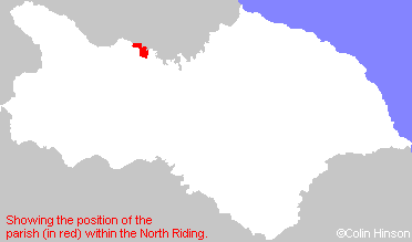
- For a detailed map of this parish see this parish boundaries map.
- For a more detailed map of the parishes in the riding please see the Yorkshire parish maps page.
- For a more detailed map of the county please see the Yorkshire map page.
- Here is a map showing the wapentakes for the county.
You can see maps centred on OS grid reference NZ223134 (Lat/Lon: 54.515415, -1.657051), Manfield which are provided by:
- OpenStreetMap
- Google Maps
- StreetMap (Current Ordnance Survey maps)
- Bing (was Multimap)
- Old Maps Online
- National Library of Scotland (Old Ordnance Survey maps)
- Vision of Britain (Click "Historical units & statistics" for administrative areas.)
- English Jurisdictions in 1851 (Unfortunately the LDS have removed the facility to enable us to specify a starting location, you will need to search yourself on their map.)
- Magic (Geographic information) (Click + on map if it doesn't show)
- GeoHack (Links to on-line maps and location specific services.)
- All places within the same township/parish shown on an Openstreetmap map.
- Nearby townships/parishes shown on an Openstreetmap map.
- Nearby places shown on an Openstreetmap map.
- This parish is covered by the following Society: