
Hide
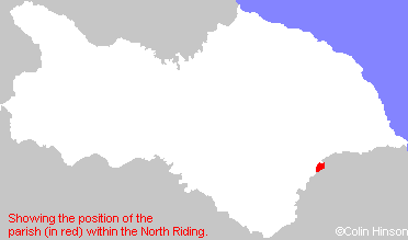
Old Malton
hide
Hide
hide
Hide
Hide
The Ancient Parish of OLD MALTON
[Transcribed information mainly from the early 1820s]
"OLD MALTON, a parish in the wapentake of Rydale, a part in the liberty of St. Peter's; adjacent to New Malton. The parish church, dedicated to St. Mary (see Churches for photograph), is a very ancient structure, with the abbey-house and monastery adjoining. The living is a perpetual curacy, in the patronage of Earl Fitzwilliam, and the Rev. William Flower, A. M. is the incumbent. Pop. 1064.In Leland's time, it appears to have been the mother-church to St. Michael and St Leonard, at New-Malton; and has been built where stood the priory, founded by Eustachius, or Eustace Fitz-John, for canons of the order of St. Gilbert. In 1200, William Laceles, Knight, granted them two bovates of land in Old-Malton, in lieu of certain tithes, -valued at the dissolution at 197L. 19s. 2d. -Dugdale.
In 1546, Robert Holgate, D.D. Archbishop of York, founded a free grammar-school here, and endowed it with lands and tenements, of the value of £20 per annum. "The master is appointed by the Archbishop of York. -Anciently, it appears, there were lands belonging to this school; but now instead of them, there are certain money payments amounting to about £100 per annum, with a good house and garden attached to it." -Carlisle's Gram. Schools.
This village is much noted for its lime quarries."
"HOWE, and HOWBRIDGE, 3 houses in the township and parish of Old Malton, and wapentake of Rydale; 2 miles NNE. of Old Malton, 3 miles from Malton."
"WYKEHAM, in the parish of Old Malton, and wapentake of Rydale; 1¾ miles NE. of Old Malton."
[Description(s) edited mainly from various 19th century sources by Colin Hinson. ©2010]
Hide
- The Ingham Charity in St. Mary's Church, Old Malton.
- The Taylor Charity in St. Mary's Church, Old Malton.
- The Barton Benefaction in St. Mary's Church, Old Malton.
- Here are 3 photographs of St. Mary the Virgin's Church:
- View 1,
- Internal view looking down the nave
- The Altar and the Choir
- The font
- View 2,
- View 3.
- View 1,
- The former Primitive Methodist Chapel, Old Malton. Opened in 1857, now a community centre.
- A transcript of Malton Congregational Church History
- Transcript of the entry for Old Malton in the "Collections relative to Churches and Chapels".
- The biography of St. Gilbert in St. Mary's Church, Old Malton.
- The whereabouts and dates of the Registers etc. for the Parish of Old Malton.
- The list of Priors - on the wall inside St Marys Priory Church, Old Malton.
- The list of Vicars - on the wall inside St Marys Priory Church, Old Malton.
- The list of the Vicars of Old Malton in St. Mary's Church.
- Transcript of the entry of "professions and trades" in the Baines's Directory of 1823, of the North Riding.
- There is further information about this parish from Bulmer's 1890 History and Directory of the North Riding of Yorkshire. (Press "Back" to return to this page.)
- There is further information about this parish from the National Gazetteer 1868, Yorkshire extracts.
- There is further information about this parish from the Lewis's Topographical Dictionary of England 1835, Yorkshire extracts.
- Ask for a calculation of the distance from Old Malton to another place.
- For a detailed map of this parish see this parish boundaries map.
- For a more detailed map of the parishes in the riding please see the Yorkshire parish maps page.
- For a more detailed map of the county please see the Yorkshire map page.
- Here is a map showing the wapentakes for the county.
You can see maps centred on OS grid reference SE799728 (Lat/Lon: 54.144827, -0.778328), Old Malton which are provided by:
- OpenStreetMap
- Google Maps
- StreetMap (Current Ordnance Survey maps)
- Bing (was Multimap)
- Old Maps Online
- National Library of Scotland (Old Ordnance Survey maps)
- Vision of Britain (Click "Historical units & statistics" for administrative areas.)
- English Jurisdictions in 1851 (Unfortunately the LDS have removed the facility to enable us to specify a starting location, you will need to search yourself on their map.)
- Magic (Geographic information) (Click + on map if it doesn't show)
- GeoHack (Links to on-line maps and location specific services.)
- All places within the same township/parish shown on an Openstreetmap map.
- Nearby townships/parishes shown on an Openstreetmap map.
- Nearby places shown on an Openstreetmap map.
- The Memorial Plaque in St. Mary's Church, Old Malton.
- The following places are within the boundaries of this (ancient) parish, but I have no further information on them other than the Ordnance Survey Landranger Grid reference shown:
- (SE776721) Middlecave
- This parish is covered (or partly covered) by the following Societies: