
Hide
Thirsk
hide
Hide
hide
Hide
Hide
The Ancient Parish of THIRSK
[Transcribed information mainly from the early 1820s]
"THIRSK, a small market town and a parish in the wapentake of Birdforth : 9 miles from Northallerton; 10 miles from Easingwold; 11 from Boroughbridge; and 23 from York. This town is pleasantly situated in the vale of Mowbray; and is conjectured to derive its name from the ancient British words, Tre -a town, and Isk -a river, or brook." (There is further information for Thirsk)."CARLTON MINIOTT, (or Carleton Islebeck) in the parish of Thirsk, wapentake of Birdforth, and liberty of St. Peter's; 2 miles WSW. of Thirsk. Pop. 221."
"SANDHUTTON, in the parish of Thirsk, and wapentake of Birdforth; 3 miles W. of Thirsk, 3 miles WSW. of Thirsk. In addition to the Chapel of Ease dedicated to St. Mary, there is here a chapel for the Methodists. Pop. 273."
"SOWERBY, in the parish of Thirsk, and wapentake of Birdforth; (the seats of Robert Bell Livesy, and Cornelius Cayley, Esqrs.); ½ mile SSE. of Thirsk. Is a pleasant village, containing many good houses, and communicates with Thirsk by an excellent gravel walk, across the fields called the flats. This walk commands a fine view of the adjacent country, terminated by the Hambleton hills, and is the favourite promenade of the inhabitants. There is here an ancient Chapel of Ease to the church of Thirsk, Population, 748."
[Description(s) edited mainly from various 19th century sources by Colin Hinson. ©2010]
Hide
- St Leonard's Church, Sand Hutton has two graveyards - the old one round the church and a new one in a separate location about 50 yards away. The church practices the Living Churchyard system. [Judith Richardson, January 2008]
- The first list of Benefactions in St. Mary's Church, Thirsk.
- The first list of Benefactions in St. Mary's Church, Thirsk.
- The various Benefactions for St. Oswald's Church, Sowerby.
- Here are photographs of Churches etc. in the parish:
- St. Mary's Church, Thirsk.
- St. Mary's Church, Thirsk. (The Church's website is here.)
- Internal view looking down the nave
- The font and cover
- All Saints Roman Catholic Church, Thirsk. (The Church's website is here.)
- St. James Green Methodist Church, Thirsk. (The Church's website is here.)
- St. Lawrence's Church, Carlton Miniott.
- Hambleton Evangelical Church, Carlton Miniott. (The Church's website is here.)
- St. Leonard's Church, Sandhutton.
- The former Methodist Church, Sandhutton.
- St. Oswald's Church, Sowerby. (The Church's website is here.)
- Internal view looking down the nave
- The Methodist Church, Sowerby. (The Church's website is here.)
- A short history of St. Mary's Church, Thirsk.
- A transcript of Thirsk Congregational Church History
- Transcript of the entry for Thirsk in the "Collections relative to Churches and Chapels".
- Transcript of the entry for Carlton Miniot in the "Collections relative to Churches and Chapels".
- Transcript of the entry for Sand Hutton Thirsk in the "Collections relative to Churches and Chapels".
- Transcript of the entry for Sowerby in the "Collections relative to Churches and Chapels".
- The History of Thirsk Church.
- The whereabouts and dates of the Registers etc. for the Chapelry of Carlton Miniott.
- The whereabouts and dates of the Registers etc. for the Chapelry of Sand Hutton near Thirsk.
- The whereabouts and dates of the Registers etc. for the Chapelry of Sowerby.
- The whereabouts and dates of the Registers etc. for the Parish of Thirsk.
- The List of Incumbents in St. Mary's Church, Thirsk.
- Transcript of the entry of "professions and trades" in the Baines's Directory of 1823, of the North Riding.
- Transcript of the entry of "professions and trades" in the Pigot's 1829 Directory, Yorkshire section.
- Transcript of the entry of "professions and trades" in the Pigot's 1834 Directory, Yorkshire section.
- Transcript of the entry of "professions and trades" in the White's Directory of 1840, Yorkshire section.
- Transcript of the entry of "professions and trades" in the Bulmers Directory of 1890. of the North Riding.
- There is further information about this parish from the Pigot's 1829 Directory, Yorkshire section.
- There is further information about this parish from the Pigot's 1834 Directory, Yorkshire section.
- There is further information about this parish from the National Gazetteer 1868, Yorkshire extracts.
- There is further information about this parish from the Lewis's Topographical Dictionary of England 1835, Yorkshire extracts.
- There is further information about this parish from the Stephen Whatley's Gazetteer 1750, Yorkshire extracts.
- There is further information about this parish from the Bulmer's 1890 History and Directory of the North Riding.
- Ask for a calculation of the distance from Thirsk to another place.
- A history of Thirsk by Thirskweb.com. (Archived)
- In 1868, Carlton Miniott (in this parish) was constituted a separate parish for all civil and ecclesiastical purposes. See Carlton Miniott Parish.
- Between 1822 and 1890, Sowerby (in this parish) was constituted for all civil and ecclesiastical purposes, became a separate parish. See Sowerby Parish.
- Between 1865 and 1890, Sand Hutton (a township in this parish) was constituted a separate parish. See Sand Hutton Parish.
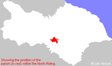
- For a detailed map of this parish see this parish boundaries map.
- For a more detailed map of the parishes in the riding please see the Yorkshire parish maps page.
- For a more detailed map of the county please see the Yorkshire map page.
- Here is a map showing the wapentakes for the county.
You can see maps centred on OS grid reference SE429821 (Lat/Lon: 54.232817, -1.34337), Thirsk which are provided by:
- OpenStreetMap
- Google Maps
- StreetMap (Current Ordnance Survey maps)
- Bing (was Multimap)
- Old Maps Online
- National Library of Scotland (Old Ordnance Survey maps)
- Vision of Britain (Click "Historical units & statistics" for administrative areas.)
- English Jurisdictions in 1851 (Unfortunately the LDS have removed the facility to enable us to specify a starting location, you will need to search yourself on their map.)
- Magic (Geographic information) (Click + on map if it doesn't show)
- GeoHack (Links to on-line maps and location specific services.)
- All places within the same township/parish shown on an Openstreetmap map.
- Nearby townships/parishes shown on an Openstreetmap map.
- Nearby places shown on an Openstreetmap map.
- A Complete listing of all the men on the war memorials in Sowerby plus biographies and photographs for many of the men.
- The War Memorial in St. Leonard's Churchyard, Sand Hutton, near Thirsk.
- The 1914-1918 War Memorial Plaque in St. Oswald's Church, Sowerby.
- The 1939-1845 War Memorial Plaque in St. Oswald's Church, Sowerby.
- The War Memorial Plaques in St. Mary's Church, Thirsk.
- This parish is covered by the following Society: