
Hide
Braithwell
hide
Hide
hide
Hide
Hide
hide
Hide
The Ancient Parish of BRAITHWELL
[Transcribed information mainly from the early 1820s]
"BRAITHWELL, a parish-town, in the upper-division of Strafforth and Tickhill; 5 miles from Tickhill, 6 miles NE. of Rotherham, 8 from Doncaster, 45 from York, Pop. 438. The Church is a vicarage, dedicated to St. James, in the deanry of Doncaster, value, ~£7. 7s. 6d. p.r. £70. Patron, the King.""BRAMLEY, in the parish of Braithwell, upper-division of Strafforth and Tickhill; (Bramley Hall, the seat of John Fullarton, Esq.) 4 miles E. of Rotherham, 10 from Doncaster. Pop. 310. Here is a Chapel of Ease to Braithwell."
"BRAMLEY GRANGE, in the parish of Braithwell, and wapentake of Strafforth and Tickhill; 4 miles E. of Rotherham."
"LAMBCOTE GRANGE, a farm-house in the township and parish of Braithwell, liberty of Tickhill; 5 miles from Tickhill."
"MICKLEBRING, in the township and parish of Braithwell, upper division of Strafforth and Tickhill; 5½ miles E. of Rotherham, 9 from Doncaster."
[Description(s) edited from various 19th century sources by Colin Hinson © 2013]
Hide
- Here are photographs of Churches etc. in the parish:
- St. James's Church, Braithwell (view 1).
- St. James' Church, Braithwell (view 2).
- St. James' Church, Braithwell (view 3).
- St. James's Church, Braithwell from an old postcard (believed to be from the early 1920s).
- The former Methodist Chapel, Braithwell from an old postcard (believed to be from the early 1920s).
- The former Methodist Chapel, Braithwell (now a house).
- St. Francis's Church, Bramley.
- Transcript of the entry for Braithwell in the "Collections relative to Churches and Chapels".
- Transcript of the entry for Bramley in the "Collections relative to Churches and Chapels".
- The whereabouts and dates of the Registers etc. for the Parish of Braithwell.
- Transcript of the entry of "professions and trades" in the Baines's Directory and Gazetteer, Vol I, West Riding.
- There is further information about this parish from the National Gazetteer 1868, Yorkshire extracts.
- There is further information about this parish from the Lewis's Topographical Dictionary of England, Yorkshire extracts.
- Ask for a calculation of the distance from Braithwell to another place.
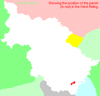
- For a detailed map of this parish see this parish boundaries map.
- For a more detailed map of the parishes in the riding please see the Yorkshire parish maps page.
- For a more detailed map of the county please see the Yorkshire map page.
- Here is a map showing the wapentakes for the county.
You can see maps centred on OS grid reference SK531946 (Lat/Lon: 53.445501, -1.201995), Braithwell which are provided by:
- OpenStreetMap
- Google Maps
- StreetMap (Current Ordnance Survey maps)
- Bing (was Multimap)
- Old Maps Online
- National Library of Scotland (Old Ordnance Survey maps)
- Vision of Britain (Click "Historical units & statistics" for administrative areas.)
- English Jurisdictions in 1851 (Unfortunately the LDS have removed the facility to enable us to specify a starting location, you will need to search yourself on their map.)
- Magic (Geographic information) (Click + on map if it doesn't show)
- GeoHack (Links to on-line maps and location specific services.)
- All places within the same township/parish shown on an Openstreetmap map.
- Nearby townships/parishes shown on an Openstreetmap map.
- Nearby places shown on an Openstreetmap map.
- This parish is covered by the following Society:
- A list of those paying the 1379 Subsidy Rolls (Poll Tax) for this parish.