
Hide
Darrington
hide
Hide
hide
Hide
Hide
The Ancient Parish of DARRINGTON
[Transcribed information mainly from the early 1820s]
"DARRINGTON, a parish-town, in the wapentake of Osgoldcross, liberty of Pontefract; (the seat of Robert Oliver, Esq.) 3 miles S. of Ferrybridge and Pontefract, 12¼ from Doncaster, 14½ from Barnsley, 24 from York. Pop. 510. The Church is a vicarage, dedicated to St. Luke and All-Saints, in the deanry of Pontefract, value, ~£16. 11s. 3d. Patron, the Archbishop of York.""CRIDLING PARK, a farm-house in the township of Criddling Stubbs, and parish of Darrington, liberty of Pontefract; 2½ miles from Ferrybridge."
"CRIDLING STUBBS, in the parishes of Womersley and Darrington, wapentake of Osgoldcross, liberty of Pontefract; 2½ miles SE. of Ferrybridge, 4½ from Pontefract. Pop. 96."
"GROVE HALL, (the residence of William Lee, Esq.) in the township and parish of Darrington; 2 miles from Ferrybridge, 3 from Pontefract."
"STAPLETON, a township, in the parish of Darrington, wapentake of Osgoldcross, liberty of Pontefract; (Stapleton Park, the seat of the Hon. Edward Robert Petre) 4 miles from Ferrybridge, 4½ from Pontefract, 12 from Doncaster. Pop. 109." (There is further information for Stapleton).
"WENTBRIDGE, in the townships of Kirk Smeaton, Darrington, and Thorpe Audlin, and parishes of Kirk Smeaton, Badsworth, and Darrington, wapentake of Osgoldcross, liberty of Pontefract, 4½ miles SE. of Pontefract and Ferrybridge, 10½ from Doncaster."
[Description(s) edited from various 19th century sources by Colin Hinson © 2013]
Hide
- Here are photographs of Churches etc. in the parish:
- St. Luke's Church, Darrington.
- Transcript of the entry for Darrington in the "Collections relative to Churches and Chapels".
- The whereabouts and dates of the Registers etc. for the Parish of Darrington.
- Transcript of the entry of "professions and trades" in the Baines's Directory and Gazetteer, Vol I, West Riding.
- There is further information about this parish from the National Gazetteer 1868, Yorkshire extracts.
- There is further information about this parish from the Lewis's Topographical Dictionary of England, Yorkshire extracts.
- Ask for a calculation of the distance from Darrington to another place.
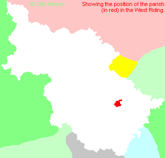
- For a detailed map of this parish see this parish boundaries map.
- For a more detailed map of the parishes in the riding please see the Yorkshire parish maps page.
- For a more detailed map of the county please see the Yorkshire map page.
- Here is a map showing the wapentakes for the county.
You can see maps centred on OS grid reference SE485200 (Lat/Lon: 53.674228, -1.267314), Darrington which are provided by:
- OpenStreetMap
- Google Maps
- StreetMap (Current Ordnance Survey maps)
- Bing (was Multimap)
- Old Maps Online
- National Library of Scotland (Old Ordnance Survey maps)
- Vision of Britain (Click "Historical units & statistics" for administrative areas.)
- English Jurisdictions in 1851 (Unfortunately the LDS have removed the facility to enable us to specify a starting location, you will need to search yourself on their map.)
- Magic (Geographic information) (Click + on map if it doesn't show)
- GeoHack (Links to on-line maps and location specific services.)
- All places within the same township/parish shown on an Openstreetmap map.
- Nearby townships/parishes shown on an Openstreetmap map.
- Nearby places shown on an Openstreetmap map.
- Transcription and photograph of Darrington war memorial
- This parish is covered (or partly covered) by the following Societies:
- A list of those paying the 1379 Subsidy Rolls (Poll Tax) for this parish.