
Hide
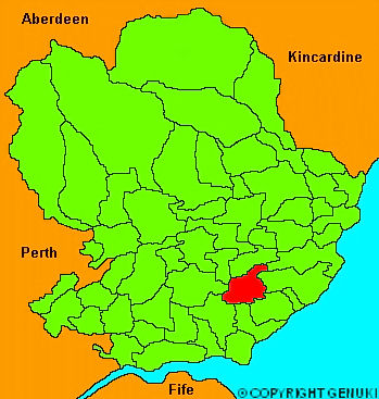
Carmyllie
hide
Hide
"Extending in length about 4 miles, and in breadth about 3, the parish is a hilly tract of country, but the hills are capable of cultivation to the summits. Almost the whole district is a wet, cold soil, on a till or gravelly bottom. There are several extensive muirs and marshes in the parish, which might be drained and improved. A part of that extensive moss, called Dilty Moss, lies in this parish. There are sveral inexhaustible quarries of grey slate and pavement stones, which have been wrought for centuries, and supply the neighbourhood, besides exporting to Perthshire, Fife &c. Mr Ouchterlony of Guynd, one of the proprietors, has lately made out some extensive plantations of oak and larch, which promise in a short time, to remove the present barren and inhospitable appearance of the parish. The small river Elliot which takes its rise in the Dilty Moss,, runs through the whole length of the parish."
The Gazetteer of Scotland, W Chalmers, Dundee 1803.
Hide
| Carmyllie Parish Church, Carmyllie, Church of Scotland |
| Carmyllie Parish Church, Carmyllie, Church of Scotland |
- The transcription of the section for Carmyllie from the National Gazetteer (1868) provided by Colin Hinson.
- Ask for a calculation of the distance from Carmyllie to another place.
You can see maps centred on OS grid reference NO546438 (Lat/Lon: 56.583591, -2.740776), Carmyllie which are provided by:
- OpenStreetMap
- Google Maps
- StreetMap (Current Ordnance Survey maps)
- Bing (was Multimap)
- Old Maps Online
- National Library of Scotland (Old Ordnance Survey maps)
- Vision of Britain (Click "Historical units & statistics" for administrative areas.)
- Magic (Geographic information) (Click + on map if it doesn't show)
- GeoHack (Links to on-line maps and location specific services.)
- All places within the same township/parish shown on an Openstreetmap map.
- Nearby townships/parishes shown on an Openstreetmap map.
- Nearby places shown on an Openstreetmap map.