
Hide
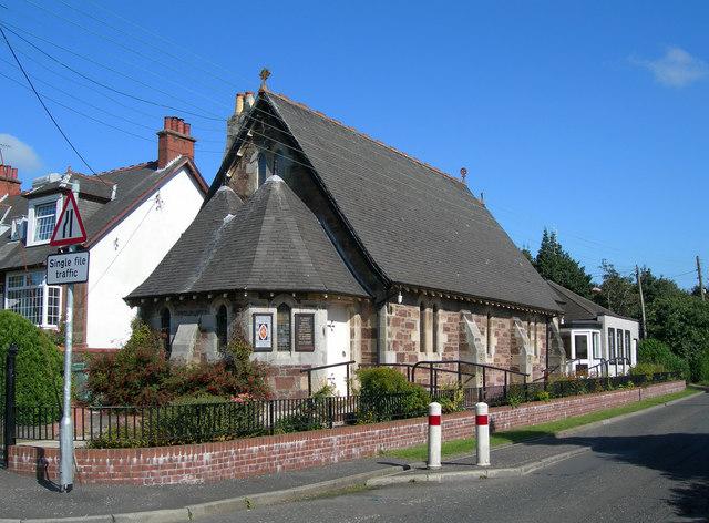
St Oswald, Maybole, Scottish Episcopal
hide
Hide
© Copyright Mary and Angus Hogg and licensed for reuse under this Creative Commons Licence.
Hide
St Oswald,
Cargill Road,
Maybole
Hide
It is located at NS2990510093 (Lat/Lon 55.355318, -4.684619). You can see this on maps provided by:
- OpenStreetMap
- Google Maps
- StreetMap (Current Ordnance Survey maps)
- Bing (was Multimap)
- Old Maps Online
- National Library of Scotland (Old Ordnance Survey maps)
- Vision of Britain (Click "Historical units & statistics" for administrative areas.)
- Magic (Geographic information) (Click + on map if it doesn't show)
- GeoHack (Links to on-line maps and location specific services.)