
Hide
Inverkeithny
hide
Hide
hide
Hide
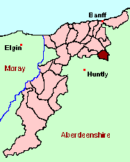
See the Maps Section below for links to
a fully-detailed version of this location plan.
Hide
Hide
"A very large burn, or rivulet, which comes through the parishes of Drumblade and Forgue, falls into the river Deveron, near the church, from which it is probable the parish derives the name of Inverkeithny. The parish is situated on the S. side of the river, and is in the commissariot of Moray. It is in length, along the river side, from 5 to 6 English miles, and between 4 and 5 in breadth. ... A considerable quantity of grain is annually raised in the parish. The rent is fully 900 L. Sterling. ... There is scarcely anything in the parish, that can be called moss or peats. The inhabitants are supplied with peats from the mosses of Foudland, in the parish of Forgue, and of Auchintoul, in the parish of Marnoch. They also burn a kind of turf, which they get upon the hills. Banff is the nearest sea-port where coals can be got, which is about 12 English miles distant from the church." [From The Statistical Account for Scotland, 1791-1799 Volume XVI, Banffshire, Moray & Nairnshire.]
Hide
Monumental Inscriptions for Inverkeithny have been published by Aberdeen And North-East Scotland FHS (ANESFHS) (Booklet AA142).
These are included in the Online Index to the MIs
| Inverkeithny, Church of Scotland |
Aberdeen And North-East Scotland FHS (ANESFHS) have published a name Index to the 1851 Census for Banffshire. Inverkeithny (together with Marnoch, Forglen and Rothiemay) is published as code AA211.
ANESFHS also hold unpublished indexes and transcriptions of the 1861 Census for most Banffshire parishes (including Inverkeithny).
| Inverkeithny, Church of Scotland |
Kirk of Scotland
- OPRs held by the General Register Office, Scotland.
GROS Baptism Marriage Death 158/1 1721-1819 1721-1806 1726-41 158/2 1820-54 1827-54 - - LDS Film numbers:
Baptisms Marriages Deaths 6902573 6902547 990998p - Batch numbers (for FamilySearch)
Baptisms (C) Marriages (M) C111582
C111584M111582
M111584
Kirk Session Records
Kirk Session records generally include records of Discipline, which often include information on illegitimate births, and Accounts, which may mention persons on Poor Relief. The surviving Inverkeithny Kirk Session records are listed on a separate webpage.
A transcript of Parish of Inverkeithny by Rev. Mr. John Milne.
- Ask for a calculation of the distance from Inverkeithny to another place.
There is a wide range of maps available for Inverkeithny, historical and modern, on paper and online. Many ancient placenames continue in use, and will therefore appear on modern maps, but as parishes ceased to be of any significance for Local Government in Scotland in 1976, parish boundaries will be found only on historical maps.
Maps on Paper
- The best general-purpose modern printed map is the Ordnance Survey "Landranger" Series, which has a scale of 1:50000 (about one-and-a-quarter inches to a mile). Inverkeithny will be found on "Landranger Sheet 29".
- Reproductions of late-19th century Ordnance Survey maps are published by Caledonian Maps, and are also available via Family History Societies. Inverkeithny will be found on sheet 96.
Maps Online
- The small location plan at the head of this page is based on an 1845 map included in the Banffshire volume of the New Statistical Account of Scotland. View a fully-detailed version of this map.
You can see maps centred on OS grid reference NJ642450 (Lat/Lon: 57.493751, -2.598092), Inverkeithny which are provided by:
- OpenStreetMap
- Google Maps
- StreetMap (Current Ordnance Survey maps)
- Bing (was Multimap)
- Old Maps Online
- National Library of Scotland (Old Ordnance Survey maps)
- Vision of Britain (Click "Historical units & statistics" for administrative areas.)
- Magic (Geographic information) (Click + on map if it doesn't show)
- GeoHack (Links to on-line maps and location specific services.)
- All places within the same township/parish shown on an Openstreetmap map.
- Nearby townships/parishes shown on an Openstreetmap map.
- Nearby places shown on an Openstreetmap map.
You can view a comprehensive Gazetteer list for Inverkeithny including placenames culled from the Ordnance Survey "Explorer" (1:25000) map, the 1896 Ordnance Survey 1" map, the 1841, 1851 and 1861 Census and Thomson's "Atlas of Scotland" (1832).
Under the "Poor Law Amendment Act, Scotland" (1845) responsibility for Poor Relief was taken from the Parishes of the Kirk of Scotland, and vested in new Parochial Boards, whose territories largely coincided with the old parishes. The Parochial Boards were not (as in England) grouped into Poor Law Unions, and there were few Poorhouses outside the cities and large towns.
Day-to-day administration of the Poor Law was in the hands of the Inspector of the Poor for each parish, and these Inspectors were obliged by law to maintain detailed records of applications and of relief supplied. The most valuable of these are the "Record of Applications" and the "General Register of the Poor". The "Minutes" are very variable, but on occasion can also contain information on named individuals.
The following Poor Law records have survived for the Parish of Inverkeithny:
- General Register of the Poor 1880-1930
- Record of Applications 1893-1938
- Minutes
These are held by Aberdeen City Archives. The records are available for viewing, subject to the 100-year rule.
Items marked * are included in a name index compiled by Aberdeen And North-East Scotland FHS (ANESFHS), and held by both ANESFHS and Aberdeen City Archives.
| Year | 1801 | 1811 | 1821 | 1831 | 1841 | 1851 | 1861 |
| Population | 503 | 533 | 577 | 589 | 687 | 835 | 880 |
| Year | 1871 | 1881 | 1891 | 1901 | 1911 | 1921 | 1931 |
| Population | 1000 | 909 | 826 | 769 | 725 | 667 | 640 |
You can also see Family History Societies covering the nearby area, plotted on a map. This facility is being developed, and is awaiting societies to enter information about the places they cover.