
Hide
Ratho Parish Church, Ratho and Stobhill, Church of Scotland
hide
Hide
Hide
Ratho Parish Church,
Baird Road,
Ratho and Stobhill
Hide
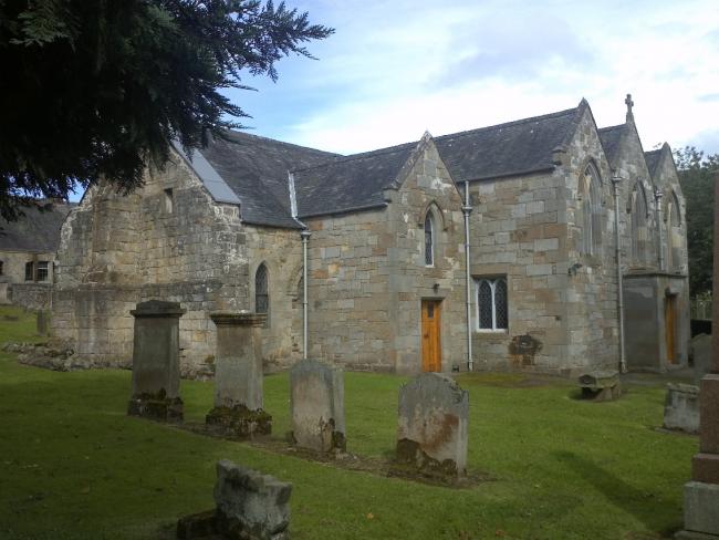
Ratho Parish Church dates back to the 12th or 13th Century, although the building was considerably altered and added to in the 17th century and later.
Canmore provides some information on the building, and photographs.
OPRs (Old Parish Registers) are available from 1682 (Births and Deaths), 1741 (Marriages)
The births are blank between 1689 & 1739. Furtehr details of the gaps can be found on the NRS.
It is located at NT1384771004 (Lat/Lon 55.924368, -3.380265). You can see this on maps provided by:
- OpenStreetMap
- Google Maps
- StreetMap (Current Ordnance Survey maps)
- Bing (was Multimap)
- Old Maps Online
- National Library of Scotland (Old Ordnance Survey maps)
- Vision of Britain (Click "Historical units & statistics" for administrative areas.)
- Magic (Geographic information) (Click + on map if it doesn't show)
- GeoHack (Links to on-line maps and location specific services.)
A war memorial is adjacent to the parish church. Details of the inscription, names, etc, can be found in the IWM database.