
Hide
Parish Maps from 'Historic Parishes of England and Wales - Boundaries before 1850'
hide
Hide
Alltyblaca 78
Rhyddlan-ucha 79
Rhyddlan-issa part 80
Llechwedd part 81a
Rhiwsion 81b
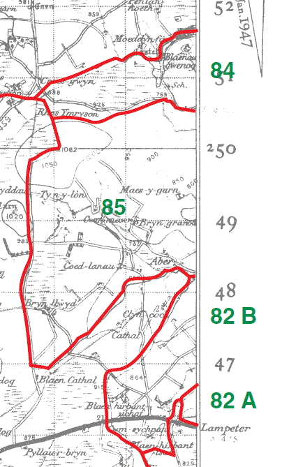
Gwillim part 82a
Bryn-llefrith part 82b
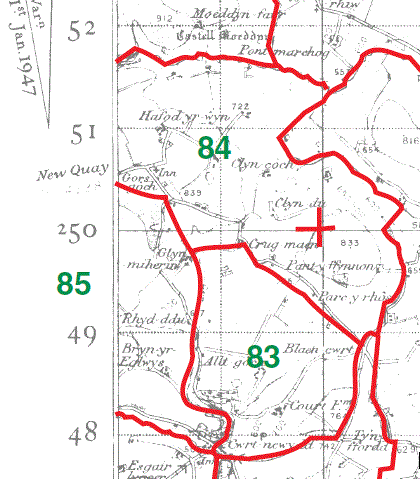
Court 83
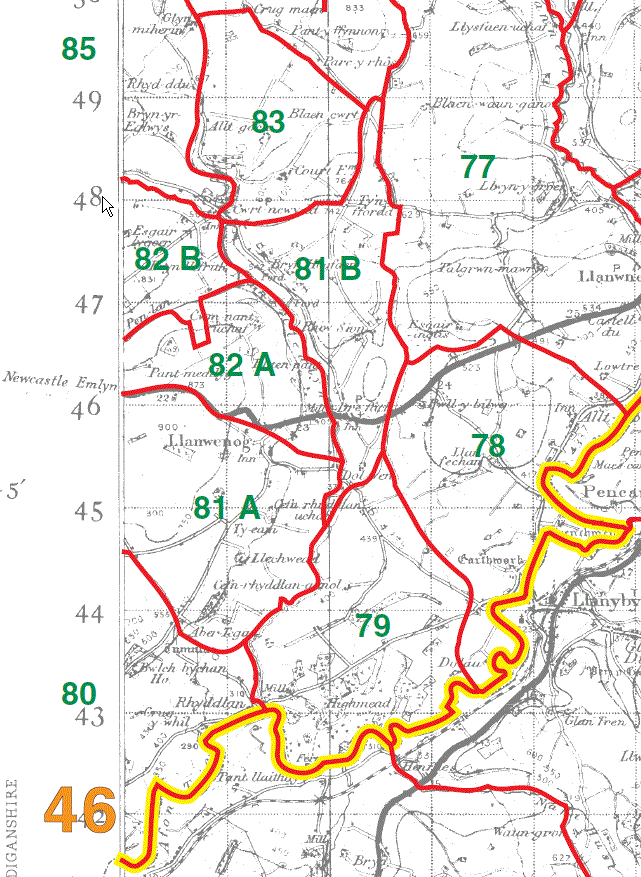
Gwillim part 82a
Bryn-llefrith part 82b
Fawnog 84
Brynhaugh 85
|
|
Rhyddlan-issa part 80
Llechwedd part 81a

Overview diagram
Key to numbers shown on diagram
| 
|
This map is extracted from:
Kain, R.J.P., Oliver, R.R., Historic Parishes of England and Wales: an Electronic Map of Boundaries before 1850 with a Gazetteer and Metadata [computer file]. Colchester, Essex: History Data Service, UK Data Archive [distributor], 17 May 2001. SN: 4348.
Acknowledgement is made to R.J.P. Kain, R.R Oliver, the Economic and Social Research Council, the History Data Service and the UK Data Archive.