
Hide
Parish Maps from 'Historic Parishes of England and Wales - Boundaries before 1850'
hide
Hide
Laugharne Parish Map 62 and 63
Llandawke Parish Map 64
Llansadurnen Parish Map 65
Pendine Parish Map 66
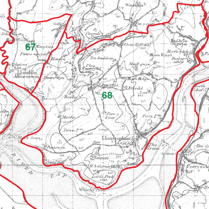
Llandilo Abercowin Parish Map 67
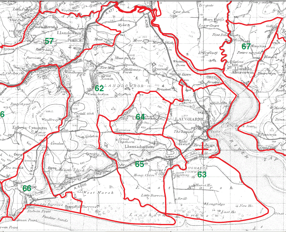
Llanstephan Parish Map 68
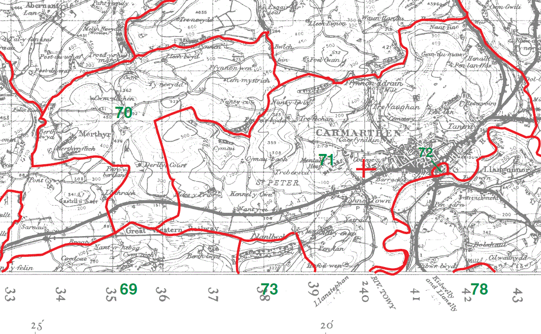
Llangynog Parish Map part 69
Merthyr Parish Map 70
Carmarthen Parish Map St Peter part 71 & Castle Green 72
Llangain Parish Map part 73
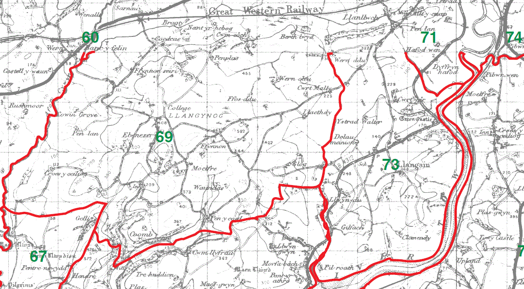
Llangynog Parish Map part 69
Carmarthen Parish Map St Peter part 71
Llangain Parish Map part 73
This map is extracted from:
Kain, R.J.P., Oliver, R.R., Historic Parishes of England and Wales: an Electronic Map of Boundaries before 1850 with a Gazetteer and Metadata [computer file]. Colchester, Essex: History Data Service, UK Data Archive [distributor], 17 May 2001. SN: 4348.
Acknowledgement is made to R.J.P. Kain, R.R Oliver, the Economic and Social Research Council, the History Data Service and the UK Data Archive.
(Gareth Hicks; 21 Dec 2012)