
Hide
Parish Maps from 'Historic Parishes of England and Wales - Boundaries before 1850'
hide
Hide
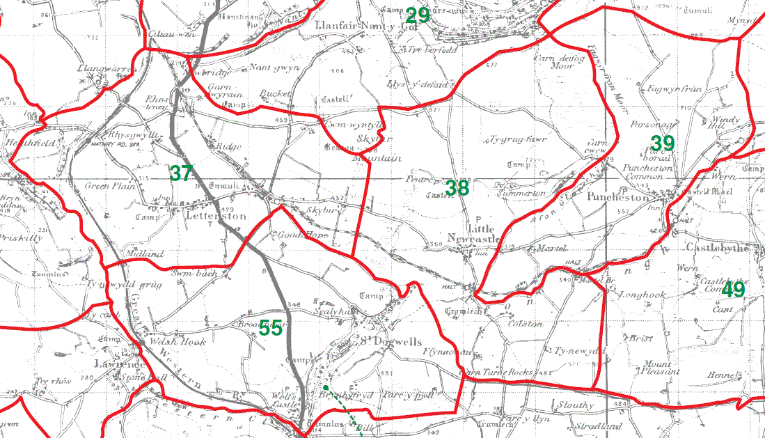
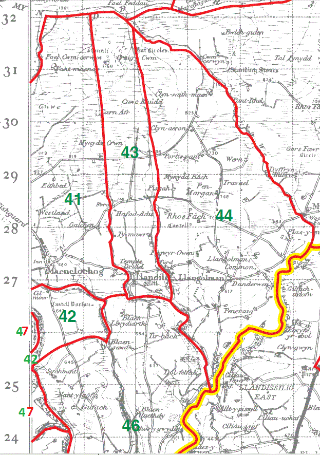
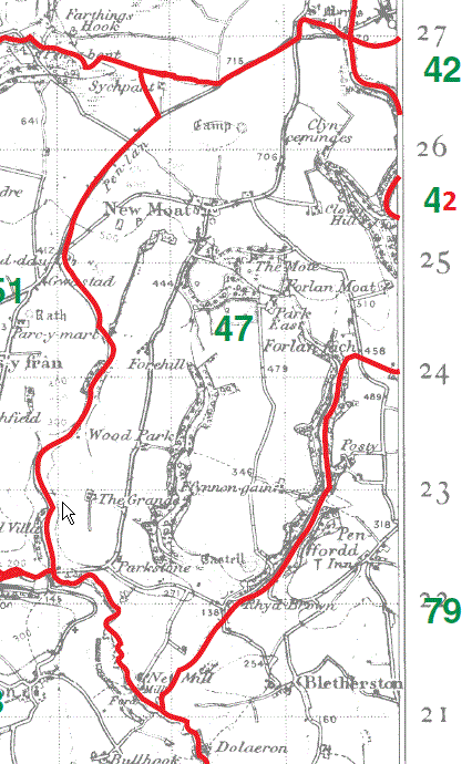
[I have made changes, highlighted in red, to several green numbers (42/47) on the map edges to correct errors on the original maps]
Letterston Parish Map 37
Little Newcastle Parish Map 38
Puncheston Parish Map 39
Morfil Parish Map 40
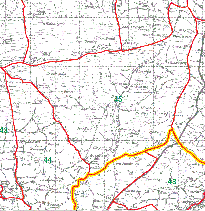
Maenclochog Parish Map part 41 & Vorlan part 42 / 42
Henry's Moat Parish Map 48
Castlebythe Parish Map 49
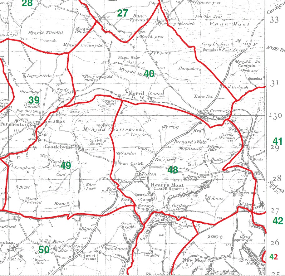
Maenclochog Parish Map part 41 & Vorlan part 42
Llandilo Parish Map 43
Llangolman Parish Map 44
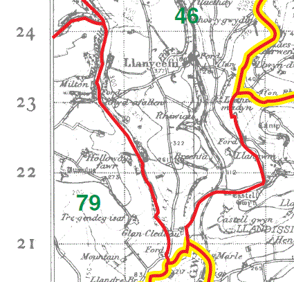
Llanycefn Parish Map part 46
New Moat Parish Map part 47
Llanycefn Parish Map part 46
New Moat Parish Map part 47
Mynachlogddu Parish Map 45
This map is extracted from:
Kain, R.J.P., Oliver, R.R., Historic Parishes of England and Wales: an Electronic Map of Boundaries before 1850 with a Gazetteer and Metadata [computer file]. Colchester, Essex: History Data Service, UK Data Archive [distributor], 17 May 2001. SN: 4348.
Acknowledgement is made to R.J.P. Kain, R.R Oliver, the Economic and Social Research Council, the History Data Service and the UK Data Archive.
[Gareth Hicks: 27 Dec 2012]