
Hide
Parish Maps from 'Historic Parishes of England and Wales - Boundaries before 1850'
hide
Hide
Pembroke St Michael Parish Map 149
Pembroke St Mary Parish Map 150
& 150a (an unnumbered section on original map thought to belong to this parish)
Monkton Parish Map 151 & 152
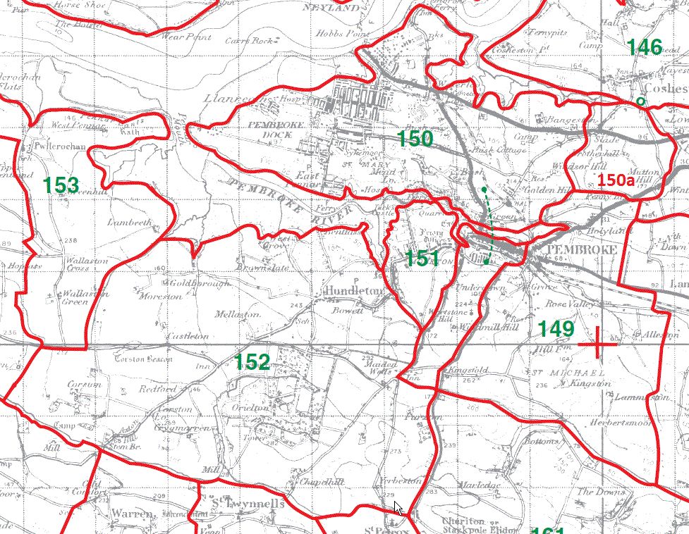
Pwllcrochan Parish Map 153
Rhoscrowther Parish Map 154
Angle Parish Map 155

Castlemartin Parish Map 156
Warren Parish Map 157
St Twynnells Parish Map 158
St Petrox Parish Map 159
Bosherston Parish Map 160

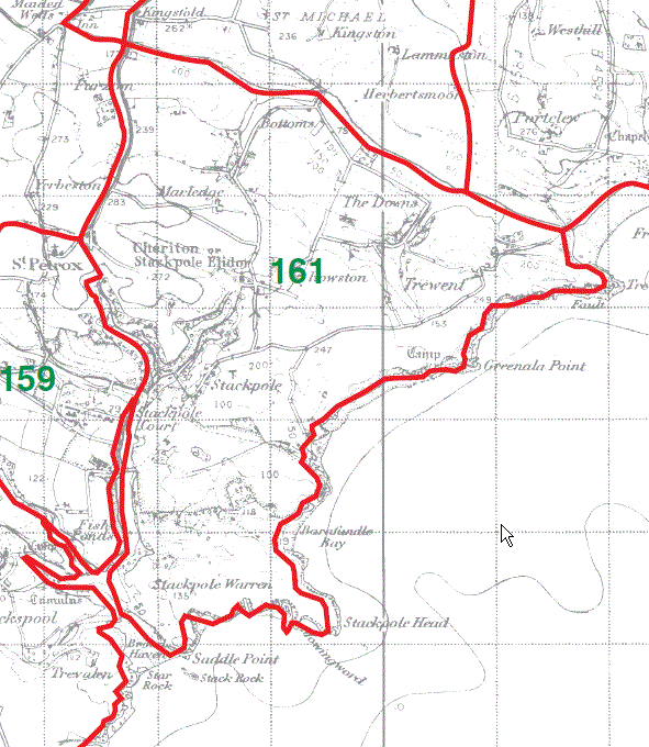
Stackpole Elidor Parish Map 161
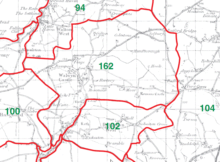
Walwyn's Castle Parish Map 162
This map is extracted from:
Kain, R.J.P., Oliver, R.R., Historic Parishes of England and Wales: an Electronic Map of Boundaries before 1850 with a Gazetteer and Metadata [computer file]. Colchester, Essex: History Data Service, UK Data Archive [distributor], 17 May 2001. SN: 4348.
Acknowledgement is made to R.J.P. Kain, R.R Oliver, the Economic and Social Research Council, the History Data Service and the UK Data Archive.