
Hide
Parish Maps from 'Historic Parishes of England and Wales - Boundaries before 1850'
hide
Hide
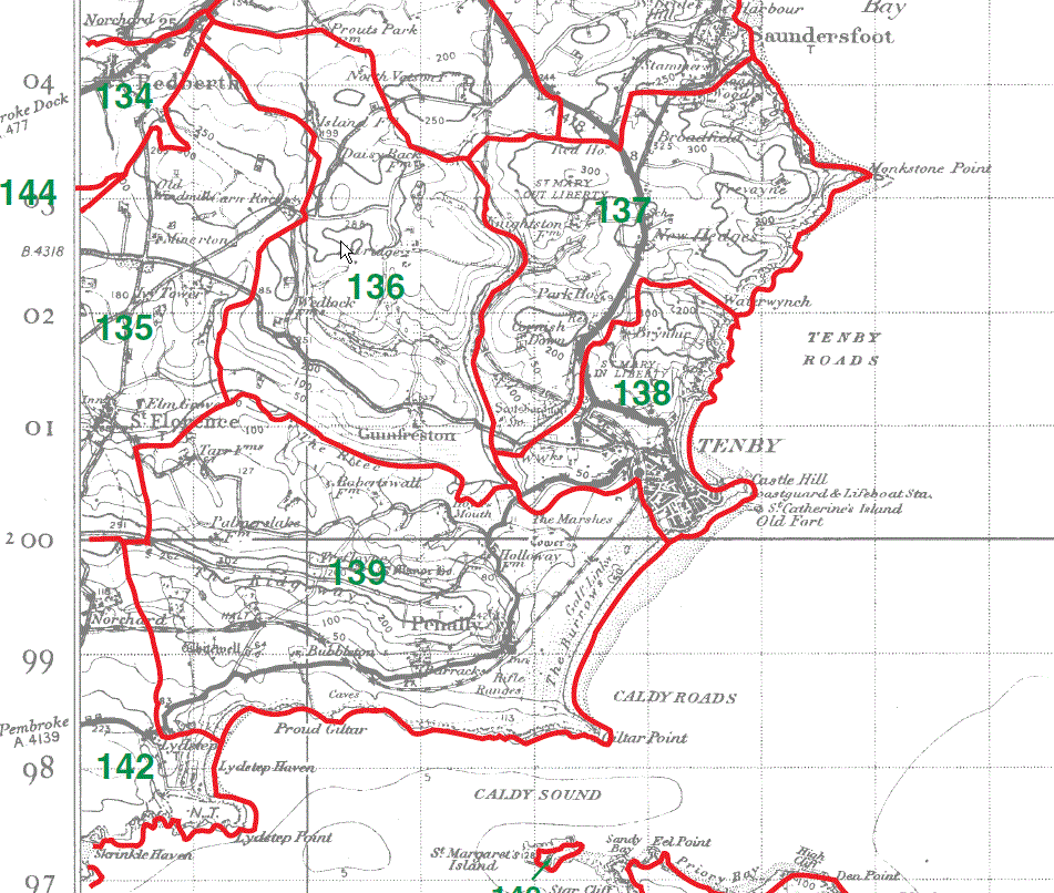
Redberth Parish Map part 134
St Florence Parish Map part 135
Gumfreston Parish Map 136
Tenby St Mary (Out-Liberty) Parish Map 137
Tenby St Mary (In-Liberty) Parish Map 138
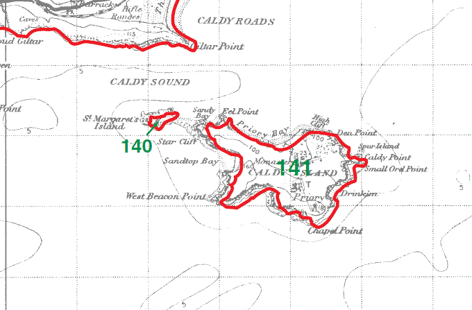
Penally Parish Map 139
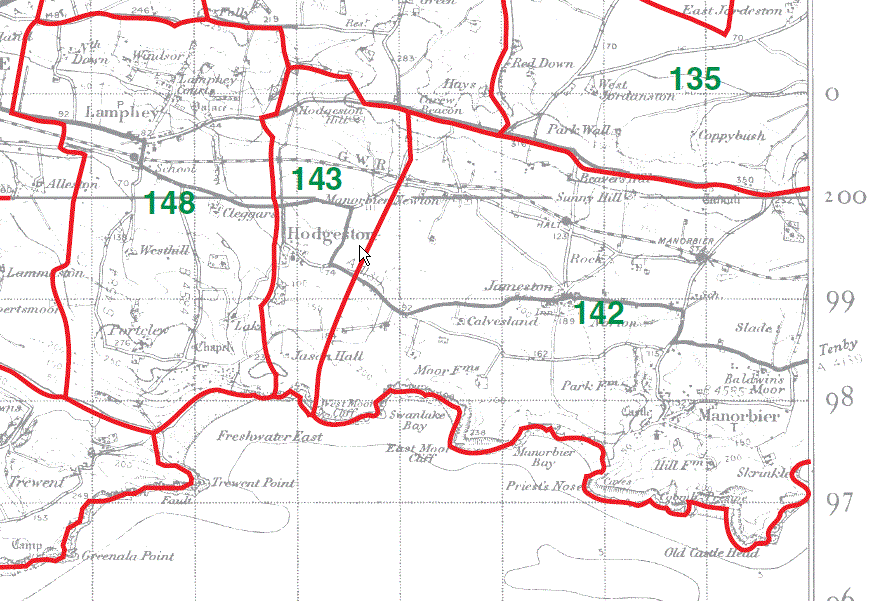
Manorbier Parish Map part 142
Carew Parish Map part 144
St Margaret's Island (under Penally Parish) 140
Caldey Island (under Penally Parish) 141
Redberth Parish Map part 134
St Florence Parish Map part 135
Carew Parish Map part 144
Upton Parish Map 145
Cosheston Parish Map 146
Nash Parish Map 147

Manorbier Parish Map part 142
Hodgeston Parish Map 143
Lamphey Parish Map 148
This map is extracted from:
Kain, R.J.P., Oliver, R.R., Historic Parishes of England and Wales: an Electronic Map of Boundaries before 1850 with a Gazetteer and Metadata [computer file]. Colchester, Essex: History Data Service, UK Data Archive [distributor], 17 May 2001. SN: 4348.
Acknowledgement is made to R.J.P. Kain, R.R Oliver, the Economic and Social Research Council, the History Data Service and the UK Data Archive.
[Gareth Hicks - 30 Dec 2012]