
Hide
St Bede, Claughton, Church of England
hide
Hide
Hide
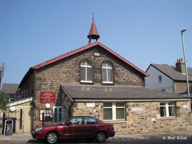
St Bede,
Upton Road,
Claughton
Hide
Laird Street/Hoylake Road
Church History
Built in 1858 as a chapel to Birkenhead: St. Mary. On 24 July 1869 it became a district church for part of the township of Birkenhead (previously served by Birkenhead: St. Mary).
On 1 August 1972 the district was amalgamated with that of Birkenhead: St. Bede, to form the combined district of "St. James with St. Bede".
Church Records
C = Christenings (Baptisms) ; M = Marriages ; B = Burials ; BTs = Bishop's Transcripts
| Original Registers | C 1865-1967 ; M 1869-1972 — Cheshire Archives (P 75) C from 1967 ; M from 1972 — Church |
| Microfilm Copies | C 1865-1951 ; M 1869-1972 — Cheshire Archives ; Family History Society of Cheshire C 1865-1967 ; M 1869-1972 — Manchester Archives & Local Studies ; Birkenhead Central Library |
| Bishop's Transcripts | C 1898-1899 (microfilmed) — Cheshire Archives ; Family History Society of Cheshire |
| Copies and Indexes | M 1869-1951 — Cheshire BMD (WR:BK5) |
| Notes | B — none |
St James
It was founded in 1888.
Upton Road, Claughton
Church History
Built in 1888 in Park Road West as a chapel to Bidston: St. Oswald. In 1911 it became part of a new district for parts of the townships of Oxton and Claughton with Grange (previously served by Oxton: St. Saviour and Bidston: St. Oswald). The boundaries of "The Consolidated Chapelry of Saint Bede, Birkenhead" were described in the London Gazette on 24 January 1911:
"I. All that portion of the new parish (sometime particular district) of Saint Saviour, Oxton, in the county of Chester and in the diocese of Chester, which is bounded upon the north by the parish of Bidston, upon the east by the new parish of Christ Church, Claughton with Grange, both in the said county and diocese, and upon the remaining sides, that is to say, upon the south and upon the west, by an imaginary line commencing upon the boundary, which divides the said new parish of Christ Church, Claughton with Grange, from the said new parish of Saint Saviour, Oxton, at the junction of the road called Manor Hill with the road called Sandy Way, and extending thence south-westward along the middle of Sandy Way for a distance of nine chains or thereabouts to its junction with Shrewsbury Road North, and extending thence northward along the middle of Shrewsbury Road North for a distance of seven chains or thereabouts to the boundary which divides the said new parish of Saint Saviour, Oxton, from the said parish of Bidston."
"II. And also all that portion of the said parish of Bidston, which is bounded upon all sides as follows, that is to say, upon the northwest and upon the north by the new parish of Saint James, Birkenhead, upon the east partly by the last-named new parish and partly by the new parish of Saint Anne, Birkenhead, both in the said county and diocese, upon the south partly by the said new parish of Christ Church, Claughton with Grange, and partly by the above-described portion of the said new parish of Saint Saviour, Oxton, and upon the south-west partly by the last-named new parish and partly by an imaginary line commencing at the point near the eastern end of Ashburton Road where the boundary which divides the said new parish of Saint Saviour, Oxton, from the said parish of Bidston meets the middle of Ashburton Road, and extending thence eastward along the middle of Ashburton Road for a distance of two chains and a half or thereabouts to its junction with Tollemache Road, and extending thence north-westward along the middle of Tollemache Road for a distance of twenty-one chains and a half or thereabouts to a point opposite to the boundary stone on the eastern side of Tollemache Road where the boundary which divides the said parish of Bidston from the said new parish of Saint Bede, Birkenhead, meets the eastern side of such road, and extending thence eastward across Tollemache Road to the said boundary stone."
St. Bede's was initially used as the parish hall, while Birkenhead: All Saints served as the district church. In 1913 a new temporary church of St. Bede opened as a mission church, but this was forced to close in 1941 as a result of air-raid damage. A replacement church opened in Upton Road in 1960.
On 1 August 1972 the district was amalgamated with that of Birkenhead: St. James, to form the combined district of "St. James with St. Bede".
Church Records
C = Christenings (Baptisms) ; M = Marriages ; B = Burials ; BTs = Bishop's Transcripts
| Original Registers | C 1888-1907 — Cheshire Archives (P 86) C from 1947 — at Birkenhead: St. James |
| Microfilm Copies | C 1888-1907 — Cheshire Archives |
| Notes | C 1907-1947 — recorded at Birkenhead: All Saints MB — none |
- OpenStreetMap
- Google Maps
- StreetMap (Current Ordnance Survey maps)
- Bing (was Multimap)
- Old Maps Online
- National Library of Scotland (Old Ordnance Survey maps)
- Vision of Britain (Click "Historical units & statistics" for administrative areas.)
- English Jurisdictions in 1851 (Unfortunately the LDS have removed the facility to enable us to specify a starting location, you will need to search yourself on their map.)
- Magic (Geographic information) (Click + on map if it doesn't show)
- GeoHack (Links to on-line maps and location specific services.)