
Hide
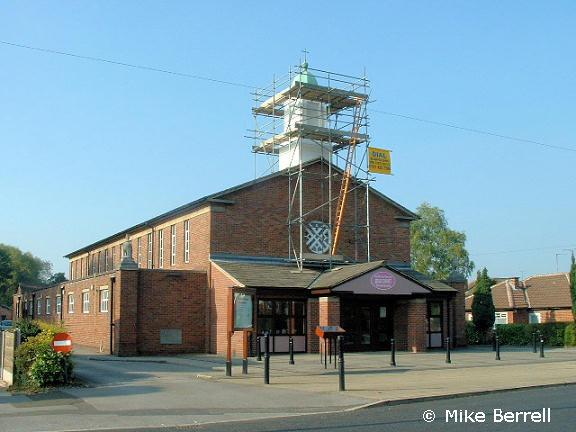
St Andrew, Cheadle Hulme, Church of England
hide
Hide
Hide
St Andrew,
Cheadle Road,
Cheadle Hulme
Hide
It was founded in 1958.
Cheadle Road.
Church History
In 1959 it became a district church for part of Cheadle Hulme (previously served by Cheadle: St. Mary). The boundaries of "The District (or Parish) of Saint Andrew, Cheadle Hulme" were described in the London Gazette on 15 May 1959:
"All that part of the parish of Cheadle which lies to the south, of an imaginary line commencing on the boundary which divides the parish of All Saints, Cheadle Hulme, from the parish of Cheadle in the middle of Ladybridge Road at a point where the road is carried over the middle of Micker Brook and extending thence generally northwestwards along the middle of Micker Brook to a point opposite the northern end of the western boundary of close numbered 695 (on the map) thence southwards to and along the last mentioned boundary and the western boundary of close numbered 693 to its end and in the same straight line to and then northwestwards along the middle of Cheadle Road to a point opposite the middle of an unnamed stream at the northern boundary of close numbered 671 thence southwestwards in a straight line to and then along the middle of the last mentioned stream to a point opposite the northeastern end of the southeastern boundary of close numbered 672 then southwestwards to and along the last-mentioned boundary to its end thence in the same straight line (thereby crossing close numbered 616) to the middle of Bruntwood Lane thence southwards along the middle of Bruntwood Lane to a point opposite the northeastern end of the southeastern boundary of close numbered 612 thence southwestwards to and along the last mentioned boundary to its end and thence in a straight line to the northeastern end of the southeastern boundary of close numbered 514 (thereby crossing closes numbered 608 and 609) thence in the same straight line to the boundary in the middle of Wilmslow Road which divides the parish of Cheadle from the parish of Saint Catherine, Heald Green"
Church Records
C = Christenings (Baptisms) ; M = Marriages ; B = Burials ; BTs = Bishop's Transcripts
| Original Registers | C from 1937 ; M from 1959 — Church |
| Copies and Indexes | M 1959-1989 — Cheshire BMD (ST:ST67) |
| Notes | B — none |
- OpenStreetMap
- Google Maps
- StreetMap (Current Ordnance Survey maps)
- Bing (was Multimap)
- Old Maps Online
- National Library of Scotland (Old Ordnance Survey maps)
- Vision of Britain (Click "Historical units & statistics" for administrative areas.)
- English Jurisdictions in 1851 (Unfortunately the LDS have removed the facility to enable us to specify a starting location, you will need to search yourself on their map.)
- Magic (Geographic information) (Click + on map if it doesn't show)
- GeoHack (Links to on-line maps and location specific services.)